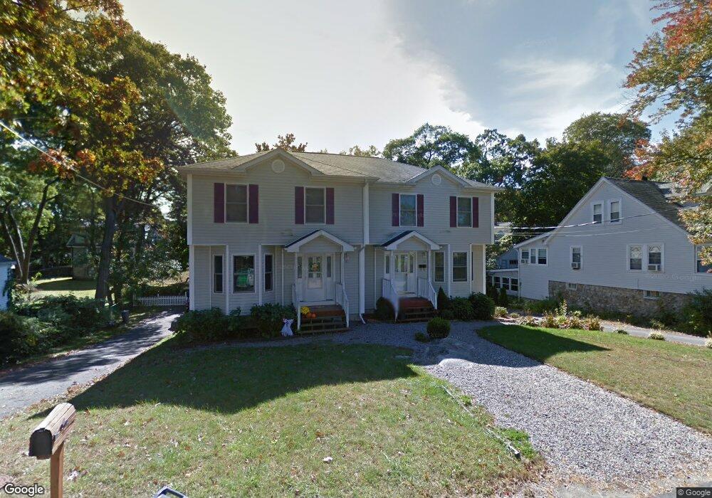
137 Paul St Dedham, MA 02026
The Manor NeighborhoodEstimated Value: $604,000 - $630,000
3
Beds
2
Baths
1,576
Sq Ft
$394/Sq Ft
Est. Value
About This Home
This home is located at 137 Paul St, Dedham, MA 02026 and is currently estimated at $620,872, approximately $393 per square foot. 137 Paul St is a home located in Norfolk County with nearby schools including Greenlodge Elementary School, Dedham Middle School, and Dedham High School.
Ownership History
Date
Name
Owned For
Owner Type
Purchase Details
Closed on
Nov 9, 2007
Sold by
Schloth Arthur H and Schloth Carrie L
Bought by
Lewis Kerri A
Current Estimated Value
Home Financials for this Owner
Home Financials are based on the most recent Mortgage that was taken out on this home.
Original Mortgage
$285,000
Outstanding Balance
$181,158
Interest Rate
6.47%
Mortgage Type
Purchase Money Mortgage
Estimated Equity
$439,714
Purchase Details
Closed on
Sep 20, 2002
Sold by
Crosby Audrey R
Bought by
Gerstein Robert B
Home Financials for this Owner
Home Financials are based on the most recent Mortgage that was taken out on this home.
Original Mortgage
$516,537
Interest Rate
6.36%
Mortgage Type
Purchase Money Mortgage
Create a Home Valuation Report for This Property
The Home Valuation Report is an in-depth analysis detailing your home's value as well as a comparison with similar homes in the area
Home Values in the Area
Average Home Value in this Area
Purchase History
| Date | Buyer | Sale Price | Title Company |
|---|---|---|---|
| Lewis Kerri A | $345,000 | -- | |
| Gerstein Robert B | $297,000 | -- |
Source: Public Records
Mortgage History
| Date | Status | Borrower | Loan Amount |
|---|---|---|---|
| Open | Lewis Kerri A | $285,000 | |
| Previous Owner | Gerstein Robert B | $516,537 |
Source: Public Records
Tax History
| Year | Tax Paid | Tax Assessment Tax Assessment Total Assessment is a certain percentage of the fair market value that is determined by local assessors to be the total taxable value of land and additions on the property. | Land | Improvement |
|---|---|---|---|---|
| 2025 | $6,889 | $545,900 | $0 | $545,900 |
| 2024 | $6,561 | $524,900 | $0 | $524,900 |
| 2023 | $6,265 | $487,900 | $0 | $487,900 |
| 2022 | $6,145 | $460,300 | $0 | $460,300 |
| 2021 | $6,150 | $449,900 | $0 | $449,900 |
| 2020 | $5,536 | $403,500 | $0 | $403,500 |
| 2019 | $5,295 | $374,200 | $0 | $374,200 |
| 2018 | $5,241 | $360,200 | $0 | $360,200 |
| 2017 | $5,225 | $354,000 | $0 | $354,000 |
| 2016 | $5,220 | $337,000 | $0 | $337,000 |
| 2015 | $5,262 | $331,600 | $0 | $331,600 |
| 2014 | $5,332 | $331,600 | $0 | $331,600 |
Source: Public Records
Map
Nearby Homes
Your Personal Tour Guide
Ask me questions while you tour the home.