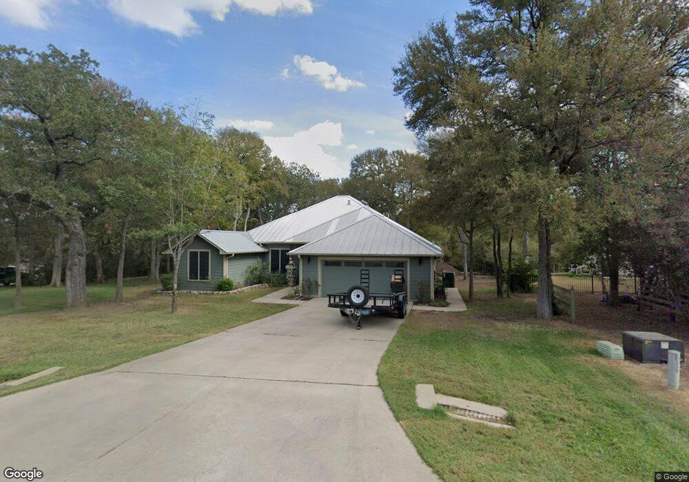
137 Spring Branch Bastrop, TX 78602
Estimated Value: $383,000 - $499,000
3
Beds
2
Baths
1,819
Sq Ft
$251/Sq Ft
Est. Value
About This Home
This home is located at 137 Spring Branch, Bastrop, TX 78602 and is currently estimated at $456,340, approximately $250 per square foot. 137 Spring Branch is a home located in Bastrop County with nearby schools including Mina Elementary School, Bastrop Intermediate School, and Bastrop Middle School.
Ownership History
Date
Name
Owned For
Owner Type
Purchase Details
Closed on
Aug 27, 2010
Sold by
Taylor Bennie L
Bought by
Wolf Ryan W
Current Estimated Value
Home Financials for this Owner
Home Financials are based on the most recent Mortgage that was taken out on this home.
Original Mortgage
$141,600
Outstanding Balance
$94,259
Interest Rate
4.6%
Mortgage Type
New Conventional
Estimated Equity
$362,081
Purchase Details
Closed on
Mar 2, 2005
Sold by
Calvin Bruce R
Bought by
Taylor Bennie L
Home Financials for this Owner
Home Financials are based on the most recent Mortgage that was taken out on this home.
Original Mortgage
$25,500
Interest Rate
5.66%
Mortgage Type
Future Advance Clause Open End Mortgage
Create a Home Valuation Report for This Property
The Home Valuation Report is an in-depth analysis detailing your home's value as well as a comparison with similar homes in the area
Home Values in the Area
Average Home Value in this Area
Purchase History
| Date | Buyer | Sale Price | Title Company |
|---|---|---|---|
| Wolf Ryan W | $141,600 | Alamo Title Company | |
| Taylor Bennie L | -- | Alamo Title Company |
Source: Public Records
Mortgage History
| Date | Status | Borrower | Loan Amount |
|---|---|---|---|
| Open | Wolf Ryan W | $141,600 | |
| Previous Owner | Taylor Bennie L | $25,500 |
Source: Public Records
Tax History Compared to Growth
Tax History
| Year | Tax Paid | Tax Assessment Tax Assessment Total Assessment is a certain percentage of the fair market value that is determined by local assessors to be the total taxable value of land and additions on the property. | Land | Improvement |
|---|---|---|---|---|
| 2025 | $5,583 | $465,931 | -- | -- |
| 2023 | $5,583 | $385,067 | $0 | $0 |
| 2022 | $4,731 | $299,966 | $0 | $0 |
| 2021 | $5,398 | $287,503 | $57,685 | $229,818 |
| 2020 | $5,060 | $247,905 | $34,990 | $212,915 |
| 2019 | $5,235 | $247,027 | $34,990 | $212,037 |
| 2018 | $5,566 | $261,410 | $34,990 | $226,708 |
| 2017 | $5,318 | $237,645 | $38,489 | $208,534 |
| 2016 | $4,834 | $216,041 | $34,990 | $187,543 |
| 2015 | $3,738 | $195,675 | $34,990 | $160,685 |
| 2014 | $3,738 | $182,389 | $27,492 | $154,897 |
Source: Public Records
Map
Nearby Homes
- 175 Cassena Ranch Dr
- TBD (27 Acres) Shiloh Rd
- 0 Texas 304
- 156 Lone Star Cir
- 123 Lone Star Cir
- 110 Trapper Trail
- 206 Pheasant Trail
- 203 Pheasant Trail
- 102 Thompson Trail
- 102 Buck Shot Ct
- 341 Bird Dog Bend
- 127 Eleanor Ln
- 204 Caliber Cove
- 235 El Camino River Rd
- 709 Bluffview Dr
- 175 Bobs Trail
- 1133 Largemouth Ln
- 217 Baron Creek Trail
- 310 Pack Horse Dr
- 132 Brittany Ln
- 133 Spring Branch
- 141 Spring Branch
- 132 Spring Branch
- 144 Spring Branch
- 110 Bobcat Trail
- 150 Spring Meadow
- 262 Trigg Rd
- 147 Spring Branch
- 258 Trigg Rd
- 121 Spring Branch
- 268 Trigg Rd
- 118 Spring Branch
- 121 Spring Branch
- 150 Spring Branch
- 272 Trigg Rd
- 128 Spring Meadow
- 152 Spring Branch
- 153 Spring Branch
- 252 Trigg Rd
- 103 Jacobs Cove