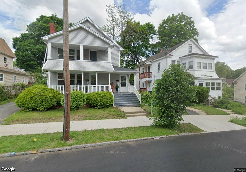
137 Suffolk St Springfield, MA 01109
Upper Hill NeighborhoodEstimated Value: $298,819 - $394,000
6
Beds
2
Baths
2,216
Sq Ft
$156/Sq Ft
Est. Value
About This Home
This home is located at 137 Suffolk St, Springfield, MA 01109 and is currently estimated at $345,455, approximately $155 per square foot. 137 Suffolk St is a home located in Hampden County with nearby schools including Daniel B Brunton, John J Duggan Middle, and Springfield High School of Science and Technology.
Ownership History
Date
Name
Owned For
Owner Type
Purchase Details
Closed on
Sep 30, 2005
Sold by
Jtg Rlty Developers Ll and Laurie
Bought by
Eatmon Annette B and Williams Charlotte L
Current Estimated Value
Home Financials for this Owner
Home Financials are based on the most recent Mortgage that was taken out on this home.
Original Mortgage
$148,500
Outstanding Balance
$78,909
Interest Rate
5.84%
Mortgage Type
Purchase Money Mortgage
Estimated Equity
$266,546
Purchase Details
Closed on
Aug 17, 2004
Sold by
Wells Fargo Bank Mn
Bought by
Jtj Rlty Developers Ll
Purchase Details
Closed on
Mar 23, 2004
Sold by
Wells Fargo Bank Minne and Kinisu
Bought by
Wells Fargo Bank Minne
Purchase Details
Closed on
Sep 30, 1994
Sold by
Gingras Arthur H and Gingras Iris
Bought by
Kinisu Bernard W and Chele Robai N
Home Financials for this Owner
Home Financials are based on the most recent Mortgage that was taken out on this home.
Original Mortgage
$50,102
Interest Rate
8.5%
Mortgage Type
Purchase Money Mortgage
Create a Home Valuation Report for This Property
The Home Valuation Report is an in-depth analysis detailing your home's value as well as a comparison with similar homes in the area
Home Values in the Area
Average Home Value in this Area
Purchase History
| Date | Buyer | Sale Price | Title Company |
|---|---|---|---|
| Eatmon Annette B | $165,000 | -- | |
| Eatmon Annette B | $165,000 | -- | |
| Jtj Rlty Developers Ll | $85,000 | -- | |
| Jtj Rlty Developers Ll | $85,000 | -- | |
| Wells Fargo Bank Minne | $87,568 | -- | |
| Wells Fargo Bank Minne | $87,568 | -- | |
| Kinisu Bernard W | $51,000 | -- | |
| Kinisu Bernard W | $51,000 | -- |
Source: Public Records
Mortgage History
| Date | Status | Borrower | Loan Amount |
|---|---|---|---|
| Open | Eatmon Annette B | $148,500 | |
| Closed | Kinisu Bernard W | $148,500 | |
| Previous Owner | Kinisu Bernard W | $70,400 | |
| Previous Owner | Kinisu Bernard W | $50,102 |
Source: Public Records
Tax History
| Year | Tax Paid | Tax Assessment Tax Assessment Total Assessment is a certain percentage of the fair market value that is determined by local assessors to be the total taxable value of land and additions on the property. | Land | Improvement |
|---|---|---|---|---|
| 2025 | $3,964 | $252,800 | $30,700 | $222,100 |
| 2024 | $4,184 | $260,500 | $30,700 | $229,800 |
| 2023 | $3,453 | $202,500 | $27,900 | $174,600 |
| 2022 | $3,457 | $183,700 | $26,100 | $157,600 |
| 2021 | $3,302 | $174,700 | $18,500 | $156,200 |
| 2020 | $3,144 | $161,000 | $18,500 | $142,500 |
| 2019 | $2,887 | $146,700 | $15,800 | $130,900 |
| 2018 | $2,765 | $140,500 | $15,800 | $124,700 |
| 2017 | $2,621 | $133,300 | $14,800 | $118,500 |
| 2016 | $2,229 | $113,400 | $14,800 | $98,600 |
| 2015 | $2,223 | $113,000 | $14,800 | $98,200 |
Source: Public Records
Map
Nearby Homes
- 135-137 Suffolk St
- 89 Bristol St
- 111 Marlborough St
- 62-64 Bristol St
- 31-33 Suffolk St
- 283 Wilbraham Rd
- 87 Fenwick St
- 11 Ina St
- 48-50 Dresden St
- 25 Dresden St
- 0 NS (24) Alden St
- 21 Westford Cir
- 19 Westford Ave
- 34 Elsie St
- 189 Northampton Ave
- 46 Mapledell St
- 236 Pondview Dr
- 22 Amanda St
- 65 Montrose St
- 290 Quincy St
- 135 Suffolk St
- 143 Suffolk St
- 129 Suffolk St
- 125 Suffolk St Unit 127
- 192 Westford Cir Unit 194
- 138 Bristol St
- 138 Bristol St Unit R
- 136 Suffolk St
- 134 Bristol St
- 202 Westford Cir
- 142 Suffolk St Unit 144
- 130-132 Suffolk St
- 130 Suffolk St Unit 132
- 121 Suffolk St
- 128 Bristol St
- 206 Westford Cir Unit 208
- 184 Westford Cir Unit 186
- 184-186 Westford Cir
- 126 Suffolk St
- 117 Suffolk St
Your Personal Tour Guide
Ask me questions while you tour the home.