Estimated Value: $839,801 - $895,000
3
Beds
2
Baths
1,678
Sq Ft
$516/Sq Ft
Est. Value
About This Home
This home is located at 13701, Black Butte Ranch, OR 97759 and is currently estimated at $865,450, approximately $515 per square foot. 13701 is a home located in Deschutes County with nearby schools including Sisters Elementary School, Sisters Middle School, and Sisters High School.
Ownership History
Date
Name
Owned For
Owner Type
Purchase Details
Closed on
Jun 20, 2024
Sold by
Kufchak Dwayne A and Kufchak Lori A
Bought by
Acadia Holdings Llc
Current Estimated Value
Home Financials for this Owner
Home Financials are based on the most recent Mortgage that was taken out on this home.
Original Mortgage
$692,000
Outstanding Balance
$663,444
Interest Rate
6.95%
Mortgage Type
New Conventional
Estimated Equity
$196,756
Purchase Details
Closed on
May 19, 2004
Sold by
Rolf Edward R and Rolf Judith M
Bought by
Kufchak Dwayne A and Kufchak Lori A
Home Financials for this Owner
Home Financials are based on the most recent Mortgage that was taken out on this home.
Original Mortgage
$312,060
Interest Rate
5.77%
Mortgage Type
Unknown
Create a Home Valuation Report for This Property
The Home Valuation Report is an in-depth analysis detailing your home's value as well as a comparison with similar homes in the area
Home Values in the Area
Average Home Value in this Area
Purchase History
| Date | Buyer | Sale Price | Title Company |
|---|---|---|---|
| Acadia Holdings Llc | $865,000 | First American Title | |
| Kufchak Dwayne A | $390,075 | Western Title & Escrow Co |
Source: Public Records
Mortgage History
| Date | Status | Borrower | Loan Amount |
|---|---|---|---|
| Open | Acadia Holdings Llc | $692,000 | |
| Previous Owner | Kufchak Dwayne A | $281,000 | |
| Previous Owner | Kufchak Dwayne A | $312,060 |
Source: Public Records
Tax History Compared to Growth
Tax History
| Year | Tax Paid | Tax Assessment Tax Assessment Total Assessment is a certain percentage of the fair market value that is determined by local assessors to be the total taxable value of land and additions on the property. | Land | Improvement |
|---|---|---|---|---|
| 2024 | $7,464 | $474,730 | -- | -- |
| 2023 | $7,161 | $460,910 | $0 | $0 |
| 2022 | $6,650 | $434,460 | $0 | $0 |
| 2021 | $6,720 | $421,810 | $0 | $0 |
| 2020 | $6,274 | $421,810 | $0 | $0 |
| 2019 | $6,148 | $409,530 | $0 | $0 |
| 2018 | $5,880 | $397,610 | $0 | $0 |
| 2017 | $5,664 | $386,030 | $0 | $0 |
| 2016 | $5,567 | $374,790 | $0 | $0 |
| 2015 | $5,276 | $363,880 | $0 | $0 |
| 2014 | $5,072 | $353,290 | $0 | $0 |
Source: Public Records
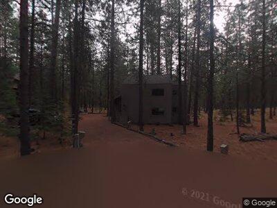
Map
Nearby Homes
- 70710 Steeple Bush
- 70686 Buck Brush Unit SM85
- 70786 Blazing Star Unit RR 64
- 70684 Steeple Bush Unit SM 153
- 70665 Buck Brush Unit SM 89
- 70612 Larkspur
- 13579 Sundew Unit SM34
- 70780 Bitter Root
- 13675 Hawks Beard Unit SM223
- 13555 Hawks Beard Unit SM 208
- 70425 Twistedstock
- 70820 Hyacinth Unit SH26
- 70340 Sword Fern Gm246
- 70335 Sword Fern Unit GM249
- 13400 Foxtail Unit 99
- 13400 Fox Tail
- 13400 Foxtail Unit GCC 101
- 12900 Hawks Beard Unit 42-43
- 70330 Willow Herb Unit GM201
- 14023 Hawks Beard Unit GM164
- 13701
- 13709 Partridge Foot
- 13700 Partridge Foot Rr#50
- 13700 Partridge Foot Rr 50
- 13700 Partridge Foot Unit RR50
- 13700 Partridge Foot
- 13706 Partridge Foot Unit RR 51
- 13706 Partridge Foot
- 13719 Partridge Foot
- 13719 Partridge Foot Unit RR 81
- 70735 Ponderosa Ln
- 13719 Partridge Foot Rr 81 (1 4)
- 13712 Partridge Foot
- 13753 Partridge Foot Unit RR 78
- 70739 Ponderosa Ln
- 13718 Partridge Foot
- 13729 Partridge Foot Unit RR80
- 13729 Partridge Foot
- 13751 Partridge Foot Rr79
- 13751 Partridge Foot Unit RR79