Estimated Value: $940,573 - $1,077,000
3
Beds
2
Baths
1,346
Sq Ft
$767/Sq Ft
Est. Value
About This Home
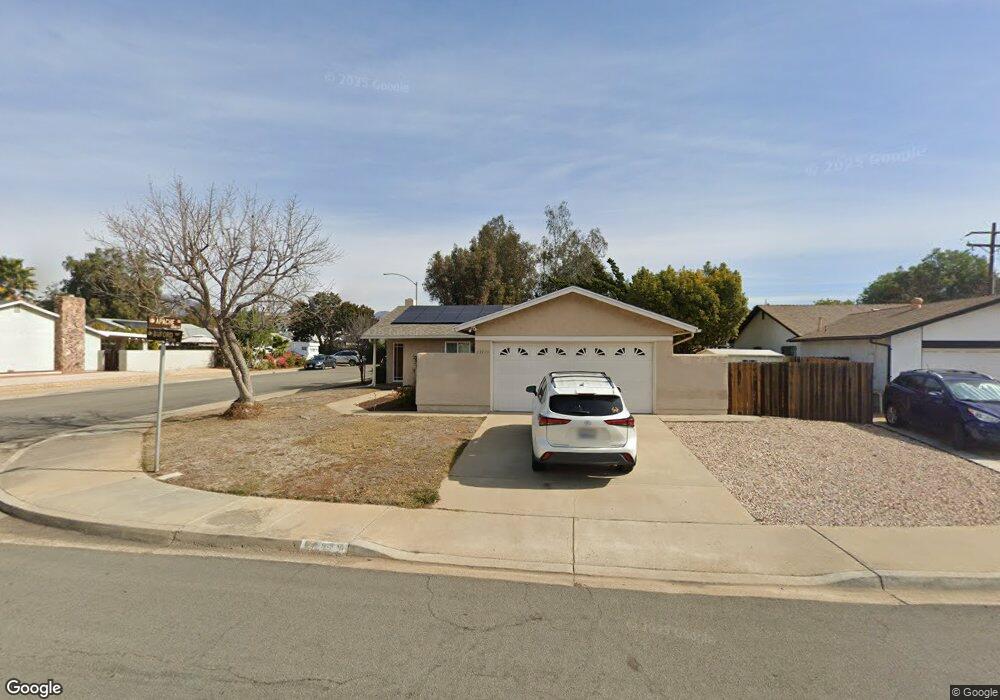
This home is located at 13709 Buford Way, Poway, CA 92064 and is currently estimated at $1,032,893, approximately $767 per square foot. 13709 Buford Way is a home located in San Diego County with nearby schools including Midland Elementary, Twin Peaks Middle, and Poway High.
Ownership History
Date
Name
Owned For
Owner Type
Purchase Details
Closed on
Jun 17, 2020
Sold by
Ozenbaugh Stanley Edwin and Ozenbaugh Jan Moyna
Bought by
Ozenbaugh Stanley Edwin and Ozenbaugh Jan Moyna
Current Estimated Value
Purchase Details
Closed on
Oct 4, 2010
Sold by
Ozenbaugh Stanley Edwin and Ozenbaugh Jan Moyna Zugay
Bought by
Ozenbaugh Stanley Edwin and Ozenbaugh Jan Moyna Zugay
Purchase Details
Closed on
Oct 5, 2006
Sold by
Ozenbaugh Stanley Edwin and Ozenbaugh Jan Moyna Zugay
Bought by
Ozenbaugh Stanley Edwin and Ozenbaugh Jan Moyna Zugay
Purchase Details
Closed on
May 31, 1991
Purchase Details
Closed on
Jan 2, 1986
Create a Home Valuation Report for This Property
The Home Valuation Report is an in-depth analysis detailing your home's value as well as a comparison with similar homes in the area
Home Values in the Area
Average Home Value in this Area
Purchase History
| Date | Buyer | Sale Price | Title Company |
|---|---|---|---|
| Ozenbaugh Stanley Edwin | -- | None Available | |
| Ozenbaugh Stanley Edwin | -- | None Available | |
| Ozenbaugh Stanley Edwin | -- | None Available | |
| -- | $169,900 | -- | |
| -- | $114,000 | -- |
Source: Public Records
Tax History
| Year | Tax Paid | Tax Assessment Tax Assessment Total Assessment is a certain percentage of the fair market value that is determined by local assessors to be the total taxable value of land and additions on the property. | Land | Improvement |
|---|---|---|---|---|
| 2025 | $3,372 | $304,795 | $135,261 | $169,534 |
| 2024 | $3,372 | $298,819 | $132,609 | $166,210 |
| 2023 | $3,300 | $292,960 | $130,009 | $162,951 |
| 2022 | $3,244 | $287,216 | $127,460 | $159,756 |
| 2021 | $3,202 | $281,585 | $124,961 | $156,624 |
| 2020 | $3,159 | $278,699 | $123,680 | $155,019 |
| 2019 | $3,077 | $273,235 | $121,255 | $151,980 |
| 2018 | $2,991 | $267,878 | $118,878 | $149,000 |
| 2017 | $2,911 | $262,627 | $116,548 | $146,079 |
| 2016 | $2,851 | $257,478 | $114,263 | $143,215 |
| 2015 | $2,808 | $253,611 | $112,547 | $141,064 |
| 2014 | $2,743 | $248,644 | $110,343 | $138,301 |
Source: Public Records
Map
Nearby Homes
- 13422 Little Dawn Ln
- 000 Carlson Ct 9 Unit 9
- 13619 Sycamore Tree Ln
- 13947 Midland Rd
- 13908 Hibiscus Ave Unit 40
- 13941 Wisteria Ave
- 14003 Jasmine Ave Unit 193
- 14015 Olive Meadows Place
- 13650 Mulberry Tree Ct Unit 167
- 13643 Melissa Ln
- 13483 Pequot Dr
- 13303 Betty Lee Way
- 13056 Poway Rd
- 12885 Rockwell Ct
- 12939 Cree Ct
- 1/2 Poway Rd
- 14403 Gaslight Ct
- 12959 Creek Park Dr
- 13087 Olympus Cir Unit 2
- 13329 Casa Vista St Unit 98
- 13705 Buford Way
- 13511 Apache Rd
- 13725 Buford Way
- 13450 Ketron Ave
- 13701 Buford Way
- 13716 Buford Way
- 13512 Apache Rd
- 13733 Buford Way
- 13724 Buford Way
- 13459 Ketron Ave
- 13442 Ketron Ave
- 13451 Ketron Ave
- 13732 Buford Way
- 13741 Buford Way
- 13711 Mckenzie Ave
- 13443 Ketron Ave
- 13520 Apache Rd
- 13440 Little Dawn Ln
- 13432 Ketron Ave
- 13719 Mckenzie Ave
Your Personal Tour Guide
Ask me questions while you tour the home.