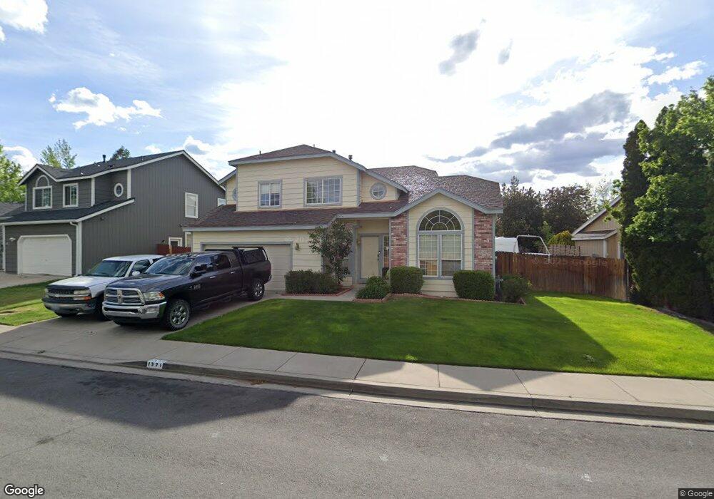
1371 Mistyridge Ln Reno, NV 89523
Kings Row NeighborhoodEstimated Value: $576,000 - $625,000
3
Beds
3
Baths
1,951
Sq Ft
$307/Sq Ft
Est. Value
About This Home
This home is located at 1371 Mistyridge Ln, Reno, NV 89523 and is currently estimated at $598,865, approximately $306 per square foot. 1371 Mistyridge Ln is a home located in Washoe County with nearby schools including Grace Warner Elementary School, Archie Clayton Pre-AP Academy, and Reno High School.
Ownership History
Date
Name
Owned For
Owner Type
Purchase Details
Closed on
Apr 30, 1998
Sold by
Tsang Kar Wing
Bought by
Sosa Daniel M
Current Estimated Value
Home Financials for this Owner
Home Financials are based on the most recent Mortgage that was taken out on this home.
Original Mortgage
$140,250
Outstanding Balance
$31,682
Interest Rate
8.87%
Estimated Equity
$567,183
Purchase Details
Closed on
Jan 7, 1994
Sold by
Centex Real Estate Corp
Bought by
Tsang Kar Wing
Home Financials for this Owner
Home Financials are based on the most recent Mortgage that was taken out on this home.
Original Mortgage
$133,443
Interest Rate
7.38%
Create a Home Valuation Report for This Property
The Home Valuation Report is an in-depth analysis detailing your home's value as well as a comparison with similar homes in the area
Home Values in the Area
Average Home Value in this Area
Purchase History
| Date | Buyer | Sale Price | Title Company |
|---|---|---|---|
| Sosa Daniel M | $165,000 | Founders Title Co | |
| Tsang Kar Wing | $153,500 | First Centennial Title Co |
Source: Public Records
Mortgage History
| Date | Status | Borrower | Loan Amount |
|---|---|---|---|
| Open | Sosa Daniel M | $140,250 | |
| Previous Owner | Tsang Kar Wing | $133,443 | |
| Closed | Sosa Daniel M | $11,000 |
Source: Public Records
Tax History Compared to Growth
Tax History
| Year | Tax Paid | Tax Assessment Tax Assessment Total Assessment is a certain percentage of the fair market value that is determined by local assessors to be the total taxable value of land and additions on the property. | Land | Improvement |
|---|---|---|---|---|
| 2025 | $4,863 | $104,110 | $44,730 | $59,380 |
| 2024 | $4,863 | $97,175 | $36,960 | $60,215 |
| 2023 | $3,054 | $94,592 | $37,240 | $57,352 |
| 2022 | $2,829 | $80,442 | $32,410 | $48,032 |
| 2021 | $2,623 | $72,457 | $24,430 | $48,027 |
| 2020 | $3,505 | $72,495 | $24,150 | $48,345 |
| 2019 | $3,360 | $70,058 | $23,100 | $46,958 |
| 2018 | $3,218 | $63,648 | $17,570 | $46,078 |
| 2017 | $2,839 | $62,865 | $16,555 | $46,310 |
| 2016 | $2,095 | $61,989 | $14,455 | $47,534 |
| 2015 | $2,094 | $60,210 | $12,740 | $47,470 |
| 2014 | $2,030 | $57,361 | $11,935 | $45,426 |
| 2013 | -- | $53,540 | $8,680 | $44,860 |
Source: Public Records
Map
Nearby Homes
- 1413 Solitude Trail
- 1592 Reno View Dr
- 610 Akard Cir
- 670 Nancy Cir
- 3271 Heights Dr
- 730 James Ct
- 2595 W 7th St
- 4530 Stonegate Ln Unit 2
- 940 Skyway Dr
- 0000 Mccarran
- 4642 Canyon Ridge Ln
- 2260 W 6th St
- 2875 Idlewild Dr Unit 91
- 2875 Idlewild Dr Unit 51
- 2875 Idlewild Dr Unit 14
- 3465 Yosemite Place
- 2855 Idlewild Dr Unit 124
- 2855 Idlewild Dr Unit 223
- 3570 W 7th St
- 2100 W 6th St
- 1375 Mistyridge Ln
- 1367 Mistyridge Ln
- 1379 Mistyridge Ln
- 1363 Mistyridge Ln
- 4485 Smokeridge Dr
- 4497 Highplains Dr
- 4484 Smokeridge Dr
- 1385 Mistyridge Ct
- 1359 Mistyridge Ln
- 4475 Smokeridge Dr
- 4487 Highplains Dr Unit 4
- 4498 Highplains Dr
- 4474 Smokeridge Dr
- 1409 Sandyhill Ln
- 1393 Mistyridge Ct
- 1355 Mistyridge Ln
- 4488 Highplains Dr
- 4501 Reddawn Dr
- 4465 Smokeridge Dr Unit 4
- 4477 Highplains Dr