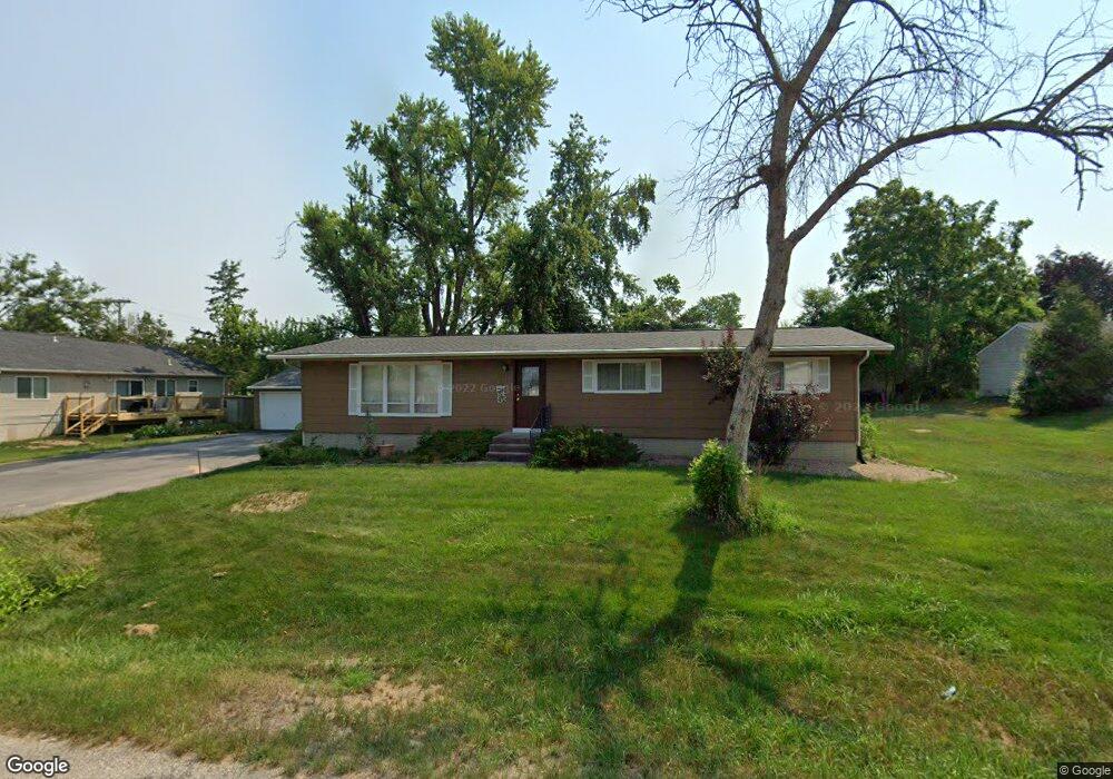
1371 Westland Rd NW Cedar Rapids, IA 52405
Estimated Value: $219,484 - $265,000
3
Beds
4
Baths
1,408
Sq Ft
$176/Sq Ft
Est. Value
About This Home
This home is located at 1371 Westland Rd NW, Cedar Rapids, IA 52405 and is currently estimated at $247,871, approximately $176 per square foot. 1371 Westland Rd NW is a home located in Linn County with nearby schools including Maple Grove Elementary School, North Middletown Elementary School, and Ponderosa Elementary School.
Ownership History
Date
Name
Owned For
Owner Type
Purchase Details
Closed on
May 13, 2004
Sold by
Starn David G and Starn Carlotta J
Bought by
Vandyke Robert J and Vandyke Jacqueline S
Current Estimated Value
Home Financials for this Owner
Home Financials are based on the most recent Mortgage that was taken out on this home.
Original Mortgage
$46,000
Outstanding Balance
$22,097
Interest Rate
5.85%
Mortgage Type
Unknown
Estimated Equity
$225,774
Create a Home Valuation Report for This Property
The Home Valuation Report is an in-depth analysis detailing your home's value as well as a comparison with similar homes in the area
Home Values in the Area
Average Home Value in this Area
Purchase History
| Date | Buyer | Sale Price | Title Company |
|---|---|---|---|
| Vandyke Robert J | $131,000 | -- |
Source: Public Records
Mortgage History
| Date | Status | Borrower | Loan Amount |
|---|---|---|---|
| Open | Vandyke Robert J | $46,000 |
Source: Public Records
Tax History Compared to Growth
Tax History
| Year | Tax Paid | Tax Assessment Tax Assessment Total Assessment is a certain percentage of the fair market value that is determined by local assessors to be the total taxable value of land and additions on the property. | Land | Improvement |
|---|---|---|---|---|
| 2025 | $2,558 | $217,900 | $28,100 | $189,800 |
| 2024 | $3,040 | $192,200 | $28,100 | $164,100 |
| 2023 | $3,040 | $170,700 | $28,100 | $142,600 |
| 2022 | $2,984 | $156,400 | $28,100 | $128,300 |
| 2021 | $2,962 | $156,400 | $28,100 | $128,300 |
| 2020 | $2,962 | $146,100 | $28,100 | $118,000 |
| 2019 | $2,690 | $136,600 | $22,500 | $114,100 |
| 2018 | $2,610 | $136,600 | $22,500 | $114,100 |
| 2017 | $2,680 | $134,800 | $22,500 | $112,300 |
| 2016 | $2,795 | $134,800 | $22,500 | $112,300 |
| 2015 | $3,075 | $147,801 | $22,496 | $125,305 |
| 2014 | $2,890 | $147,801 | $22,496 | $125,305 |
| 2013 | $2,822 | $147,801 | $22,496 | $125,305 |
Source: Public Records
Map
Nearby Homes
- 1608 Morris Ave NW
- 1722 Gardner Dr NW
- 4819 Fruitwood Ln NW
- 3802 Richland Dr NW
- 327* Edgewood Rd NW
- 3313 Crestwood Dr NW
- 3312 G Ave NW
- 1613 Southview Dr NW
- 3507 E Ave NW Unit F
- 1322 Woodside Dr NW
- 3509 E Ave NW Unit D
- 1733 Hillside Dr NW
- 4819 Ford Ave NW
- 272 Peace Ave NW
- 1410 Adair Ct SW Unit Lot 2
- 281 Jacolyn Dr NW
- 2825 Schultz Dr NW
- 3600 Midway Dr NW
- 208 Lenora Dr NW
- 912 29th St NW
- 4331 M Ave NW
- 1360 Westland Rd NW
- 1349 Westland Rd NW
- 4321 M Ave NW
- 4330 Beecher Ct NW
- 1370 Westland Rd NW
- 1350 Westland Rd NW
- 4320 Beecher Ct NW
- 4311 M Ave NW
- 4330 M Ave NW
- 4310 Beecher Ct NW
- LOT 15 Westland Rd NW
- 4350 M Ave NW
- 4320 M Ave NW
- 4241 M Ave NW
- 4410 M Ave NW
- 1330 Westland Rd NW
- 1340 Westland Rd NW
- 4240 Beecher Ct NW
- 4431 M Ave NW