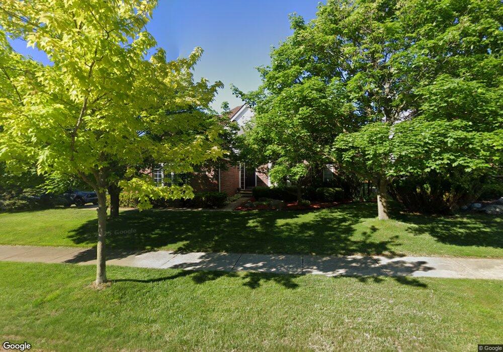
1372 Kentfield Dr Rochester, MI 48307
Estimated Value: $735,803 - $955,000
4
Beds
5
Baths
3,325
Sq Ft
$248/Sq Ft
Est. Value
About This Home
This home is located at 1372 Kentfield Dr, Rochester, MI 48307 and is currently estimated at $824,951, approximately $248 per square foot. 1372 Kentfield Dr is a home located in Oakland County with nearby schools including Hart Middle School, North Hill Elementary School, and Stoney Creek High School.
Ownership History
Date
Name
Owned For
Owner Type
Purchase Details
Closed on
Apr 14, 2011
Sold by
Gistinger Dennis J and Gistinger Maria Ann
Bought by
Pae Youn Whan
Current Estimated Value
Purchase Details
Closed on
Sep 20, 2005
Sold by
Hoffman Edmond P and Hoffman Marilyn R
Bought by
Gistinger Dennis J
Home Financials for this Owner
Home Financials are based on the most recent Mortgage that was taken out on this home.
Original Mortgage
$359,650
Interest Rate
5.88%
Mortgage Type
Fannie Mae Freddie Mac
Purchase Details
Closed on
Feb 25, 2004
Sold by
Hoffman Edmond P and Hoffman Marilyn R
Bought by
Hoffman Edmond P and Hoffman Marilyn R
Create a Home Valuation Report for This Property
The Home Valuation Report is an in-depth analysis detailing your home's value as well as a comparison with similar homes in the area
Home Values in the Area
Average Home Value in this Area
Purchase History
| Date | Buyer | Sale Price | Title Company |
|---|---|---|---|
| Pae Youn Whan | $355,000 | Capital Title Ins Agency | |
| Gistinger Dennis J | -- | -- | |
| Hoffman Edmond P | -- | Lawyers Title Insurance Corp |
Source: Public Records
Mortgage History
| Date | Status | Borrower | Loan Amount |
|---|---|---|---|
| Previous Owner | Gistinger Dennis J | $359,650 |
Source: Public Records
Tax History Compared to Growth
Tax History
| Year | Tax Paid | Tax Assessment Tax Assessment Total Assessment is a certain percentage of the fair market value that is determined by local assessors to be the total taxable value of land and additions on the property. | Land | Improvement |
|---|---|---|---|---|
| 2024 | $6,507 | $319,580 | $0 | $0 |
| 2023 | $6,231 | $303,910 | $0 | $0 |
| 2022 | $6,628 | $265,870 | $0 | $0 |
| 2021 | $6,227 | $244,120 | $0 | $0 |
| 2020 | $5,847 | $241,720 | $0 | $0 |
| 2019 | $6,428 | $244,610 | $0 | $0 |
| 2018 | $6,419 | $246,910 | $0 | $0 |
| 2017 | $6,294 | $245,800 | $0 | $0 |
| 2016 | $6,094 | $238,140 | $0 | $0 |
| 2015 | -- | $226,340 | $0 | $0 |
| 2014 | -- | $191,290 | $0 | $0 |
| 2011 | -- | $153,840 | $0 | $0 |
Source: Public Records
Map
Nearby Homes
- 1022 Pointe Place Blvd
- 674 Springview Dr
- 628 Springview Dr Unit 120
- 767 E Bluff Ct Unit 7
- 620 Appoline Ct
- 1688 Deepwood Cir
- 500 Romeo Rd Unit 122
- 801 Plate St Unit 201
- 761 Lounsbury Ave
- 536 Rewold Dr
- 417 Parkdale Ave Unit 13
- 433 Miller Ave Unit 204
- 334 Romeo Rd
- 420 Baldwin Ave Unit 79
- 1874 Flagstone Cir
- 1850 Flagstone Cir Unit 53
- 1322 Copper Cir Unit 26
- 509 E University Dr Unit 508
- 877 Quarry
- 861 Quarry
- 1364 Kentfield Dr
- 1358 Kentfield Dr
- 1273 Putnam Cir
- 450 Duncan Ct
- 1286 Putnam Cir
- 1280 Putnam Cir
- 1375 Kentfield Dr
- 1276 Putnam Cir
- 1267 Putnam Cir
- 1294 Putnam Cir
- 1348 Kentfield Dr
- 1270 Putnam Cir
- 1381 Kentfield Dr
- 462 Duncan Ct Unit Bldg-Unit
- 462 Duncan Ct
- 1261 Putnam Cir
- 1390 Kentfield Dr
- 1264 Putnam Cir
- 1336 Kentfield Dr
- 1357 Kentfield Dr