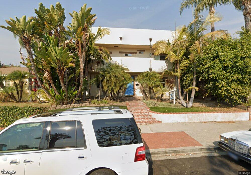
1372 Opal St San Diego, CA 92109
Pacific Beach NeighborhoodEstimated Value: $1,921,000 - $3,034,000
5
Beds
5
Baths
2,784
Sq Ft
$902/Sq Ft
Est. Value
About This Home
This home is located at 1372 Opal St, San Diego, CA 92109 and is currently estimated at $2,509,970, approximately $901 per square foot. 1372 Opal St is a home located in San Diego County with nearby schools including Pacific Beach Elementary School, Pacific Beach Middle, and Mission Bay High School.
Ownership History
Date
Name
Owned For
Owner Type
Purchase Details
Closed on
Sep 22, 2008
Sold by
Us Bank Na
Bought by
White John O and White Connie D
Current Estimated Value
Purchase Details
Closed on
Jul 9, 2008
Sold by
Zachadnyk Ethan
Bought by
Us Bank Na
Purchase Details
Closed on
Aug 20, 2002
Sold by
Lind Karen S
Bought by
Zachadnyk Ethan
Home Financials for this Owner
Home Financials are based on the most recent Mortgage that was taken out on this home.
Original Mortgage
$432,000
Interest Rate
6.5%
Purchase Details
Closed on
Sep 6, 2001
Sold by
Lind Karen S
Bought by
Lind Karen S
Purchase Details
Closed on
Jul 13, 1999
Sold by
Trust 05-30-91 Sherman Pearl Fladeboe Separat and Sherman Pearl
Bought by
Lind Karen S
Create a Home Valuation Report for This Property
The Home Valuation Report is an in-depth analysis detailing your home's value as well as a comparison with similar homes in the area
Home Values in the Area
Average Home Value in this Area
Purchase History
| Date | Buyer | Sale Price | Title Company |
|---|---|---|---|
| White John O | $599,000 | Ticor Title San Bernardino | |
| Us Bank Na | $612,800 | Accommodation | |
| Zachadnyk Ethan | $540,000 | Commonwealth Land Title Co | |
| Zachadnyk Ethan | -- | Commonwealth Land Title Co | |
| Lind Karen S | -- | -- | |
| Lind Karen S | -- | -- |
Source: Public Records
Mortgage History
| Date | Status | Borrower | Loan Amount |
|---|---|---|---|
| Previous Owner | Zachadnyk Ethan | $432,000 | |
| Closed | Zachadnyk Ethan | $108,000 |
Source: Public Records
Tax History
| Year | Tax Paid | Tax Assessment Tax Assessment Total Assessment is a certain percentage of the fair market value that is determined by local assessors to be the total taxable value of land and additions on the property. | Land | Improvement |
|---|---|---|---|---|
| 2025 | $14,864 | $1,231,658 | $710,591 | $521,067 |
| 2024 | $14,864 | $1,207,508 | $696,658 | $510,850 |
| 2023 | $13,569 | $1,104,833 | $682,999 | $421,834 |
| 2022 | $13,208 | $1,083,170 | $669,607 | $413,563 |
| 2021 | $13,118 | $1,061,932 | $656,478 | $405,454 |
| 2020 | $12,959 | $1,051,044 | $649,747 | $401,297 |
| 2019 | $12,728 | $1,030,436 | $637,007 | $393,429 |
| 2018 | $11,899 | $1,010,232 | $624,517 | $385,715 |
| 2017 | $11,616 | $990,424 | $612,272 | $378,152 |
| 2016 | $11,432 | $971,005 | $600,267 | $370,738 |
| 2015 | $11,264 | $956,421 | $591,251 | $365,170 |
| 2014 | $11,086 | $937,687 | $579,670 | $358,017 |
Source: Public Records
Map
Nearby Homes
- 5187 Foothill Blvd
- 5217 Vickie Dr
- 5111 Windsor Dr
- 5209 Foothill Blvd
- 5247 Ocean Breeze Ct
- 1147 Archer St
- 1544 Chalcedony St
- 1533-39 Chalcedony St
- 4964 Kendall St
- 974 Sapphire St Unit LA2
- 5361 Van Nuys Ct
- 4944 Cass St Unit 604
- 1326 Caminito Arriata
- 1045 Van Nuys St
- 4733 Ingraham St
- 5448 Caminito Bayo
- 1028 Van Nuys St
- 1220 Emerald St
- 928 Agate St
- 863 Agate St Unit 4
- 1382 Opal St
- 1364 Opal St
- 1374 Opal St
- 1404 Opal St
- 1356 Opal St
- 1367 Tourmaline St
- 1375 Tourmaline St
- 1348 Opal St
- 1408 Opal St
- 1359 Tourmaline St
- 1385 Tourmaline St
- 1351 Tourmaline St
- 1365 Opal St
- 1357 Opal St
- 1405 Tourmaline St
- 1340 Opal St
- 1353 Opal St
- 1401 Opal St
- 1412 Opal St
- 1345 Tourmaline St
Your Personal Tour Guide
Ask me questions while you tour the home.