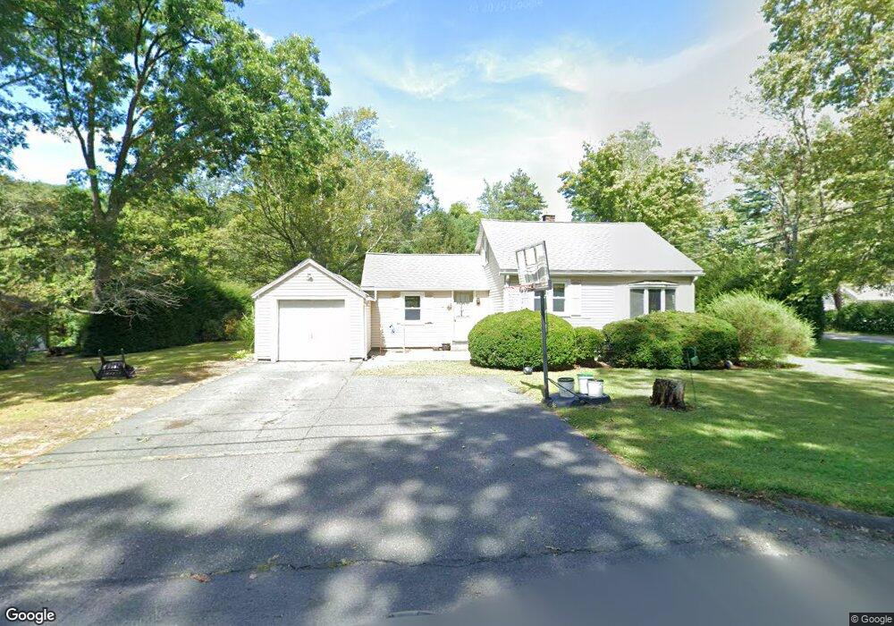
1373 Burts Pit Rd Florence, MA 01062
Florence NeighborhoodEstimated Value: $254,000 - $332,211
2
Beds
1
Bath
955
Sq Ft
$326/Sq Ft
Est. Value
About This Home
This home is located at 1373 Burts Pit Rd, Florence, MA 01062 and is currently estimated at $311,053, approximately $325 per square foot. 1373 Burts Pit Rd is a home located in Hampshire County with nearby schools including Northampton High School and Hilltown Cooperative Charter Public School.
Ownership History
Date
Name
Owned For
Owner Type
Purchase Details
Closed on
Jul 1, 2008
Sold by
Lindahl Gregory J
Bought by
Lindahl Amy L N and Lindahl Gregory J
Current Estimated Value
Purchase Details
Closed on
May 30, 2002
Sold by
Dusseault Mary P and Dusseault Robert E
Bought by
Lindahl Gregory
Create a Home Valuation Report for This Property
The Home Valuation Report is an in-depth analysis detailing your home's value as well as a comparison with similar homes in the area
Home Values in the Area
Average Home Value in this Area
Purchase History
| Date | Buyer | Sale Price | Title Company |
|---|---|---|---|
| Lindahl Amy L N | $120,000 | -- | |
| Lindahl Gregory | $120,000 | -- |
Source: Public Records
Mortgage History
| Date | Status | Borrower | Loan Amount |
|---|---|---|---|
| Open | Lindahl Gregory | $17,600 | |
| Open | Lindahl Gregory | $142,542 | |
| Previous Owner | Lindahl Gregory | $122,500 |
Source: Public Records
Tax History
| Year | Tax Paid | Tax Assessment Tax Assessment Total Assessment is a certain percentage of the fair market value that is determined by local assessors to be the total taxable value of land and additions on the property. | Land | Improvement |
|---|---|---|---|---|
| 2025 | $3,912 | $280,800 | $134,400 | $146,400 |
| 2024 | $4,112 | $270,700 | $128,200 | $142,500 |
| 2023 | $3,841 | $242,500 | $116,400 | $126,100 |
| 2022 | $3,880 | $216,900 | $109,100 | $107,800 |
| 2021 | $3,325 | $191,400 | $104,100 | $87,300 |
| 2020 | $3,216 | $191,400 | $104,100 | $87,300 |
| 2019 | $3,173 | $182,700 | $89,100 | $93,600 |
| 2018 | $3,140 | $184,300 | $89,100 | $95,200 |
| 2017 | $3,076 | $184,300 | $89,100 | $95,200 |
| 2016 | $2,978 | $184,300 | $89,100 | $95,200 |
| 2015 | $2,937 | $185,900 | $89,100 | $96,800 |
| 2014 | $2,861 | $185,900 | $89,100 | $96,800 |
Source: Public Records
Map
Nearby Homes
- 0 W Farms Rd
- 892 Westhampton Rd
- 723 Lot B Ryan Rd
- 404 Sylvester Rd
- 20-11 Sylvester Rd
- 296 Ryan Rd Unit A
- 296 Ryan Rd
- 296 Ryan Rd Unit B
- 815 Burts Pit Rd
- 72 Emerson Way
- 1260 Westhampton Rd
- 42 Clark St
- 635 Florence Rd
- 98 Park Hill Rd
- 589 Florence Rd
- 967 Florence Rd
- 36 Torrey St
- 296 Old Wilson Rd
- 18 Nicols Way Unit 18
- 41 Landy Ave
Your Personal Tour Guide
Ask me questions while you tour the home.