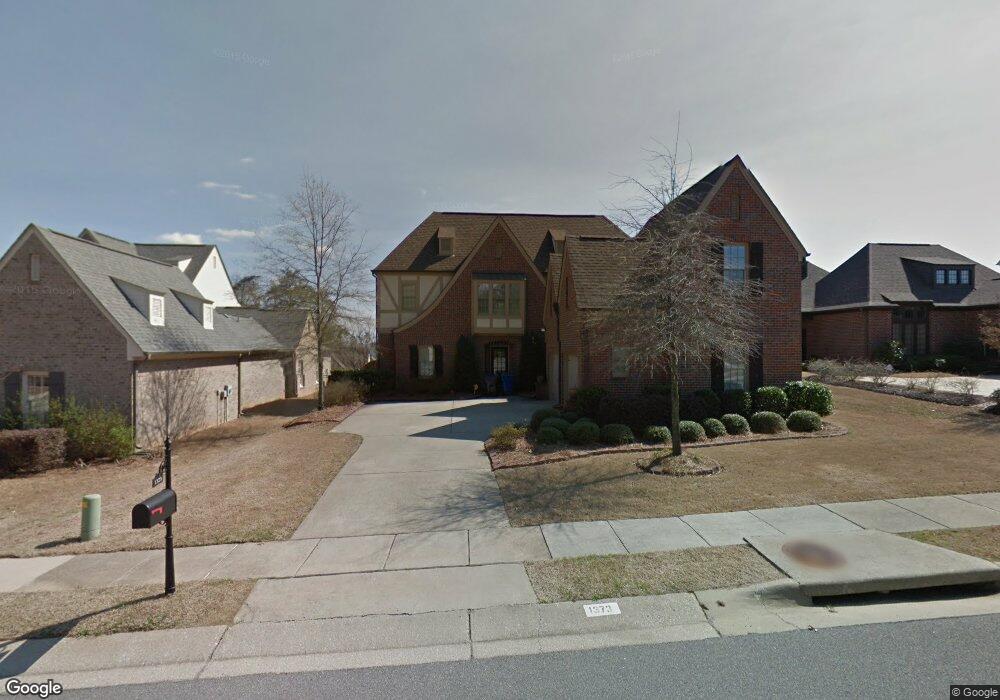
1373 Chapel St Birmingham, AL 35226
Bluff Park NeighborhoodEstimated Value: $579,920 - $637,000
4
Beds
4
Baths
3,144
Sq Ft
$192/Sq Ft
Est. Value
About This Home
This home is located at 1373 Chapel St, Birmingham, AL 35226 and is currently estimated at $603,980, approximately $192 per square foot. 1373 Chapel St is a home located in Jefferson County with nearby schools including Mcadory Middle School, Mcadory High School, and Prince Of Peace Catholic School.
Ownership History
Date
Name
Owned For
Owner Type
Purchase Details
Closed on
Dec 3, 2019
Sold by
Marett Kathryn
Bought by
Calhoun Sabrina Rundle
Current Estimated Value
Home Financials for this Owner
Home Financials are based on the most recent Mortgage that was taken out on this home.
Original Mortgage
$348,099
Outstanding Balance
$306,899
Interest Rate
3.6%
Mortgage Type
New Conventional
Estimated Equity
$297,081
Purchase Details
Closed on
Aug 16, 2013
Sold by
Mancuso Tyler R
Bought by
Marett Kathryn
Purchase Details
Closed on
Jul 6, 2009
Sold by
Marich Rachel J and Marich Joshua M
Bought by
Mancuso Tyler R and Mancuso Stefan
Home Financials for this Owner
Home Financials are based on the most recent Mortgage that was taken out on this home.
Original Mortgage
$285,200
Interest Rate
5.01%
Mortgage Type
New Conventional
Create a Home Valuation Report for This Property
The Home Valuation Report is an in-depth analysis detailing your home's value as well as a comparison with similar homes in the area
Home Values in the Area
Average Home Value in this Area
Purchase History
| Date | Buyer | Sale Price | Title Company |
|---|---|---|---|
| Calhoun Sabrina Rundle | $435,124 | -- | |
| Marett Kathryn | $397,000 | -- | |
| Mancuso Tyler R | $356,500 | None Available |
Source: Public Records
Mortgage History
| Date | Status | Borrower | Loan Amount |
|---|---|---|---|
| Open | Calhoun Sabrina Rundle | $348,099 | |
| Previous Owner | Mancuso Tyler R | $285,200 |
Source: Public Records
Tax History Compared to Growth
Tax History
| Year | Tax Paid | Tax Assessment Tax Assessment Total Assessment is a certain percentage of the fair market value that is determined by local assessors to be the total taxable value of land and additions on the property. | Land | Improvement |
|---|---|---|---|---|
| 2024 | $3,883 | $54,220 | -- | -- |
| 2022 | $3,236 | $45,290 | $7,400 | $37,890 |
| 2021 | $3,123 | $43,740 | $7,400 | $36,340 |
| 2020 | $2,794 | $39,070 | $7,400 | $31,670 |
| 2019 | $2,784 | $39,080 | $0 | $0 |
| 2018 | $2,829 | $39,700 | $0 | $0 |
| 2017 | $2,735 | $38,400 | $0 | $0 |
| 2016 | $2,735 | $38,400 | $0 | $0 |
| 2015 | $2,735 | $38,400 | $0 | $0 |
| 2014 | $2,497 | $37,880 | $0 | $0 |
| 2013 | $2,497 | $37,880 | $0 | $0 |
Source: Public Records
Map
Nearby Homes
- 313 E Stone Brook Place
- 1437 Pavillon Dr Unit 14
- 2345 Woodcreek Dr
- 2503 Hawksbury Ln
- 507 Oneal Dr
- 349 Shadeswood Dr
- 1521 Astre Cir
- 1516 Pavillon Dr
- 2424 Coronado Dr
- 3245 Verdure Dr Unit 23
- 3605 Carisbrooke Pkwy
- 3609 Carisbrooke Pkwy
- 1608 Kestwick Dr
- 2464 Savoy St
- 2516 Flagstone Cir
- 2305 Brookline Dr
- 304 N Burbank Dr
- 522 Twin Branch Dr
- 334 Bedford Ave
- 289 Laredo Dr