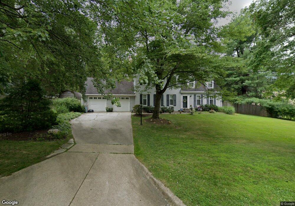
13731 Lockdale Rd Silver Spring, MD 20906
Layhill South NeighborhoodEstimated Value: $702,000 - $807,000
--
Bed
2
Baths
2,063
Sq Ft
$359/Sq Ft
Est. Value
About This Home
This home is located at 13731 Lockdale Rd, Silver Spring, MD 20906 and is currently estimated at $741,540, approximately $359 per square foot. 13731 Lockdale Rd is a home located in Montgomery County with nearby schools including Glenallan Elementary School, L'Anse Creuse Middle School - South, and Odessa Shannon Middle School.
Ownership History
Date
Name
Owned For
Owner Type
Purchase Details
Closed on
Jan 13, 2005
Sold by
Diggs Lynne D
Bought by
Diggs Lynne D and Diggs Gary Bell
Current Estimated Value
Purchase Details
Closed on
Aug 28, 2000
Sold by
Lundstrom Christopher and Lundstrom K
Bought by
Diggs Lynne D
Purchase Details
Closed on
Oct 5, 1993
Sold by
Winkler S R
Bought by
Lundstrom C
Home Financials for this Owner
Home Financials are based on the most recent Mortgage that was taken out on this home.
Original Mortgage
$235,000
Interest Rate
7%
Create a Home Valuation Report for This Property
The Home Valuation Report is an in-depth analysis detailing your home's value as well as a comparison with similar homes in the area
Home Values in the Area
Average Home Value in this Area
Purchase History
| Date | Buyer | Sale Price | Title Company |
|---|---|---|---|
| Diggs Lynne D | -- | -- | |
| Diggs Lynne D | $297,500 | -- | |
| Lundstrom C | $265,000 | -- |
Source: Public Records
Mortgage History
| Date | Status | Borrower | Loan Amount |
|---|---|---|---|
| Previous Owner | Lundstrom C | $235,000 |
Source: Public Records
Tax History Compared to Growth
Tax History
| Year | Tax Paid | Tax Assessment Tax Assessment Total Assessment is a certain percentage of the fair market value that is determined by local assessors to be the total taxable value of land and additions on the property. | Land | Improvement |
|---|---|---|---|---|
| 2025 | $6,897 | $607,100 | $195,900 | $411,200 |
| 2024 | $6,897 | $549,533 | $0 | $0 |
| 2023 | $5,357 | $491,967 | $0 | $0 |
| 2022 | $4,628 | $434,400 | $195,900 | $238,500 |
| 2021 | $4,520 | $433,167 | $0 | $0 |
| 2020 | $4,520 | $431,933 | $0 | $0 |
| 2019 | $4,483 | $430,700 | $195,900 | $234,800 |
| 2018 | $4,375 | $421,333 | $0 | $0 |
| 2017 | $4,350 | $411,967 | $0 | $0 |
| 2016 | -- | $402,600 | $0 | $0 |
| 2015 | $4,189 | $402,600 | $0 | $0 |
| 2014 | $4,189 | $402,600 | $0 | $0 |
Source: Public Records
Map
Nearby Homes
- 13708 Turnmore Rd
- 13517 Middlevale Ln
- 13621 N Gate Dr
- 13940 Alderton Rd
- 9 Coachlamp Ct
- 13773 Night Sky Dr
- 1949 Autumn Ridge Cir
- 2428 White Horse Ln
- 13201 Valley Bridge Ct
- 13629 Soaring Wing Ln
- 13805 Rippling Brook Dr
- 1605 Hutchinson Ln
- 2346 Sun Valley Cir Unit 2-A
- 2480 Sun Valley Cir
- 13135 Hutchinson Way
- 13817 Blair Stone Ln
- 2310 Sun Valley Cir Unit 1
- 2420 Sun Valley Cir
- 44 Long Green Ct
- 2611 Bainbridge Ln
- 13725 Lockdale Rd
- 13724 Wagon Way
- 13739 Lockdale Rd
- 13732 Lockdale Rd
- 13736 Lockdale Rd
- 13720 Wagon Way
- 13721 Lockdale Rd
- 13728 Lockdale Rd
- 13740 Lockdale Rd
- 13716 Wagon Way
- 13744 Lockdale Rd
- 13724 Lockdale Rd
- 13838 Turnmore Rd
- 13832 Turnmore Rd
- 13723 Wagon Way
- 13717 Lockdale Rd
- 13800 Wagon Way
- 13727 Wagon Way
- 13719 Wagon Way
- 13844 Turnmore Rd