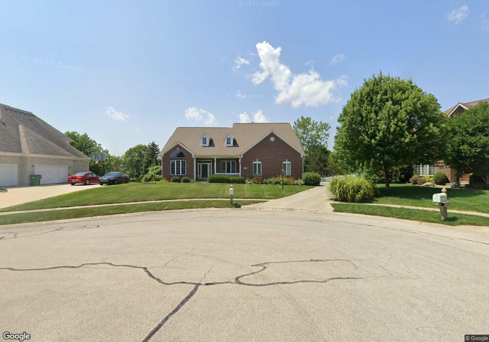
13736 High Point Cir Fishers, IN 46038
Estimated Value: $679,000 - $711,000
4
Beds
5
Baths
4,993
Sq Ft
$140/Sq Ft
Est. Value
About This Home
This home is located at 13736 High Point Cir, Fishers, IN 46038 and is currently estimated at $699,607, approximately $140 per square foot. 13736 High Point Cir is a home located in Hamilton County with nearby schools including Cumberland Road Elementary School, East Middle School, and Fishers Junior High School.
Ownership History
Date
Name
Owned For
Owner Type
Purchase Details
Closed on
Mar 21, 2022
Sold by
Hennessey Kevin K and Hennessey Dawn
Bought by
Kevin K Hennessey Revocable Trust and Dawn R Hennessey Revocable Trust
Current Estimated Value
Purchase Details
Closed on
Feb 23, 2005
Sold by
Ligon Dawn and Hennessey Dawn
Bought by
Hennessey Kevin K and Hennessey Dawn
Home Financials for this Owner
Home Financials are based on the most recent Mortgage that was taken out on this home.
Original Mortgage
$359,600
Interest Rate
5.5%
Mortgage Type
Stand Alone Refi Refinance Of Original Loan
Create a Home Valuation Report for This Property
The Home Valuation Report is an in-depth analysis detailing your home's value as well as a comparison with similar homes in the area
Home Values in the Area
Average Home Value in this Area
Purchase History
| Date | Buyer | Sale Price | Title Company |
|---|---|---|---|
| Kevin K Hennessey Revocable Trust | -- | Cohen Garelick & Glazier Profe | |
| Hennessey Kevin K | -- | Stewart Title |
Source: Public Records
Mortgage History
| Date | Status | Borrower | Loan Amount |
|---|---|---|---|
| Previous Owner | Hennessey Kevin K | $359,600 |
Source: Public Records
Tax History Compared to Growth
Tax History
| Year | Tax Paid | Tax Assessment Tax Assessment Total Assessment is a certain percentage of the fair market value that is determined by local assessors to be the total taxable value of land and additions on the property. | Land | Improvement |
|---|---|---|---|---|
| 2024 | $6,449 | $573,800 | $86,600 | $487,200 |
| 2023 | $6,484 | $556,200 | $86,600 | $469,600 |
| 2022 | $5,812 | $486,100 | $86,600 | $399,500 |
| 2021 | $5,066 | $420,100 | $86,600 | $333,500 |
| 2020 | $4,927 | $407,300 | $86,600 | $320,700 |
| 2019 | $4,773 | $394,800 | $66,200 | $328,600 |
| 2018 | $4,835 | $398,800 | $66,200 | $332,600 |
| 2017 | $4,706 | $420,600 | $66,200 | $354,400 |
| 2016 | $4,887 | $410,900 | $66,200 | $344,700 |
| 2014 | $4,235 | $389,300 | $66,200 | $323,100 |
| 2013 | $4,235 | $393,000 | $66,200 | $326,800 |
Source: Public Records
Map
Nearby Homes
- 10093 Parkshore Dr
- 13763 Meadow Lake Dr
- 10175 Pamona Ct
- 10523 Hollowood Ct
- 14041 Mimosa Ct
- 10055 Plantana Blvd
- 10343 Waveland Cir
- 9887 Cranberry Cir
- 10414 Bicknell Cir
- 10270 Apple Blossom Cir
- 13853 Oak Grove Ct
- 10150 Beresford Ct
- 10190 Holly Berry Cir
- 13125 Zinfandel Place
- 14243 Holly Berry Cir
- 9984 Gentry Dr
- 13068 Lamarque Place
- 13854 Meadow Grass Way
- 9989 Worthington Blvd
- 13048 Ross Crossing
- 13716 High Point Cir
- 13756 High Point Cir
- 10222 Parkshore Dr
- 10212 Parkshore Dr
- 10202 Parkshore Dr
- 10232 Parkshore Dr
- 13696 High Point Cir
- 13755 High Point Cir
- 13735 High Point Cir
- 10302 Parkshore Dr
- 10192 Parkshore Dr
- 13715 High Point Cir
- 10308 Parkshore Dr
- 10182 Parkshore Dr
- 13676 High Point Cir
- 10314 Parkshore Dr
- 13695 High Point Cir
- 10320 Parkshore Dr
- 10330 Aurora Ct
- 10172 Parkshore Dr