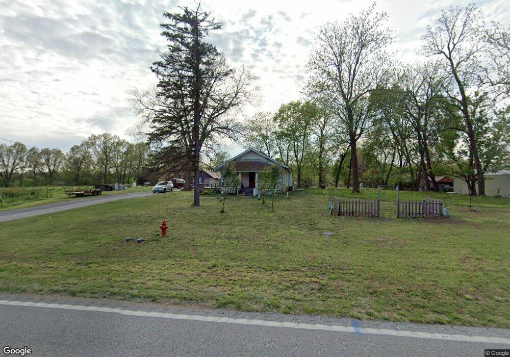
1375 N State Highway Ab Springfield, MO 65802
Estimated Value: $125,000 - $197,000
2
Beds
1
Bath
988
Sq Ft
$166/Sq Ft
Est. Value
About This Home
This home is located at 1375 N State Highway Ab, Springfield, MO 65802 and is currently estimated at $163,845, approximately $165 per square foot. 1375 N State Highway Ab is a home located in Greene County with nearby schools including Willard Central Elementary School and Willard Intermediate School North.
Ownership History
Date
Name
Owned For
Owner Type
Purchase Details
Closed on
Nov 17, 2023
Sold by
Elwood Properties Llc
Bought by
Kellar Price
Current Estimated Value
Purchase Details
Closed on
Jul 28, 2023
Sold by
Elwood Llc
Bought by
Kellar Price
Home Financials for this Owner
Home Financials are based on the most recent Mortgage that was taken out on this home.
Original Mortgage
$79,000
Interest Rate
8.25%
Mortgage Type
New Conventional
Purchase Details
Closed on
Jan 5, 2005
Sold by
Hall Ann Wilson
Bought by
Elwood Properties Llc
Home Financials for this Owner
Home Financials are based on the most recent Mortgage that was taken out on this home.
Original Mortgage
$49,000
Interest Rate
5.68%
Mortgage Type
Purchase Money Mortgage
Create a Home Valuation Report for This Property
The Home Valuation Report is an in-depth analysis detailing your home's value as well as a comparison with similar homes in the area
Home Values in the Area
Average Home Value in this Area
Purchase History
| Date | Buyer | Sale Price | Title Company |
|---|---|---|---|
| Kellar Price | -- | None Listed On Document | |
| Kellar Price | -- | None Listed On Document | |
| Elwood Properties Llc | $49,000 | None Available |
Source: Public Records
Mortgage History
| Date | Status | Borrower | Loan Amount |
|---|---|---|---|
| Previous Owner | Kellar Price | $79,000 | |
| Previous Owner | Elwood Properties Llc | $49,000 |
Source: Public Records
Tax History
| Year | Tax Paid | Tax Assessment Tax Assessment Total Assessment is a certain percentage of the fair market value that is determined by local assessors to be the total taxable value of land and additions on the property. | Land | Improvement |
|---|---|---|---|---|
| 2025 | $756 | $16,250 | $8,740 | $7,510 |
| 2024 | $756 | $13,490 | $6,270 | $7,220 |
| 2023 | $753 | $13,490 | $6,270 | $7,220 |
| 2022 | $782 | $13,890 | $6,270 | $7,620 |
| 2021 | $783 | $13,890 | $6,270 | $7,620 |
| 2020 | $662 | $12,770 | $6,270 | $6,500 |
| 2019 | $660 | $12,770 | $6,270 | $6,500 |
| 2018 | $488 | $9,390 | $6,270 | $3,120 |
| 2017 | $484 | $9,390 | $6,270 | $3,120 |
| 2016 | $481 | $9,390 | $6,270 | $3,120 |
| 2015 | $478 | $9,390 | $6,270 | $3,120 |
| 2014 | $481 | $9,390 | $6,270 | $3,120 |
Source: Public Records
Map
Nearby Homes
- 7017 W Farm Road 124
- 2548 Arrow Ln N
- 7138 W Farm Road 136
- 7105 W Woodlawn St
- 000 N Farm Road 101
- 000-Trct 4 N Farm Road 89
- 2506 N Meadow Lake Dr
- 2007 N Farm Road 89
- 2600 N Wildberry Ct
- 2571 N Honeysuckle Way
- 8249 W Spruce Ln
- 2831 N Garry St
- 6307 W Cottonwood Rd
- 000 W Independence Dr
- 580 S Farm Road 89
- 6334 Crystal Ln W
- 8756 W Farm Road 124
- 6424 W Farm Road 140
- 5817 W Alexa Ln
- 768 S Long Dr
- 1437 N State Highway Ab
- 1372 N State Highway Ab
- 1505 N State Highway Ab
- 1368 N State Highway Ab
- 1273 N State Highway Ab
- 7030 W Farm Road 124
- 1528 N State Highway Ab
- 1249 N State Highway Ab
- 1207 N State Highway Ab
- 7207 W Farm Road 124
- 6998 W Farm Road 124
- 1574 N State Highway Ab
- 7267 W Farm Road 124
- 6946 W Farm Road 124
- 7272 W Farm Road 124
- 1602 N State Highway Ab
- 1150 N State Highway Ab
- 6971 W Farm Road 124
- 1127 N State Highway Ab
- 7302 W Farm Road 124
Your Personal Tour Guide
Ask me questions while you tour the home.