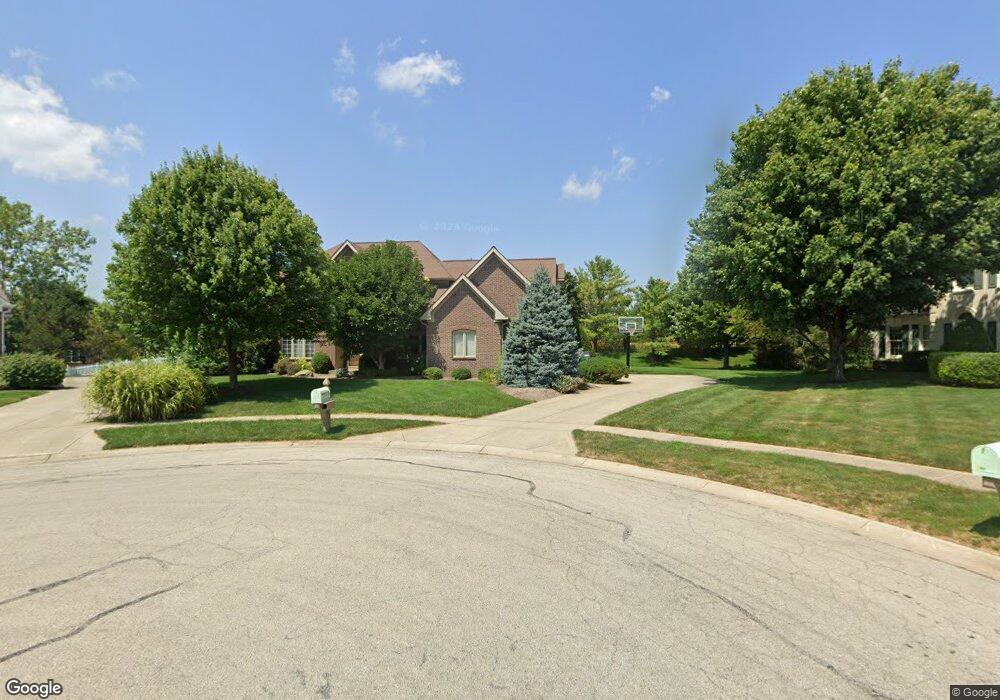
13756 High Point Cir Fishers, IN 46038
Estimated Value: $621,179 - $682,000
4
Beds
4
Baths
2,953
Sq Ft
$220/Sq Ft
Est. Value
About This Home
This home is located at 13756 High Point Cir, Fishers, IN 46038 and is currently estimated at $651,045, approximately $220 per square foot. 13756 High Point Cir is a home located in Hamilton County with nearby schools including Cumberland Road Elementary School, East Middle School, and Fishers Junior High School.
Ownership History
Date
Name
Owned For
Owner Type
Purchase Details
Closed on
Nov 8, 2011
Sold by
Hansan Paul B
Bought by
Hansan Paul B and Hansan Kelly R
Current Estimated Value
Home Financials for this Owner
Home Financials are based on the most recent Mortgage that was taken out on this home.
Original Mortgage
$307,091
Outstanding Balance
$209,406
Interest Rate
4.02%
Mortgage Type
New Conventional
Estimated Equity
$441,639
Create a Home Valuation Report for This Property
The Home Valuation Report is an in-depth analysis detailing your home's value as well as a comparison with similar homes in the area
Home Values in the Area
Average Home Value in this Area
Purchase History
| Date | Buyer | Sale Price | Title Company |
|---|---|---|---|
| Hansan Paul B | -- | None Available | |
| Hansan Paul B | -- | None Available |
Source: Public Records
Mortgage History
| Date | Status | Borrower | Loan Amount |
|---|---|---|---|
| Open | Hansan Paul B | $307,091 |
Source: Public Records
Tax History Compared to Growth
Tax History
| Year | Tax Paid | Tax Assessment Tax Assessment Total Assessment is a certain percentage of the fair market value that is determined by local assessors to be the total taxable value of land and additions on the property. | Land | Improvement |
|---|---|---|---|---|
| 2024 | $5,980 | $515,900 | $90,600 | $425,300 |
| 2023 | $6,015 | $516,300 | $90,600 | $425,700 |
| 2022 | $5,406 | $452,800 | $90,600 | $362,200 |
| 2021 | $4,711 | $392,100 | $90,600 | $301,500 |
| 2020 | $4,585 | $380,500 | $90,600 | $289,900 |
| 2019 | $4,446 | $369,200 | $79,300 | $289,900 |
| 2018 | $4,547 | $376,400 | $79,300 | $297,100 |
| 2017 | $4,411 | $371,500 | $79,300 | $292,200 |
| 2016 | $4,271 | $360,200 | $79,300 | $280,900 |
| 2014 | $3,638 | $335,000 | $79,300 | $255,700 |
| 2013 | $3,638 | $338,100 | $79,400 | $258,700 |
Source: Public Records
Map
Nearby Homes
- 10093 Parkshore Dr
- 13763 Meadow Lake Dr
- 14041 Mimosa Ct
- 10055 Plantana Blvd
- 10343 Waveland Cir
- 10175 Pamona Ct
- 10523 Hollowood Ct
- 10414 Bicknell Cir
- 9887 Cranberry Cir
- 10270 Apple Blossom Cir
- 10190 Holly Berry Cir
- 13853 Oak Grove Ct
- 14243 Holly Berry Cir
- 9984 Gentry Dr
- 10150 Beresford Ct
- 9989 Worthington Blvd
- 13125 Zinfandel Place
- 13854 Meadow Grass Way
- 9904 Worthington Blvd
- 9760 Silver Leaf Dr Unit 701
- 13736 High Point Cir
- 13755 High Point Cir
- 10302 Parkshore Dr
- 10232 Parkshore Dr
- 10308 Parkshore Dr
- 10222 Parkshore Dr
- 10314 Parkshore Dr
- 13735 High Point Cir
- 13716 High Point Cir
- 10212 Parkshore Dr
- 10320 Parkshore Dr
- 13715 High Point Cir
- 10202 Parkshore Dr
- 10330 Aurora Ct
- 13696 High Point Cir
- 10326 Parkshore Dr
- 10192 Parkshore Dr
- 10301 Parkshore Dr
- 13695 High Point Cir
- 10313 Parkshore Dr