Estimated Value: $890,000 - $1,028,000
3
Beds
2
Baths
1,729
Sq Ft
$564/Sq Ft
Est. Value
About This Home
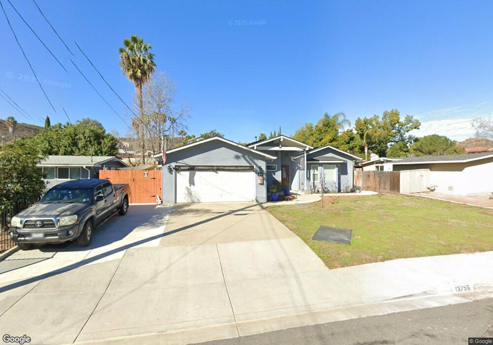
This home is located at 13756 Powers Rd, Poway, CA 92064 and is currently estimated at $975,394, approximately $564 per square foot. 13756 Powers Rd is a home located in San Diego County with nearby schools including Pomerado Elementary, Meadowbrook Middle, and Poway High.
Ownership History
Date
Name
Owned For
Owner Type
Purchase Details
Closed on
Jul 25, 2024
Sold by
Norby Steve Michael and Norby Kimberly Lee
Bought by
Steve And Kim Norby Living Trust and Norby
Current Estimated Value
Purchase Details
Closed on
Dec 23, 1998
Sold by
Arvidson Living Trust 06-08-94 and Arvidson Daniel
Bought by
Norby Steve Michael and Norby Kimberly Lee
Home Financials for this Owner
Home Financials are based on the most recent Mortgage that was taken out on this home.
Original Mortgage
$150,000
Interest Rate
6.79%
Purchase Details
Closed on
Jun 16, 1994
Sold by
Arvidson Daniel and Arvidson Beatrice P
Bought by
Arvidson Daniel and Arvidson Beatrice Peak
Purchase Details
Closed on
Jul 19, 1991
Purchase Details
Closed on
Aug 23, 1990
Purchase Details
Closed on
Jan 25, 1985
Create a Home Valuation Report for This Property
The Home Valuation Report is an in-depth analysis detailing your home's value as well as a comparison with similar homes in the area
Home Values in the Area
Average Home Value in this Area
Purchase History
| Date | Buyer | Sale Price | Title Company |
|---|---|---|---|
| Steve And Kim Norby Living Trust | -- | None Listed On Document | |
| Norby Steve Michael | $169,500 | Chicago Title Co | |
| Arvidson Daniel | -- | -- | |
| -- | $150,900 | -- | |
| -- | $152,000 | -- | |
| -- | $86,500 | -- |
Source: Public Records
Mortgage History
| Date | Status | Borrower | Loan Amount |
|---|---|---|---|
| Previous Owner | Norby Steve Michael | $150,000 |
Source: Public Records
Tax History
| Year | Tax Paid | Tax Assessment Tax Assessment Total Assessment is a certain percentage of the fair market value that is determined by local assessors to be the total taxable value of land and additions on the property. | Land | Improvement |
|---|---|---|---|---|
| 2025 | $4,205 | $380,597 | $156,805 | $223,792 |
| 2024 | $4,205 | $373,135 | $153,731 | $219,404 |
| 2023 | $4,115 | $365,819 | $150,717 | $215,102 |
| 2022 | $4,046 | $358,647 | $147,762 | $210,885 |
| 2021 | $3,993 | $351,615 | $144,865 | $206,750 |
| 2020 | $3,939 | $348,011 | $143,380 | $204,631 |
| 2019 | $3,837 | $341,188 | $140,569 | $200,619 |
| 2018 | $3,729 | $334,499 | $137,813 | $196,686 |
| 2017 | $170 | $301,470 | $135,111 | $166,359 |
| 2016 | $2,482 | $223,991 | $132,462 | $91,529 |
| 2015 | $2,446 | $220,628 | $130,473 | $90,155 |
| 2014 | $2,389 | $216,307 | $127,918 | $88,389 |
Source: Public Records
Map
Nearby Homes
- 13824 Powers Rd
- 12311 Witt Rd
- 13442 Mountainside Dr
- 12614 Orohaven Ln
- 13641 Carriage Rd
- 12450 Robison Blvd
- 12739 Papago Dr
- 13254 Powers Ct
- 12719 Robison Blvd Unit 18
- 12851 Papago Dr
- 14109 Arbolitos Dr
- 12939 Cree Ct
- 12875 Carriage Heights Way Unit 12875
- 12885 Rockwell Ct
- 12741 Liberty Way
- 12953 Carriage Rd
- 13056 Poway Rd
- 1/2 Poway Rd
- 12124 Riley Ln
- 13087 Olympus Cir Unit 2
- 13750 Powers Rd
- 13800 Powers Rd
- 13744 Powers Rd
- 13806 Powers Rd
- 13757 Powers Rd
- 13801 Powers Rd
- 13738 Powers Rd
- 13812 Powers Rd
- 13807 Powers Rd
- 13745 Powers Rd
- 13762 Pomerado Rd
- 13808 Pomerado Rd
- 13758 Pomerado Rd
- 13812 Pomerado Rd
- 13754 Pomerado Rd
- 13813 Powers Rd
- 13739 Powers Rd
- 13732 Powers Rd
- 13818 Powers Rd
- 13816 Pomerado Rd
Your Personal Tour Guide
Ask me questions while you tour the home.