Estimated Value: $281,295
--
Bed
--
Bath
1,968
Sq Ft
$143/Sq Ft
Est. Value
About This Home
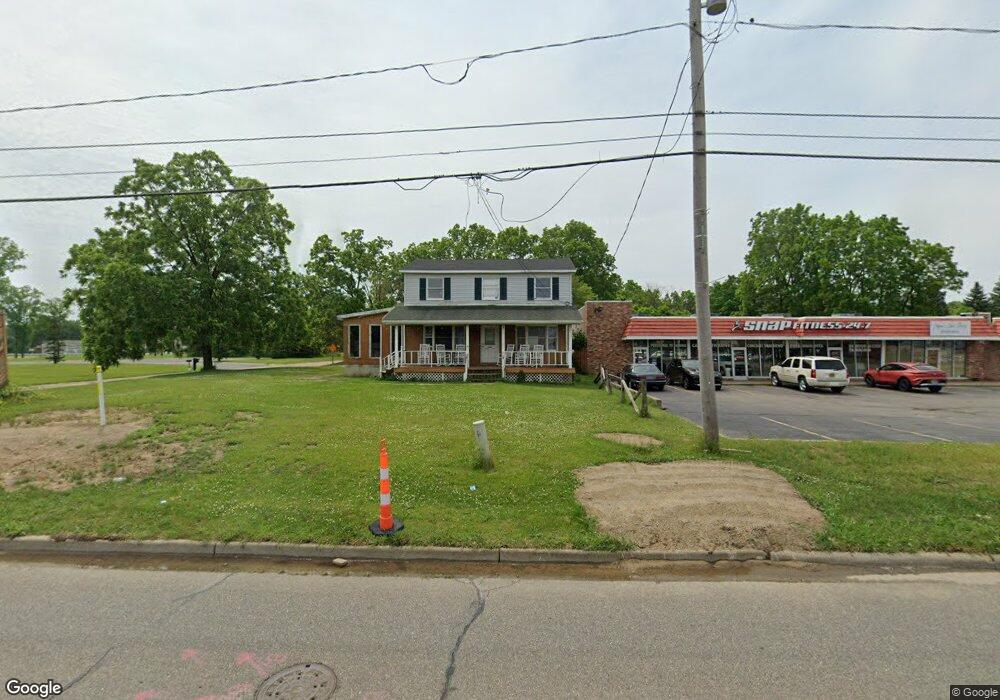
This home is located at 1377 W Bristol Rd, Flint, MI 48507 and is currently estimated at $281,295, approximately $142 per square foot. 1377 W Bristol Rd is a home located in Genesee County with nearby schools including Carman-Ainsworth High School.
Ownership History
Date
Name
Owned For
Owner Type
Purchase Details
Closed on
Jul 30, 2007
Sold by
Lee Andrea E
Bought by
Bronzo Follo Llc
Current Estimated Value
Purchase Details
Closed on
Nov 9, 2005
Sold by
Aitken Dawn Elaine and Mcbride Dawn Elaine
Bought by
Bronzo Follo Llc
Home Financials for this Owner
Home Financials are based on the most recent Mortgage that was taken out on this home.
Original Mortgage
$120,000
Interest Rate
6%
Mortgage Type
Seller Take Back
Create a Home Valuation Report for This Property
The Home Valuation Report is an in-depth analysis detailing your home's value as well as a comparison with similar homes in the area
Home Values in the Area
Average Home Value in this Area
Purchase History
| Date | Buyer | Sale Price | Title Company |
|---|---|---|---|
| Bronzo Follo Llc | -- | Metropolitan Title Company | |
| Lee Andrea E | -- | Metropolitan Title Company | |
| Bronzo Follo Llc | $155,000 | Metropolitan Title Company | |
| Bronzo Follo Llc | $155,000 | None Available | |
| Bronzo Follo Llc | -- | Metropolitan Title Company |
Source: Public Records
Mortgage History
| Date | Status | Borrower | Loan Amount |
|---|---|---|---|
| Previous Owner | Bronzo Follo Llc | $120,000 |
Source: Public Records
Tax History Compared to Growth
Tax History
| Year | Tax Paid | Tax Assessment Tax Assessment Total Assessment is a certain percentage of the fair market value that is determined by local assessors to be the total taxable value of land and additions on the property. | Land | Improvement |
|---|---|---|---|---|
| 2025 | $4,508 | $102,500 | $0 | $0 |
| 2024 | $3,190 | $96,100 | $0 | $0 |
| 2023 | $2,982 | $94,700 | $0 | $0 |
| 2022 | $2,384 | $93,200 | $0 | $0 |
| 2021 | $1,168 | $90,800 | $0 | $0 |
| 2020 | $2,673 | $91,300 | $0 | $0 |
| 2019 | $2,315 | $89,600 | $0 | $0 |
| 2018 | $3,681 | $71,200 | $0 | $0 |
| 2017 | $3,686 | $71,200 | $0 | $0 |
| 2016 | $3,917 | $63,200 | $0 | $0 |
| 2015 | $3,130 | $58,800 | $0 | $0 |
| 2014 | $2,240 | $53,500 | $0 | $0 |
| 2012 | -- | $53,500 | $36,100 | $17,400 |
Source: Public Records
Map
Nearby Homes
- 1508 W Bristol Rd
- 1247 Catalina Dr
- 1097 W Buder Ave
- 1111 W Mclean Ave
- Lot 57 Walnut Creek Dr
- 4518 Huckleberry Ln
- 1072 W Williamson Ave
- 1051 W Mclean Ave
- 1108 Trotwood Ln
- 1203 Pickwick Place
- 1144 Pickwick Place
- 1826 Greenbrook Ln
- 1902 Rockcreek Ln
- 1818 Rockcreek Ln
- 3322 Fenton Rd
- 2107 Stoney Brook Ct
- 1314 Pinehurst Ave
- 4101 Greenbrook Ln
- 1933 Greenbriar Ln
- 1809 Crestbrook Ln
- 4031 Moulton Dr
- 1381 W Bristol Rd
- 4043 Moulton Dr
- 1395 W Bristol Rd
- 4053 Moulton Dr
- 1345 W Bristol Rd
- 4040 Moulton Dr
- 4067 Moulton Dr
- 4046 Moulton Dr
- 1370 W Bristol Rd
- 1354 W Bristol Rd
- 4054 Moulton Dr
- 1344 W Bristol Rd
- 4083 Moulton Dr
- 4064 Moulton Dr
- 1338 W Bristol Rd
- 1388 W Bristol Rd
- 4087 Moulton Dr
- 4109 Moulton Dr
- 3511 Hammerberg Rd