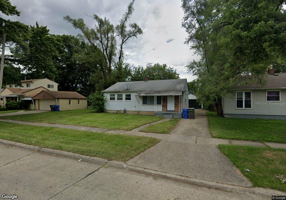
1377 Woodland Dr Inkster, MI 48141
Estimated Value: $101,000 - $126,000
--
Bed
1
Bath
962
Sq Ft
$117/Sq Ft
Est. Value
About This Home
This home is located at 1377 Woodland Dr, Inkster, MI 48141 and is currently estimated at $112,387, approximately $116 per square foot. 1377 Woodland Dr is a home located in Wayne County with nearby schools including American International Academy - Elementary, Inkster Preparatory Academy, and American International Academy.
Ownership History
Date
Name
Owned For
Owner Type
Purchase Details
Closed on
Nov 30, 2016
Sold by
Charter County Of Wayne Treasurer Of The
Bought by
Rightmove Properties Llc
Current Estimated Value
Purchase Details
Closed on
Apr 1, 1998
Sold by
Western United Life Assurance Co
Bought by
Bank Of New York and Metropolitan Asset Funding Inc Ii
Purchase Details
Closed on
Jun 17, 1997
Sold by
Dempster A and Ross Gail J
Bought by
Western United Life Assurance Co
Create a Home Valuation Report for This Property
The Home Valuation Report is an in-depth analysis detailing your home's value as well as a comparison with similar homes in the area
Home Values in the Area
Average Home Value in this Area
Purchase History
| Date | Buyer | Sale Price | Title Company |
|---|---|---|---|
| Rightmove Properties Llc | $2,400 | None Available | |
| Bank Of New York | -- | -- | |
| Bank Of New York | $19,678 | -- | |
| Western United Life Assurance Co | $15,900 | -- |
Source: Public Records
Tax History Compared to Growth
Tax History
| Year | Tax Paid | Tax Assessment Tax Assessment Total Assessment is a certain percentage of the fair market value that is determined by local assessors to be the total taxable value of land and additions on the property. | Land | Improvement |
|---|---|---|---|---|
| 2025 | $1,094 | $47,700 | $0 | $0 |
| 2024 | $1,094 | $39,100 | $0 | $0 |
| 2023 | $1,129 | $32,000 | $0 | $0 |
| 2022 | $1,607 | $25,800 | $0 | $0 |
| 2021 | $1,666 | $24,100 | $0 | $0 |
| 2020 | $1,634 | $20,900 | $0 | $0 |
| 2019 | $1,632 | $17,200 | $0 | $0 |
| 2018 | $1,058 | $15,000 | $0 | $0 |
| 2017 | $973 | $14,700 | $0 | $0 |
| 2016 | $1,467 | $13,700 | $0 | $0 |
| 2015 | $1,700 | $17,000 | $0 | $0 |
| 2013 | $2,420 | $24,200 | $0 | $0 |
| 2012 | $1,383 | $26,600 | $3,100 | $23,500 |
Source: Public Records
Map
Nearby Homes
- 1338 Helen St
- 28148 Rosewood St
- 1248 Colonial Dr
- 28338 Parkwood St
- 27922 Rosewood St
- 27817 Rosewood St
- 1049 Woodland Dr
- 1144 Center St
- 27805 Avondale St
- 28058 Avondale St
- 28541 Glenwood St
- 27455 Avondale St
- 28645 Glenwood St
- 720 Magnolia Dr
- 622 Tromley St
- 537 Helen St
- 28993 Glenwood St
- Lot Michigan Ave
- VACANT LOT Tromley St
- 29416 Michigan Ave
- 1389 Woodland Dr
- 1353 Woodland Dr
- 1353 Woodland Dr
- 1326 Helen St
- 1350 Helen St
- 1341 Woodland Dr
- 1421 Woodland Dr
- 1364 Woodland Dr
- 1388 Woodland Dr
- 1408 Helen St Unit Bldg-Unit
- 1408 Helen St
- 1352 Woodland Dr
- 1292 Helen St
- 1433 Woodland Dr
- 1329 Woodland Dr
- 1420 Woodland Dr
- 1340 Woodland Dr
- 1418 Helen St
- 1280 Helen St
- 1317 Woodland Dr