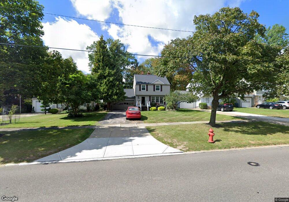
1378 Brainard Rd Cleveland, OH 44124
Estimated Value: $197,000 - $241,000
3
Beds
1
Bath
1,176
Sq Ft
$184/Sq Ft
Est. Value
About This Home
This home is located at 1378 Brainard Rd, Cleveland, OH 44124 and is currently estimated at $216,098, approximately $183 per square foot. 1378 Brainard Rd is a home located in Cuyahoga County with nearby schools including Sunview Elementary School, Greenview Upper Elementary School, and Memorial Junior High School.
Ownership History
Date
Name
Owned For
Owner Type
Purchase Details
Closed on
Jun 8, 1994
Sold by
Leden Gary R
Bought by
Goff Robert and Goff Joanne
Current Estimated Value
Home Financials for this Owner
Home Financials are based on the most recent Mortgage that was taken out on this home.
Original Mortgage
$76,000
Interest Rate
8.45%
Mortgage Type
New Conventional
Purchase Details
Closed on
Aug 30, 1990
Sold by
Leden Gary
Bought by
Leden Gary Aka
Purchase Details
Closed on
Jun 18, 1986
Sold by
Leden Gary
Bought by
Leden Gary
Purchase Details
Closed on
Feb 25, 1981
Sold by
Nelson James A and Nelson Margaret A
Bought by
Leden Gary
Purchase Details
Closed on
Jul 12, 1979
Sold by
Nelson James A and M A
Bought by
Nelson James A and Nelson Margaret A
Purchase Details
Closed on
Jan 1, 1975
Bought by
Nelson James A and M A
Create a Home Valuation Report for This Property
The Home Valuation Report is an in-depth analysis detailing your home's value as well as a comparison with similar homes in the area
Home Values in the Area
Average Home Value in this Area
Purchase History
| Date | Buyer | Sale Price | Title Company |
|---|---|---|---|
| Goff Robert | $95,000 | -- | |
| Leden Gary Aka | -- | -- | |
| Leden Gary | -- | -- | |
| Leden Gary | $67,000 | -- | |
| Nelson James A | -- | -- | |
| Nelson James A | -- | -- |
Source: Public Records
Mortgage History
| Date | Status | Borrower | Loan Amount |
|---|---|---|---|
| Previous Owner | Goff Robert | $76,000 |
Source: Public Records
Tax History Compared to Growth
Tax History
| Year | Tax Paid | Tax Assessment Tax Assessment Total Assessment is a certain percentage of the fair market value that is determined by local assessors to be the total taxable value of land and additions on the property. | Land | Improvement |
|---|---|---|---|---|
| 2024 | $3,731 | $55,020 | $11,235 | $43,785 |
| 2023 | $4,132 | $47,640 | $10,150 | $37,490 |
| 2022 | $4,108 | $47,635 | $10,150 | $37,485 |
| 2021 | $4,073 | $47,640 | $10,150 | $37,490 |
| 2020 | $3,819 | $39,060 | $8,330 | $30,730 |
| 2019 | $3,443 | $111,600 | $23,800 | $87,800 |
| 2018 | $3,425 | $39,060 | $8,330 | $30,730 |
| 2017 | $3,448 | $36,130 | $8,440 | $27,690 |
| 2016 | $3,422 | $36,130 | $8,440 | $27,690 |
| 2015 | $3,562 | $36,130 | $8,440 | $27,690 |
| 2014 | $3,562 | $36,860 | $8,610 | $28,250 |
Source: Public Records
Map
Nearby Homes
- 1307 Ford Rd
- 1291 Haverston Rd
- 1391 Iroquois Ave
- 1284 Haverston Rd
- 1433 Churchill Rd
- 1443 Churchill Rd
- 1151 Brainard Rd
- 1363 Ranchland Dr
- 1151 Croyden Rd
- 1213 Eastwood Ave
- 1192 Blanchester Rd
- 1548 Biltmore Rd
- 1218 Summit Dr
- 1430 Belrose Rd
- 1368 Irene Rd
- 1233 Summit Dr
- 1590 Longwood Dr
- 1574 Hawthorne Dr
- 1120 Croyden Rd
- 1201 Summit Dr
- 1384 Brainard Rd
- 1374 Brainard Rd
- 1370 Brainard Rd
- 1390 Brainard Rd
- 1364 Brainard Rd
- 1379 Ford Rd
- 1383 Ford Rd
- 1373 Ford Rd
- 1396 Brainard Rd
- 1389 Ford Rd
- 1360 Brainard Rd
- 1393 Ford Rd
- 1363 Ford Rd
- 1400 Brainard Rd
- 1377 Brainard Rd
- 1383 Brainard Rd
- 1373 Brainard Rd
- 1387 Brainard Rd
- 1354 Brainard Rd
- 1399 Ford Rd