Estimated Value: $599,194 - $651,000
Studio
--
Bath
1,452
Sq Ft
$427/Sq Ft
Est. Value
About This Home
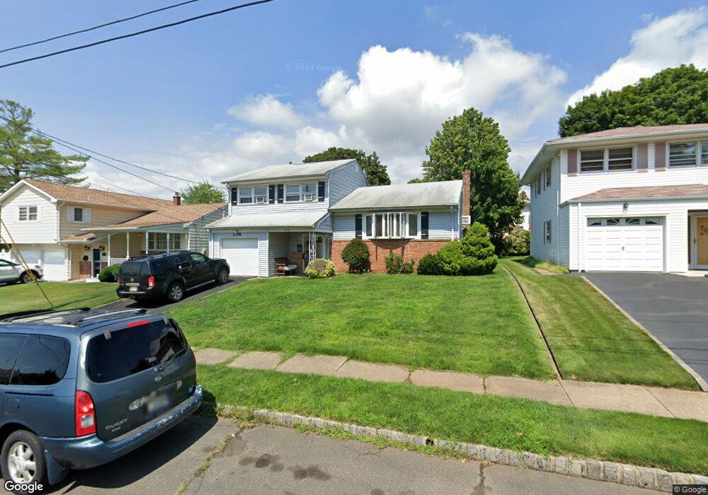
This home is located at 1378 Mark Dr, Union, NJ 07083 and is currently estimated at $620,299, approximately $427 per square foot. 1378 Mark Dr is a home located in Union County with nearby schools including Hannah Caldwell Elementary School, Burnet Middle School, and Union High School.
Ownership History
Date
Name
Owned For
Owner Type
Purchase Details
Closed on
Jul 26, 2006
Sold by
Quagliato Dominick A
Bought by
Badejo Ayoola O and Badejo Adesola A
Current Estimated Value
Home Financials for this Owner
Home Financials are based on the most recent Mortgage that was taken out on this home.
Original Mortgage
$312,000
Outstanding Balance
$186,709
Interest Rate
6.7%
Estimated Equity
$433,590
Purchase Details
Closed on
Sep 16, 1994
Sold by
Sicoli Anthony V and Sicoli Robin A
Bought by
Quagliato Dominick A and Quagliato Joan A
Create a Home Valuation Report for This Property
The Home Valuation Report is an in-depth analysis detailing your home's value as well as a comparison with similar homes in the area
Home Values in the Area
Average Home Value in this Area
Purchase History
| Date | Buyer | Sale Price | Title Company |
|---|---|---|---|
| Badejo Ayoola O | $390,000 | -- | |
| Quagliato Dominick A | $175,000 | -- |
Source: Public Records
Mortgage History
| Date | Status | Borrower | Loan Amount |
|---|---|---|---|
| Open | Badejo Ayoola O | $312,000 |
Source: Public Records
Tax History
| Year | Tax Paid | Tax Assessment Tax Assessment Total Assessment is a certain percentage of the fair market value that is determined by local assessors to be the total taxable value of land and additions on the property. | Land | Improvement |
|---|---|---|---|---|
| 2025 | $11,198 | $50,100 | $20,400 | $29,700 |
| 2024 | $10,856 | $50,100 | $20,400 | $29,700 |
| 2023 | $10,856 | $50,100 | $20,400 | $29,700 |
| 2022 | $10,479 | $50,100 | $20,400 | $29,700 |
| 2021 | $10,225 | $50,100 | $20,400 | $29,700 |
| 2020 | $10,021 | $50,100 | $20,400 | $29,700 |
| 2019 | $9,886 | $50,100 | $20,400 | $29,700 |
| 2018 | $9,718 | $50,100 | $20,400 | $29,700 |
| 2017 | $9,574 | $50,100 | $20,400 | $29,700 |
| 2016 | $9,341 | $50,100 | $20,400 | $29,700 |
| 2015 | $9,186 | $50,100 | $20,400 | $29,700 |
| 2014 | $8,980 | $50,100 | $20,400 | $29,700 |
Source: Public Records
Map
Nearby Homes
- 2273 Balmoral Ave
- 2255 Morrison Ave
- 2265 Copper Hill Dr
- 2269 Copper Hill Dr
- 1265 Shetland Dr
- 4 Sadie Cir Unit 4103
- 4 Sadie Cir Unit 4205
- 2144 Tyler St
- 261 Revere Ave
- 267 Perry Ave Unit 202
- 267 Perry Ave Unit 267
- 2485 Vauxhall Rd
- 304 Concord Ave
- 2200 Vauxhall Rd
- 31 Grove Rd
- 2096 Lentz Ave
- 1395 Isabella Ave
- 1618 Andrew St
- 2047 Gless Ave
- 1121 Jeanette Ave
Your Personal Tour Guide
Ask me questions while you tour the home.