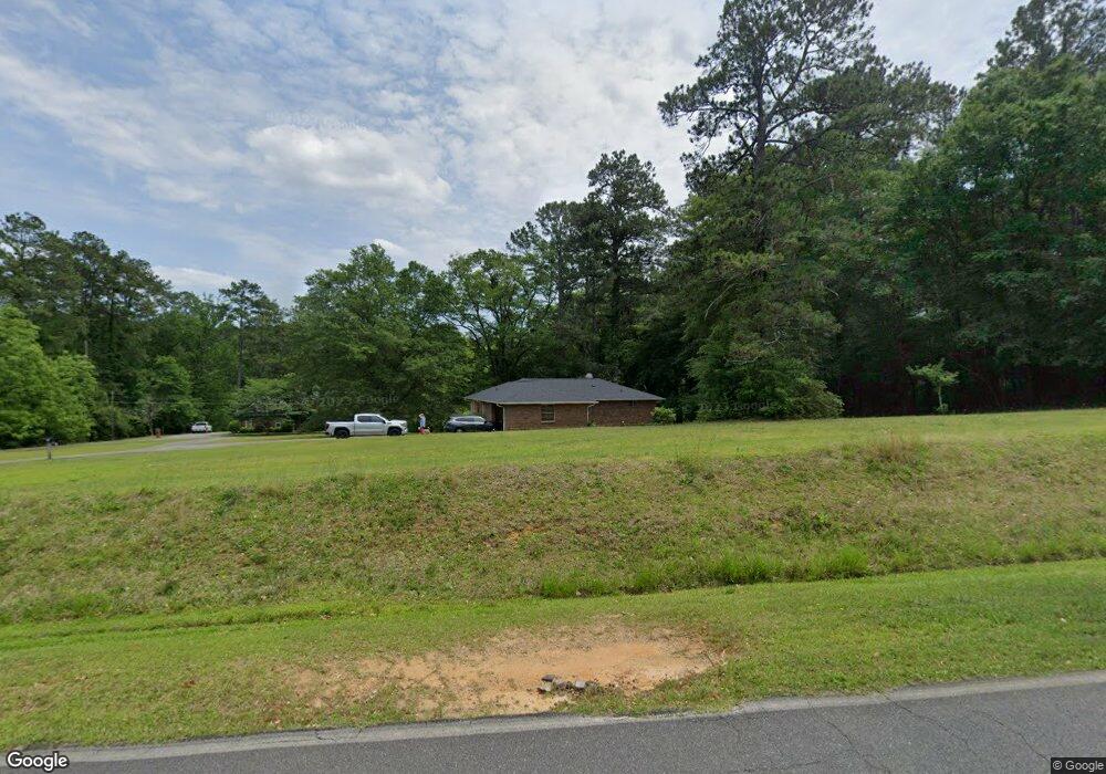
138 Baker Rd Macon, GA 31211
Estimated Value: $104,000 - $184,000
Studio
3
Baths
1,200
Sq Ft
$105/Sq Ft
Est. Value
About This Home
This home is located at 138 Baker Rd, Macon, GA 31211 and is currently estimated at $126,574, approximately $105 per square foot. 138 Baker Rd is a home located in Jones County with nearby schools including Mattie Wells Elementary School, Clifton Ridge Middle School, and Jones County High School.
Ownership History
Date
Name
Owned For
Owner Type
Purchase Details
Closed on
Mar 16, 2022
Sold by
Carden David
Bought by
Bresse Ryan and Bresse Ashley
Current Estimated Value
Home Financials for this Owner
Home Financials are based on the most recent Mortgage that was taken out on this home.
Original Mortgage
$72,750
Outstanding Balance
$62,856
Interest Rate
3.69%
Mortgage Type
New Conventional
Estimated Equity
$63,718
Purchase Details
Closed on
Oct 24, 2000
Sold by
Chadwick N Carden
Bought by
David Carden and David Cherry D
Create a Home Valuation Report for This Property
The Home Valuation Report is an in-depth analysis detailing your home's value as well as a comparison with similar homes in the area
Purchase History
| Date | Buyer | Sale Price | Title Company |
|---|---|---|---|
| Bresse Ryan | $75,000 | -- | |
| David Carden | $73,500 | -- |
Source: Public Records
Mortgage History
| Date | Status | Borrower | Loan Amount |
|---|---|---|---|
| Open | Bresse Ryan | $72,750 |
Source: Public Records
Tax History
| Year | Tax Paid | Tax Assessment Tax Assessment Total Assessment is a certain percentage of the fair market value that is determined by local assessors to be the total taxable value of land and additions on the property. | Land | Improvement |
|---|---|---|---|---|
| 2025 | $1,098 | $33,488 | $5,700 | $27,788 |
| 2024 | $1,184 | $33,346 | $3,800 | $29,546 |
| 2023 | $1,055 | $29,688 | $3,800 | $25,888 |
| 2022 | $900 | $25,048 | $3,610 | $21,438 |
| 2021 | $901 | $25,048 | $3,610 | $21,438 |
| 2020 | $901 | $25,048 | $3,610 | $21,438 |
| 2019 | $901 | $25,048 | $3,610 | $21,438 |
| 2018 | $901 | $25,048 | $3,610 | $21,438 |
| 2017 | $901 | $25,048 | $3,610 | $21,438 |
| 2016 | $901 | $25,048 | $3,610 | $21,438 |
| 2015 | $853 | $25,048 | $3,610 | $21,438 |
| 2014 | $823 | $26,262 | $3,610 | $22,652 |
Source: Public Records
Map
Nearby Homes
- 3462 Joycliff Rd
- 227 Dusty Ln
- 225 Olivia Cir
- 118 Oakwood Dr
- 0 Kings Ct N Unit 10666708
- 3446 Kingsview Cir
- 3614 Kingsview Dr
- 3608 Joycliff Rd
- 0 Champion Dr Unit 10666714
- 3576 Confederate Dr
- 132 Spradley Dr
- 201 Joycliff Cir
- 168 Ruby Dr
- 687 Jasmine Dr
- 1030 Sun Valley Ct Unit C55
- 1030 Sun Valley Ct
- 224 Rebel Dr
- 1034 Sun Valley Ct Unit C56
- 1034 Sun Valley Ct
- 1038 Sun Valley Ct Unit C57
- 142 Baker Rd
- 2 Baker Rd
- 162 Baker Rd
- 152 Baker Rd
- #2 Baker Rd
- # Baker Rd
- 182 Baker Rd
- 3533 Joycliff Rd
- 3559 Joycliff Rd Unit 73
- 3559 Joycliff Rd Unit 73
- 3559 Joycliff Rd
- 0 Joycliff Rd Unit 20006891
- 000 Joycliff Rd
- 104 John Michael Dr
- 105 John Michael Dr
- 239 Dusty Ln
- 3514 Joycliff Rd
- 109 John Michael Dr
- 110 John Michael Dr
- 3437 Joycliff Rd
Your Personal Tour Guide
Ask me questions while you tour the home.