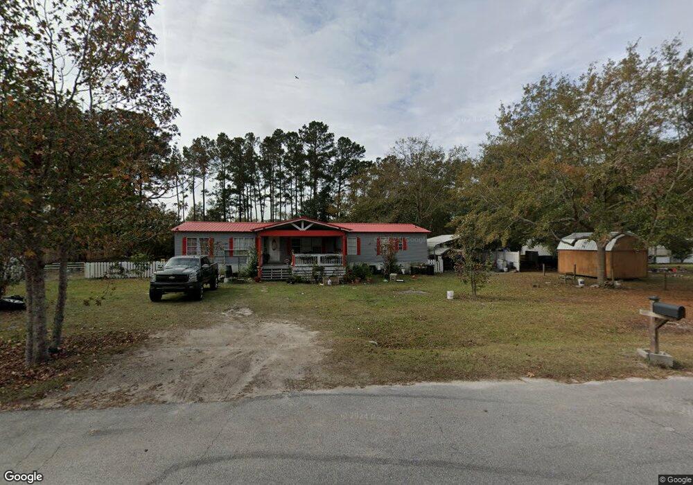
138 Burnt Tree Dr Guyton, GA 31312
Estimated Value: $100,000 - $387,000
--
Bed
--
Bath
1,848
Sq Ft
$106/Sq Ft
Est. Value
About This Home
This home is located at 138 Burnt Tree Dr, Guyton, GA 31312 and is currently estimated at $196,559, approximately $106 per square foot. 138 Burnt Tree Dr is a home with nearby schools including Marlow Elementary School, South Effingham Middle School, and South Effingham High School.
Ownership History
Date
Name
Owned For
Owner Type
Purchase Details
Closed on
Jul 1, 2019
Sold by
Zuniga Orquidea Varela
Bought by
Trujillo Roberto Mota
Current Estimated Value
Purchase Details
Closed on
Jun 11, 2013
Sold by
Montes Ana
Bought by
Zuniga Orquidea Varela
Home Financials for this Owner
Home Financials are based on the most recent Mortgage that was taken out on this home.
Original Mortgage
$13,000
Interest Rate
3.53%
Mortgage Type
New Conventional
Purchase Details
Closed on
Mar 29, 2006
Sold by
Lorwil Land Corp
Bought by
Wasdin George E
Home Financials for this Owner
Home Financials are based on the most recent Mortgage that was taken out on this home.
Original Mortgage
$16,000
Interest Rate
6.2%
Mortgage Type
New Conventional
Create a Home Valuation Report for This Property
The Home Valuation Report is an in-depth analysis detailing your home's value as well as a comparison with similar homes in the area
Home Values in the Area
Average Home Value in this Area
Purchase History
| Date | Buyer | Sale Price | Title Company |
|---|---|---|---|
| Trujillo Roberto Mota | $85,000 | -- | |
| Zuniga Orquidea Varela | -- | -- | |
| Montes Ana | $23,000 | -- | |
| Wasdin George E | $26,000 | -- |
Source: Public Records
Mortgage History
| Date | Status | Borrower | Loan Amount |
|---|---|---|---|
| Previous Owner | Montes Ana | $13,000 | |
| Previous Owner | Wasdin George E | $16,000 |
Source: Public Records
Tax History Compared to Growth
Tax History
| Year | Tax Paid | Tax Assessment Tax Assessment Total Assessment is a certain percentage of the fair market value that is determined by local assessors to be the total taxable value of land and additions on the property. | Land | Improvement |
|---|---|---|---|---|
| 2025 | $1,203 | $26,633 | $22,800 | $3,833 |
| 2024 | $1,203 | $26,633 | $22,800 | $3,833 |
| 2023 | $1,185 | $7,214 | $0 | $7,214 |
| 2022 | $805 | $14,960 | $12,000 | $2,960 |
| 2021 | $726 | $12,960 | $10,000 | $2,960 |
| 2020 | $694 | $12,960 | $10,000 | $2,960 |
| 2019 | $692 | $12,960 | $10,000 | $2,960 |
| 2018 | $625 | $10,960 | $8,000 | $2,960 |
| 2017 | $620 | $10,960 | $8,000 | $2,960 |
| 2016 | -- | $10,960 | $8,000 | $2,960 |
| 2015 | -- | $9,360 | $6,400 | $2,960 |
| 2014 | -- | $6,960 | $4,000 | $2,960 |
Source: Public Records
Map
Nearby Homes
- 0 Low Ground Rd Unit 10630626
- 0 Low Ground Rd Unit 25321474
- 268 Appaloosa Way
- 1379 Low Ground Rd
- 1367 Low Ground Rd
- 297 Horsepen Rd
- 189 Little Horsepen Rd
- 05 Little McCall Rd
- 06 Little McCall Rd
- 100 Saratoga Dr
- 131 Saratoga Dr
- 128 Aquaduct Dr
- 105 Santa Anita Way
- 105 Willow Dr
- 203 Timberlake Dr
- 208 Timberlake Dr
- 106 Meadowlands Dr
- 111 Oaklawn Dr
- 223 Blandford Crossing
- 405 Pine Top Rd
- 127 Burnt Tree Dr
- 142 Burnt Tree Dr
- 144 Burnt Tree Dr
- 119 Burnt Tree Dr
- 131 Burnt Tree Dr
- 117 Burnt Tree Dr
- 1000 Low Ground Rd
- 115 Burnt Tree Dr
- 133 Burnt Tree Dr
- 146 Burnt Tree Dr
- 118 Burnt Tree Dr
- 114 Burnt Tree Dr Unit &116
- 124 Burnt Tree Dr
- 148 Burnt Tree Dr
- 120 Burnt Tree Dr
- 109 Burnt Tree Dr
- 110 Burnt Tree Dr
- 137 Burnt Tree Dr
- 108 Burnt Tree Dr
- 150 Burnt Tree Dr