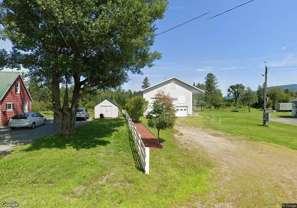
138 Grange Rd Lancaster, NH 03584
Estimated Value: $144,000 - $213,000
2
Beds
1
Bath
1,153
Sq Ft
$145/Sq Ft
Est. Value
About This Home
This home is located at 138 Grange Rd, Lancaster, NH 03584 and is currently estimated at $166,944, approximately $144 per square foot. 138 Grange Rd is a home located in Coos County with nearby schools including Lancaster Elementary School and White Mountains Regional High School.
Ownership History
Date
Name
Owned For
Owner Type
Purchase Details
Closed on
Feb 1, 2022
Sold by
Savage Alan M and Savage Joanne F
Bought by
Samson Michael P and Samson Jamie
Current Estimated Value
Home Financials for this Owner
Home Financials are based on the most recent Mortgage that was taken out on this home.
Original Mortgage
$96,000
Outstanding Balance
$88,689
Interest Rate
3.45%
Mortgage Type
Purchase Money Mortgage
Estimated Equity
$78,255
Create a Home Valuation Report for This Property
The Home Valuation Report is an in-depth analysis detailing your home's value as well as a comparison with similar homes in the area
Home Values in the Area
Average Home Value in this Area
Purchase History
| Date | Buyer | Sale Price | Title Company |
|---|---|---|---|
| Samson Michael P | $96,000 | None Available |
Source: Public Records
Mortgage History
| Date | Status | Borrower | Loan Amount |
|---|---|---|---|
| Open | Samson Michael P | $96,000 |
Source: Public Records
Tax History Compared to Growth
Tax History
| Year | Tax Paid | Tax Assessment Tax Assessment Total Assessment is a certain percentage of the fair market value that is determined by local assessors to be the total taxable value of land and additions on the property. | Land | Improvement |
|---|---|---|---|---|
| 2024 | $2,428 | $126,600 | $46,400 | $80,200 |
| 2023 | $2,191 | $126,600 | $46,400 | $80,200 |
| 2022 | $1,669 | $68,700 | $27,100 | $41,600 |
| 2021 | $1,799 | $68,700 | $27,100 | $41,600 |
| 2020 | $1,700 | $68,700 | $27,100 | $41,600 |
| 2019 | $1,711 | $68,700 | $27,100 | $41,600 |
| 2018 | $1,797 | $68,700 | $27,100 | $41,600 |
| 2017 | $1,825 | $69,300 | $27,000 | $42,300 |
| 2016 | $1,775 | $69,300 | $27,000 | $42,300 |
| 2015 | $1,905 | $69,300 | $27,000 | $42,300 |
| 2014 | $1,622 | $69,300 | $27,000 | $42,300 |
| 2013 | $1,618 | $69,300 | $27,000 | $42,300 |
Source: Public Records
Map
Nearby Homes
- 19 Great Rock Rd
- 86 & 89 Garland Rd
- 0 Garland Rd Unit 38
- 86 & 90 Garland Rd
- 98 Rowell Rd
- 101 Page Hill Rd
- Lot 12 Page Hill Rd
- 36 Longview Dr
- Lots 7 & 8 Kelsea Dr
- Lot 5 Kelsea Ave
- 140 Middle St
- 10 1st St
- 435 North Rd
- 90 Bunker Hill St
- 8 Richardson St
- Lot 82 Portland St
- Lot 2 Portland St
- 218 Portland St
- 12 High St
- 5 Cubb St
- 56 Lost Nation Rd
- 119 Lost Nation Rd
- 116 Lost Nation Rd
- 80 Lost Nation Rd
- 64 Lost Nation Rd
- 56 Lost Nation Rd
- 14 Lost Nation Rd
- 10 Lost Nation Rd
- 208 Grange Rd
- 178 Grange Rd
- 166 Grange Rd
- 142 Grange Rd
- 5 Lost Nation Rd
- 44 Pleasant Valley Rd
- 74 Pleasant Valley Rd
- 100 Pleasant Valley Rd
- 79 Lost Nation Rd
- 115 Lost Nation Rd
- 23 Pleasant Valley Rd
- 3 Pleasant Valley Rd