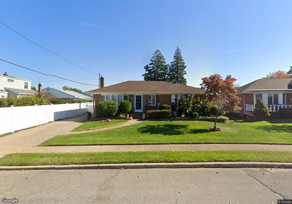
138 Miriam St Bethpage, NY 11714
Estimated Value: $724,490 - $745,000
3
Beds
2
Baths
1,140
Sq Ft
$645/Sq Ft
Est. Value
About This Home
This home is located at 138 Miriam St, Bethpage, NY 11714 and is currently estimated at $734,745, approximately $644 per square foot. 138 Miriam St is a home located in Nassau County with nearby schools including Michael F. Stokes Elementary School, J Fred Sparke Elementary School, and Island Trees Middle School.
Ownership History
Date
Name
Owned For
Owner Type
Purchase Details
Closed on
Oct 20, 2014
Sold by
Karas Theodore S
Bought by
Lauria Janelle and Lauria Kenneth R
Current Estimated Value
Home Financials for this Owner
Home Financials are based on the most recent Mortgage that was taken out on this home.
Original Mortgage
$347,200
Outstanding Balance
$267,252
Interest Rate
4.21%
Mortgage Type
Purchase Money Mortgage
Estimated Equity
$467,493
Purchase Details
Closed on
Aug 5, 1999
Sold by
Karas Socrates and Karas Anastasia
Bought by
Karas Theodore S
Purchase Details
Closed on
Aug 4, 1999
Sold by
Karas Anastasia
Bought by
Karas Socrates and Karas Anastasia
Create a Home Valuation Report for This Property
The Home Valuation Report is an in-depth analysis detailing your home's value as well as a comparison with similar homes in the area
Home Values in the Area
Average Home Value in this Area
Purchase History
| Date | Buyer | Sale Price | Title Company |
|---|---|---|---|
| Lauria Janelle | $434,000 | Advantage Title | |
| Karas Theodore S | -- | First American Title Ins Co | |
| Karas Socrates | -- | First American Title Ins Co |
Source: Public Records
Mortgage History
| Date | Status | Borrower | Loan Amount |
|---|---|---|---|
| Open | Lauria Janelle | $347,200 |
Source: Public Records
Tax History Compared to Growth
Tax History
| Year | Tax Paid | Tax Assessment Tax Assessment Total Assessment is a certain percentage of the fair market value that is determined by local assessors to be the total taxable value of land and additions on the property. | Land | Improvement |
|---|---|---|---|---|
| 2025 | $10,428 | $439 | $209 | $230 |
| 2024 | $3,273 | $440 | $210 | $230 |
| 2023 | $9,281 | $470 | $224 | $246 |
| 2022 | $9,281 | $470 | $224 | $246 |
| 2021 | $12,112 | $476 | $227 | $249 |
| 2020 | $9,424 | $602 | $557 | $45 |
| 2019 | $8,657 | $645 | $453 | $192 |
| 2018 | $8,789 | $760 | $0 | $0 |
| 2017 | $5,841 | $760 | $597 | $163 |
| 2016 | $9,342 | $760 | $597 | $163 |
| 2015 | -- | $760 | $597 | $163 |
| 2014 | -- | $760 | $597 | $163 |
| 2013 | $3,094 | $760 | $597 | $163 |
Source: Public Records
Map
Nearby Homes
- 111 Michael Place
- 3806 Windsor Dr
- 15 Hewmann Place
- 253 Hicksville Rd Unit 2K
- 307- 13 Hicksville Rd Unit 13
- 149 Cardinal Rd
- 107 Cardinal Rd
- 47 Cardinal Rd
- 4030 Avoca Ave
- 3680 Stokes Ave
- 43 Crag Ln
- 35 Whaley Ave
- 43 Farmedge Rd
- 34 Ripple Ln
- 3562 Raven St
- 12 Carson St
- 38 Bradford Ln
- 11 Surrey Ln
- 186 Robin Place
- 11 Berryhill Ln