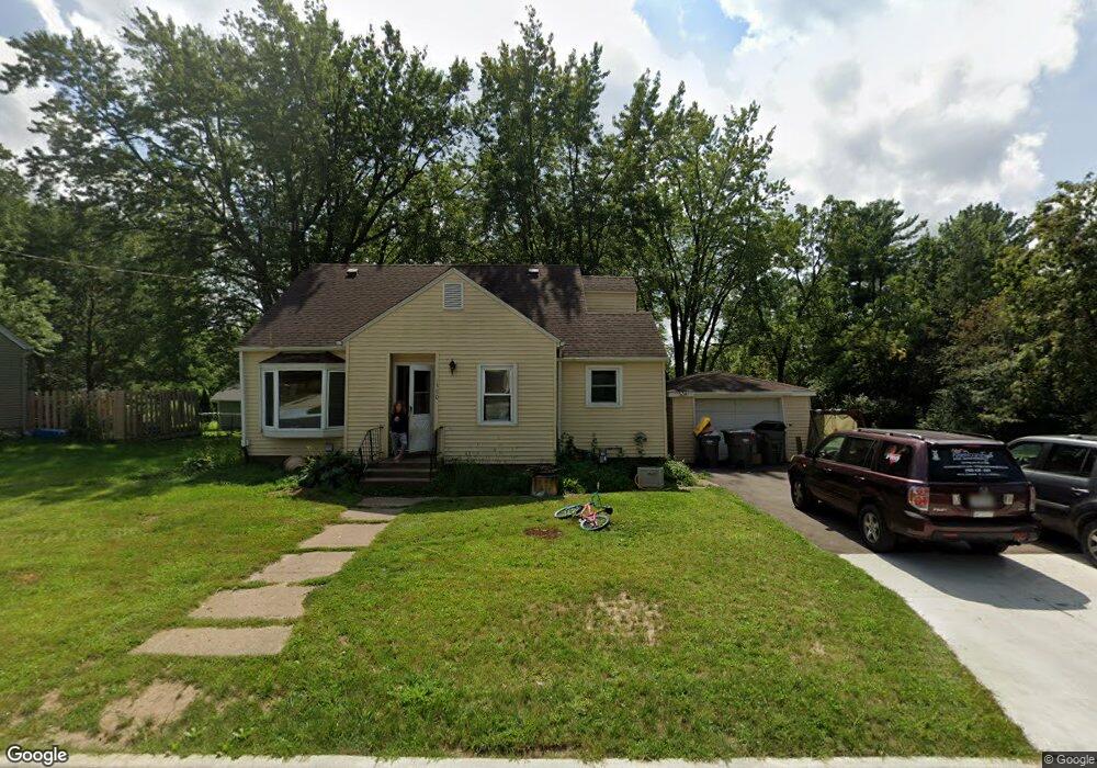
1380 Curtis St Baldwin, WI 54002
Estimated Value: $223,000 - $289,000
4
Beds
2
Baths
--
Sq Ft
8,930
Sq Ft Lot
About This Home
This home is located at 1380 Curtis St, Baldwin, WI 54002 and is currently estimated at $246,519. 1380 Curtis St is a home located in St. Croix County with nearby schools including Greenfield Elementary School, Viking Middle School, and Baldwin-Woodville High School.
Ownership History
Date
Name
Owned For
Owner Type
Purchase Details
Closed on
Feb 8, 2023
Sold by
Munkittrick David A and Munkittrick Catherine R
Bought by
Munkittrick Living Trust and Munkittrick
Current Estimated Value
Purchase Details
Closed on
Jun 24, 2010
Sold by
Marson Derith J
Bought by
Munkittrick David A and Munkittrick Catherine R
Create a Home Valuation Report for This Property
The Home Valuation Report is an in-depth analysis detailing your home's value as well as a comparison with similar homes in the area
Home Values in the Area
Average Home Value in this Area
Purchase History
| Date | Buyer | Sale Price | Title Company |
|---|---|---|---|
| Munkittrick Living Trust | -- | None Listed On Document | |
| Munkittrick David A | $75,000 | River Valley Abstract & Titl |
Source: Public Records
Tax History
| Year | Tax Paid | Tax Assessment Tax Assessment Total Assessment is a certain percentage of the fair market value that is determined by local assessors to be the total taxable value of land and additions on the property. | Land | Improvement |
|---|---|---|---|---|
| 2025 | $3,375 | $167,400 | $25,100 | $142,300 |
| 2024 | $32 | $167,400 | $25,100 | $142,300 |
| 2023 | $2,721 | $167,400 | $25,100 | $142,300 |
| 2022 | $2,683 | $167,400 | $25,100 | $142,300 |
| 2021 | $2,671 | $167,400 | $25,100 | $142,300 |
| 2020 | $2,599 | $117,100 | $18,800 | $98,300 |
| 2019 | $2,531 | $117,100 | $18,800 | $98,300 |
| 2018 | $2,302 | $117,100 | $18,800 | $98,300 |
| 2017 | $2,430 | $117,100 | $18,800 | $98,300 |
| 2016 | $2,430 | $117,100 | $18,800 | $98,300 |
| 2015 | $2,782 | $114,200 | $18,800 | $95,400 |
| 2014 | $2,515 | $114,200 | $18,800 | $95,400 |
| 2013 | $2,563 | $114,200 | $18,800 | $95,400 |
Source: Public Records
Map
Nearby Homes
- 1230 Curtis St
- 1239 Newton St
- 1331 Franklin St
- 1210 14th Ave
- 720 Newton St
- 1130 Florence St
- 1090 7th Ave
- xxx Lot #3 38th St
- 695 Willow St
- Lot 15 Summit Cir
- 144 6th Ave
- 183 Pintail St
- 180 Pintail St
- 195 Pintail St
- 191 Pintail St
- 187 Pintail St
- 198 Pintail St
- 1621 Mallard Ave
- 1632 Mallard Ave
- 1629 Mallard Ave
- 1370 Curtis St
- 1340 Curtis St
- 1330 Curtis St
- 1430 Curtis St
- 1430 Curtis St
- 1270 Curtis St
- 1320 Franklin St
- 1420 Curtis St
- 1360 Franklin St
- 1300 Franklin St
- 1250 Curtis St
- 1380 Franklin St
- 1210 Curtis St
- 740 12th Ave
- 740 12th Ave
- 1240 Curtis St
- 800 12th Ave
- 820 12th Ave
- 1230 Franklin St
- 1408 Franklin St
Your Personal Tour Guide
Ask me questions while you tour the home.