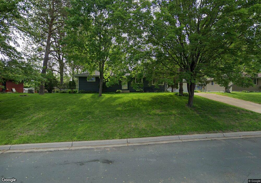
13805 Thomas Ave S Burnsville, MN 55337
Estimated Value: $364,000 - $383,000
3
Beds
2
Baths
1,290
Sq Ft
$289/Sq Ft
Est. Value
About This Home
This home is located at 13805 Thomas Ave S, Burnsville, MN 55337 and is currently estimated at $373,084, approximately $289 per square foot. 13805 Thomas Ave S is a home located in Dakota County with nearby schools including Edward Neill Elementary School, Joseph Nicollet Middle School, and Burnsville High School.
Ownership History
Date
Name
Owned For
Owner Type
Purchase Details
Closed on
Feb 15, 2020
Sold by
Andrews Jeffrey and Andrews Jessika
Bought by
Andrews Jeffrey
Current Estimated Value
Home Financials for this Owner
Home Financials are based on the most recent Mortgage that was taken out on this home.
Original Mortgage
$188,500
Outstanding Balance
$166,904
Interest Rate
3.6%
Mortgage Type
New Conventional
Estimated Equity
$206,180
Purchase Details
Closed on
Sep 27, 2002
Sold by
Anderson Stephen J and Anderson Beth M
Bought by
Andrews Jeffrey
Purchase Details
Closed on
Aug 28, 1998
Sold by
Young Walter N and Young Lena R
Bought by
Anderson Stephen J and Anderson Beth M
Create a Home Valuation Report for This Property
The Home Valuation Report is an in-depth analysis detailing your home's value as well as a comparison with similar homes in the area
Home Values in the Area
Average Home Value in this Area
Purchase History
| Date | Buyer | Sale Price | Title Company |
|---|---|---|---|
| Andrews Jeffrey | -- | None Available | |
| Andrews Jeffrey | $189,900 | -- | |
| Anderson Stephen J | $124,900 | -- |
Source: Public Records
Mortgage History
| Date | Status | Borrower | Loan Amount |
|---|---|---|---|
| Open | Andrews Jeffrey | $188,500 |
Source: Public Records
Tax History Compared to Growth
Tax History
| Year | Tax Paid | Tax Assessment Tax Assessment Total Assessment is a certain percentage of the fair market value that is determined by local assessors to be the total taxable value of land and additions on the property. | Land | Improvement |
|---|---|---|---|---|
| 2024 | $3,348 | $309,000 | $86,300 | $222,700 |
| 2023 | $3,348 | $308,200 | $86,400 | $221,800 |
| 2022 | $2,902 | $309,700 | $86,200 | $223,500 |
| 2021 | $2,938 | $262,300 | $74,900 | $187,400 |
| 2020 | $2,930 | $252,200 | $71,400 | $180,800 |
| 2019 | $2,962 | $242,600 | $68,000 | $174,600 |
| 2018 | $2,857 | $233,600 | $64,700 | $168,900 |
| 2017 | $2,692 | $219,000 | $61,600 | $157,400 |
| 2016 | $2,724 | $203,500 | $58,700 | $144,800 |
| 2015 | $2,550 | $178,580 | $51,409 | $127,171 |
| 2014 | -- | $172,476 | $50,111 | $122,365 |
| 2013 | -- | $148,496 | $44,619 | $103,877 |
Source: Public Records
Map
Nearby Homes
- 13817 Thomas Ave S
- 2408 Friendship Ln
- 2104 W 140th St
- 2704 W 135th St
- 13840 York Ave S
- 1905 W 140th St
- 13812 Sunset Lake Dr
- 1701 W 138th St
- 1725 W 140th St
- 13717 W Preserve Blvd
- 13303 Morgan Ave S
- 13147 Thomas Ave S
- 13208 Upton Ave S
- 4008 W 137th St
- 1200 W 136th St
- 13100 Thomas Ave S
- 2909 Sunnyside Cir
- 2729 Terrace Dr
- 1009 Knob Hill Rd
- 1503 Summit Shores W
- 13801 Thomas Ave S
- 13809 Thomas Ave S
- 13804 Scott St
- 13808 Scott St
- 13800 Scott St
- 13813 Thomas Ave S
- 13804 Thomas Ave S
- 13800 Thomas Ave S
- 13808 Thomas Ave S
- 13709 Thomas Ave S
- 13708 Thomas Ave S
- 2508 Shady Ln
- 13812 Thomas Ave S
- 13816 Scott St
- 13705 Thomas Ave S
- 2504 Shady Ln
- 13805 Scott St
- 13809 Scott St
- 13821 Thomas Ave S
- 13816 Thomas Ave S