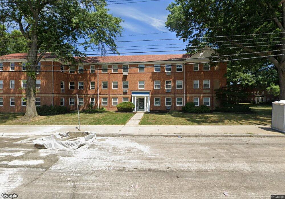
13809 Cedar Rd Cleveland, OH 44118
Estimated Value: $64,833 - $76,000
2
Beds
1
Bath
1,056
Sq Ft
$65/Sq Ft
Est. Value
About This Home
This home is located at 13809 Cedar Rd, Cleveland, OH 44118 and is currently estimated at $68,208, approximately $64 per square foot. 13809 Cedar Rd is a home located in Cuyahoga County with nearby schools including Gearity Professional Development School, Monticello Middle School, and Cleveland Heights High School.
Ownership History
Date
Name
Owned For
Owner Type
Purchase Details
Closed on
Jun 1, 1994
Sold by
Brosse Rina Lasky
Bought by
Wahba Jacob Y and Wahba Shulamit
Current Estimated Value
Home Financials for this Owner
Home Financials are based on the most recent Mortgage that was taken out on this home.
Original Mortgage
$20,000
Interest Rate
8.48%
Mortgage Type
New Conventional
Purchase Details
Closed on
Mar 7, 1984
Sold by
Kvashis Arkady
Bought by
Brosse Rina L
Purchase Details
Closed on
Nov 2, 1979
Sold by
Simon Jennie
Bought by
Kvashis Arkady
Purchase Details
Closed on
Apr 29, 1977
Bought by
Simon Jennie
Purchase Details
Closed on
Oct 29, 1976
Sold by
Hennessey Kenneth J
Bought by
Carl Milstein Trs
Purchase Details
Closed on
Jan 1, 1975
Bought by
Hennessey Kenneth J
Create a Home Valuation Report for This Property
The Home Valuation Report is an in-depth analysis detailing your home's value as well as a comparison with similar homes in the area
Home Values in the Area
Average Home Value in this Area
Purchase History
| Date | Buyer | Sale Price | Title Company |
|---|---|---|---|
| Wahba Jacob Y | $37,500 | -- | |
| Brosse Rina L | $37,000 | -- | |
| Kvashis Arkady | $35,000 | -- | |
| Simon Jennie | $22,200 | -- | |
| Carl Milstein Trs | $20,000 | -- | |
| Hennessey Kenneth J | -- | -- |
Source: Public Records
Mortgage History
| Date | Status | Borrower | Loan Amount |
|---|---|---|---|
| Closed | Wahba Jacob Y | $20,000 |
Source: Public Records
Tax History Compared to Growth
Tax History
| Year | Tax Paid | Tax Assessment Tax Assessment Total Assessment is a certain percentage of the fair market value that is determined by local assessors to be the total taxable value of land and additions on the property. | Land | Improvement |
|---|---|---|---|---|
| 2024 | $1,491 | $23,765 | $2,380 | $21,385 |
| 2023 | $972 | $15,790 | $1,580 | $14,210 |
| 2022 | $1,015 | $15,785 | $1,575 | $14,210 |
| 2021 | $1,000 | $15,790 | $1,580 | $14,210 |
| 2020 | $570 | $11,520 | $1,160 | $10,360 |
| 2019 | $552 | $32,900 | $3,300 | $29,600 |
| 2018 | $552 | $11,520 | $1,160 | $10,360 |
| 2017 | $680 | $12,360 | $1,230 | $11,130 |
| 2016 | $675 | $12,360 | $1,230 | $11,130 |
| 2015 | $798 | $12,360 | $1,230 | $11,130 |
| 2014 | $798 | $13,730 | $1,370 | $12,360 |
Source: Public Records
Map
Nearby Homes
- 13805 Cedar Rd Unit 203
- 13801 Cedar Rd Unit 102
- 3841 Washington Blvd
- 13765 Cedar Rd Unit 303C
- 3797 Bushnell Rd
- 3781 Bushnell Rd
- 3874 Washington Blvd
- 13726 Cedar Rd
- 2223 Fenwick Rd
- 2187 Barrington Rd
- 2244 Edgerton Rd
- 2192 Barrington Rd
- 13677 Cedar Rd
- 2216 Barrington Rd
- 3778 E Antisdale Rd
- 2227 Cranston Rd
- 3958 Bushnell Rd
- 2203 Brockway Rd
- 3733 E Antisdale Rd
- 13629 Cedar Rd
- 13809 Cedar Rd Unit 104
- 13809 Cedar Rd Unit 305
- 13809 Cedar Rd Unit 102
- 13809 Cedar Rd Unit 304
- 13809 Cedar Rd Unit 204
- 13809 Cedar Rd Unit 301
- 13809 Cedar Rd Unit 206
- 13809 Cedar Rd
- 13809 Cedar Rd Unit 201
- 13809 Cedar Rd
- 13809 Cedar Rd Unit 306
- 13809 Cedar Rd Unit 105
- 13809 Cedar Rd Unit 106
- 13809 Cedar Rd
- 13809 Cedar Rd
- 13809 Cedar Rd
- 13809 Cedar Rd Unit 202
- 13809 Cedar Rd Unit 302h
- 13809 Cedar Rd Unit 205B
- 13805 Cedar Rd Unit 201