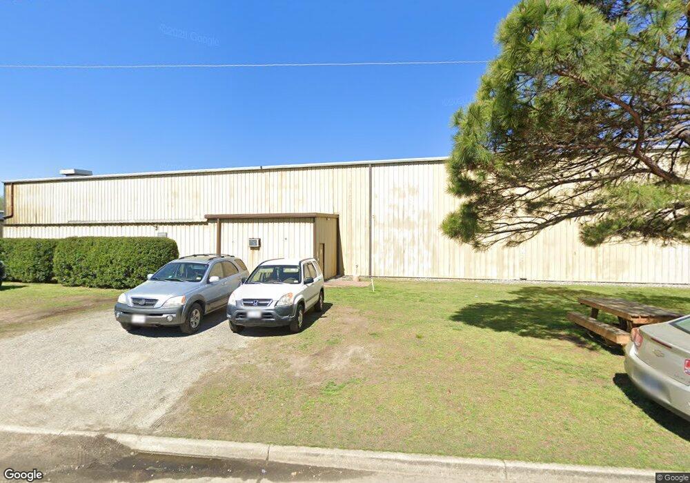
1381 Air Rail Ave Virginia Beach, VA 23455
Bayside NeighborhoodEstimated Value: $2,735,844
--
Bed
--
Bath
41,865
Sq Ft
$65/Sq Ft
Est. Value
About This Home
This home is located at 1381 Air Rail Ave, Virginia Beach, VA 23455 and is currently estimated at $2,735,844, approximately $65 per square foot. 1381 Air Rail Ave is a home located in Virginia Beach City with nearby schools including Bayside Elementary School, Bayside 6th Grade Campus, and Bayside High School.
Ownership History
Date
Name
Owned For
Owner Type
Purchase Details
Closed on
Nov 27, 2019
Sold by
Bruce & Ken Holdings Inc
Bought by
1381 Air Rail Avenue Llc
Current Estimated Value
Home Financials for this Owner
Home Financials are based on the most recent Mortgage that was taken out on this home.
Original Mortgage
$1,440,000
Outstanding Balance
$1,266,829
Interest Rate
3.6%
Mortgage Type
Commercial
Estimated Equity
$1,469,015
Create a Home Valuation Report for This Property
The Home Valuation Report is an in-depth analysis detailing your home's value as well as a comparison with similar homes in the area
Home Values in the Area
Average Home Value in this Area
Purchase History
| Date | Buyer | Sale Price | Title Company |
|---|---|---|---|
| 1381 Air Rail Avenue Llc | $1,800,000 | Attorney |
Source: Public Records
Mortgage History
| Date | Status | Borrower | Loan Amount |
|---|---|---|---|
| Open | 1381 Air Rail Avenue Llc | $1,440,000 |
Source: Public Records
Tax History Compared to Growth
Tax History
| Year | Tax Paid | Tax Assessment Tax Assessment Total Assessment is a certain percentage of the fair market value that is determined by local assessors to be the total taxable value of land and additions on the property. | Land | Improvement |
|---|---|---|---|---|
| 2025 | $17,622 | $1,817,600 | $639,600 | $1,178,000 |
| 2024 | $17,622 | $1,816,700 | $639,600 | $1,177,100 |
| 2023 | $17,686 | $1,786,500 | $639,600 | $1,146,900 |
| 2022 | $16,526 | $1,669,300 | $664,200 | $1,005,100 |
| 2021 | $16,182 | $1,634,500 | $639,600 | $994,900 |
| 2020 | $16,638 | $1,635,200 | $639,600 | $995,600 |
| 2019 | $16,923 | $1,575,600 | $565,800 | $1,009,800 |
| 2018 | $15,795 | $1,575,600 | $565,800 | $1,009,800 |
| 2017 | $15,298 | $1,526,000 | $492,000 | $1,034,000 |
| 2016 | $14,697 | $1,484,500 | $447,400 | $1,037,100 |
| 2015 | $14,738 | $1,488,700 | $447,500 | $1,041,200 |
| 2014 | $13,643 | $1,355,700 | $447,500 | $908,200 |
Source: Public Records
Map
Nearby Homes
- 1027 Finney Cir
- 5712 Gretna Rd
- 1900 Darnell Dr
- 1109 Spindle Crossing
- 1957 Darnell Dr
- 1161 Hillock Crossing
- 5537 Finespun Last
- 1536 Sagewood Dr
- 5841 Hartwick Dr
- 3404 Budd Dr
- 1549 Sagewood Dr
- 3444 Budd Ct
- 1284 Hillock Crossing
- 1004 Pastern Brief
- 5644 Lawson Hall Rd
- 3521 Gamage Dr
- 2526 Wingfield Rd
- 5753 Leslie Ave
- 5545 Lambdin Arch
- 6437 Azalea Garden Rd
- 1373 Air Rail Ave
- 1391 Air Rail Ave
- 1364 Air Rail Ave
- 5932 Sandpit Rd
- 1390 Air Rail Ave
- 5920 Sandpit Rd
- 1393 Air Rail Ave
- 1249 Barrs Rd
- 5925 Thurston Ave
- 1417 Miller Store Rd
- 1399 Air Rail Ave
- 1245 Miller Store Rd
- 1401 Air Rail Ave
- LT 38 Woolwich Ct
- LT 35 Lambeth Ln
- LT 34 Lambeth Ln
- MM1 Shell Rd
- MM Maple T
- MM Bar Harbor A at Bayville at Lake Joyce
- LT 48 Battersea Ct