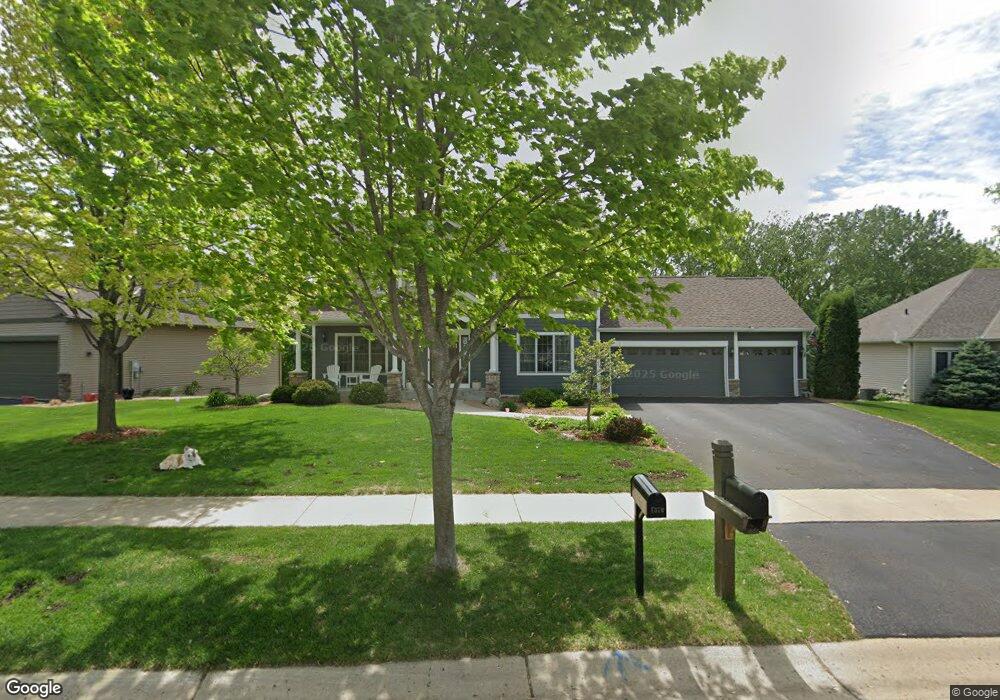
1381 Knight Ln Watertown, MN 55388
Estimated Value: $616,000 - $648,000
4
Beds
4
Baths
2,344
Sq Ft
$269/Sq Ft
Est. Value
About This Home
This home is located at 1381 Knight Ln, Watertown, MN 55388 and is currently estimated at $631,099, approximately $269 per square foot. 1381 Knight Ln is a home located in Carver County with nearby schools including Watertown-Mayer Elementary School, Watertown-Mayer Middle School, and Watertown Mayer High School.
Ownership History
Date
Name
Owned For
Owner Type
Purchase Details
Closed on
Jan 7, 2021
Sold by
Horlocker Jon D and Horlocker Victoria L
Bought by
Horlocker Jon D and Horlocker Victoria L
Current Estimated Value
Purchase Details
Closed on
Aug 25, 2006
Sold by
D W Lutterman Inc
Bought by
Horlocker Jon D and Horlocker Victoria L
Home Financials for this Owner
Home Financials are based on the most recent Mortgage that was taken out on this home.
Original Mortgage
$309,905
Interest Rate
6.77%
Mortgage Type
New Conventional
Purchase Details
Closed on
Apr 12, 2006
Sold by
Mj Watertown Development Llc
Bought by
D W Lutterman Inc
Home Financials for this Owner
Home Financials are based on the most recent Mortgage that was taken out on this home.
Original Mortgage
$230,000
Interest Rate
6.42%
Mortgage Type
Construction
Create a Home Valuation Report for This Property
The Home Valuation Report is an in-depth analysis detailing your home's value as well as a comparison with similar homes in the area
Home Values in the Area
Average Home Value in this Area
Purchase History
| Date | Buyer | Sale Price | Title Company |
|---|---|---|---|
| Horlocker Jon D | -- | None Listed On Document | |
| Horlocker Jon D | $458,905 | -- | |
| D W Lutterman Inc | $114,900 | -- |
Source: Public Records
Mortgage History
| Date | Status | Borrower | Loan Amount |
|---|---|---|---|
| Previous Owner | Horlocker Jon D | $309,905 | |
| Previous Owner | D W Lutterman Inc | $230,000 |
Source: Public Records
Tax History Compared to Growth
Tax History
| Year | Tax Paid | Tax Assessment Tax Assessment Total Assessment is a certain percentage of the fair market value that is determined by local assessors to be the total taxable value of land and additions on the property. | Land | Improvement |
|---|---|---|---|---|
| 2025 | $7,466 | $601,800 | $115,000 | $486,800 |
| 2024 | $7,232 | $579,400 | $105,000 | $474,400 |
| 2023 | $7,474 | $579,400 | $105,000 | $474,400 |
| 2022 | $7,326 | $605,500 | $105,200 | $500,300 |
| 2021 | $7,428 | $499,800 | $87,600 | $412,200 |
| 2020 | $7,480 | $499,800 | $87,600 | $412,200 |
| 2019 | $7,092 | $474,500 | $83,000 | $391,500 |
| 2018 | $7,100 | $474,500 | $83,000 | $391,500 |
| 2017 | $6,240 | $445,100 | $75,400 | $369,700 |
| 2016 | $6,324 | $390,700 | $0 | $0 |
| 2015 | $6,160 | $366,400 | $0 | $0 |
| 2014 | $6,160 | $342,800 | $0 | $0 |
Source: Public Records
Map
Nearby Homes
- 1290 Knight Ln
- 1221 Bishop Cir
- 1201 Bishop Cir
- XXX Newton Ave SE
- 555 Industrial Blvd
- 536 Industrial Blvd
- 575 Industrial Blvd
- 865 Quail Ct
- 516 Industrial Blvd
- 829 Reo Rd
- 593 Sienna Dr
- 578 Sienna Dr
- 600 Jefferson Ave SW
- 313 Angel Ave SW
- 408 Franklin Ave SW
- xxx Stevens St SW
- 605 Stevens St SW Unit 43
- 115 Riverside Terrace Dr Unit 115
- 604 White St SW Unit 35
- 604 White St SW
- 1361 Knight Ln
- 1401 Knight Ln
- 1370 Knight Ln
- 1341 Knight Ln
- 1350 Knight Ln
- 601 Quail Pkwy
- 620 Quail Pkwy
- 1321 Knight Ln
- 1310 Knight Ln
- 1301 Knight Ln
- 651 Quail Pkwy
- 1241 Bishop Cir
- 1261 Bishop Cir
- xxx Knight Ln
- 693 Quail Pkwy
- 575 Raleigh Cir
- 1281 Bishop Cir
- 1270 Knight Ln
- 1281 Knight Ln
- 701 Quail Pkwy