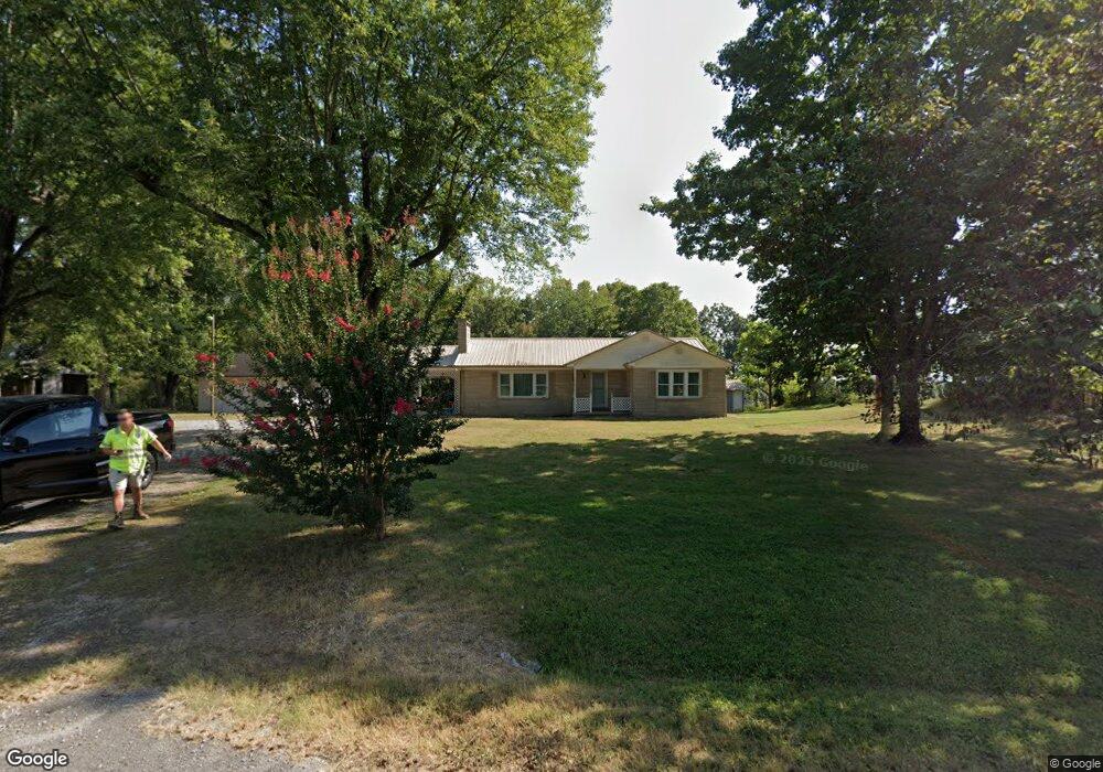
1381 Pollard Rd Walling, TN 38587
Estimated Value: $246,840 - $310,000
Studio
1
Bath
1,665
Sq Ft
$167/Sq Ft
Est. Value
About This Home
This home is located at 1381 Pollard Rd, Walling, TN 38587 and is currently estimated at $277,710, approximately $166 per square foot. 1381 Pollard Rd is a home located in White County with nearby schools including Central View Elementary School, White County Middle School, and White County High School.
Ownership History
Date
Name
Owned For
Owner Type
Purchase Details
Closed on
Oct 20, 2025
Sold by
Schoolfield Amber D and Schoolfield James C
Bought by
Brock Dustin
Current Estimated Value
Home Financials for this Owner
Home Financials are based on the most recent Mortgage that was taken out on this home.
Original Mortgage
$200,000
Outstanding Balance
$200,000
Interest Rate
5.88%
Mortgage Type
New Conventional
Estimated Equity
$77,710
Purchase Details
Closed on
Jun 30, 2020
Sold by
Howard William T and Howard Terri C
Bought by
Schoolfield Amber D and Schoolfield James C
Home Financials for this Owner
Home Financials are based on the most recent Mortgage that was taken out on this home.
Original Mortgage
$185,725
Interest Rate
3.2%
Mortgage Type
New Conventional
Purchase Details
Closed on
Apr 2, 1975
Bought by
Glenn Robert and Glenn Melba
Create a Home Valuation Report for This Property
The Home Valuation Report is an in-depth analysis detailing your home's value as well as a comparison with similar homes in the area
Purchase History
We collect this data history from publicly available records. To have your information removed, we recommend requesting removal directly through your county’s website.
| Date | Buyer | Sale Price | Title Company |
|---|---|---|---|
| Brock Dustin | $230,000 | Access Title & Escrow | |
| Schoolfield Amber D | $195,500 | None Available | |
| Glenn Robert | -- | -- |
Source: Public Records
Mortgage History
We collect this data history from publicly available records. To have your information removed, we recommend requesting removal directly through your county’s website.
| Date | Status | Borrower | Loan Amount |
|---|---|---|---|
| Open | Brock Dustin | $200,000 | |
| Previous Owner | Schoolfield Amber D | $185,725 |
Source: Public Records
Tax History
| Year | Tax Paid | Tax Assessment Tax Assessment Total Assessment is a certain percentage of the fair market value that is determined by local assessors to be the total taxable value of land and additions on the property. | Land | Improvement |
|---|---|---|---|---|
| 2025 | $762 | $54,050 | $4,325 | $49,725 |
| 2024 | $643 | $31,350 | $3,100 | $28,250 |
| 2023 | $643 | $31,350 | $3,100 | $28,250 |
| 2022 | $643 | $31,350 | $3,100 | $28,250 |
| 2021 | $643 | $31,350 | $3,100 | $28,250 |
| 2020 | $643 | $31,350 | $3,100 | $28,250 |
| 2019 | $517 | $25,200 | $3,100 | $22,100 |
| 2018 | $481 | $25,200 | $3,100 | $22,100 |
| 2017 | $481 | $23,475 | $1,875 | $21,600 |
| 2016 | $486 | $23,725 | $1,875 | $21,850 |
| 2015 | $439 | $23,725 | $1,875 | $21,850 |
| 2014 | -- | $23,725 | $1,875 | $21,850 |
| 2013 | -- | $23,575 | $1,675 | $21,900 |
Source: Public Records
Map
Nearby Homes
- 1033 Pollard Rd
- 550 N Center Point Acres
- 265 N Center Point Acres
- 0 Center Point Acres N Unit 1322803
- 0 Center Point Acres N Unit RTC3164235
- 0 Center Point Acres N Unit 240744
- 0 Center Point Acres N Unit RTC3050083
- 298 Pollard Rd
- 00 Pollard Cemetery Rd
- 0 Pollard Cemetery Rd
- 13400 Old Kentucky Rd
- 4200 #1 Will Thompson Rd
- 4200 #3 Will Thompson Rd
- 4200 #5 Will Thompson Rd
- 4200 #2 Will Thompson Rd
- 4200 #4 Will Thompson Rd
- 4200 #6 Will Thompson Rd
- 14193 Old Kentucky Rd
- 14305 Old Kentucky Rd
- 842 Dave England Rd
- 1381 Pollard Rd
- 00 Pollard Rd
- Lot 5 Pollard Rd
- Lot 3 Pollard Rd
- Lot 4 Pollard Rd
- Lot 1 Pollard Rd
- Lot 2 Pollard Rd
- 0 Pollard Rd
- 1423 Pollard Rd
- 1304 Pollard Rd
- 1279 Pollard Rd
- 1193 Pollard Rd
- 1130 Pollard Rd
- 1092 Pollard Rd
- 1092 Pollard Rd Unit 1064
- 1675 Pollard Rd
- 1064 Pollard Rd Unit 1092
- 1071 Pollard Rd Unit 1087
- 1041 Pollard Rd
- 1723 Pollard Rd
Your Personal Tour Guide
Ask me questions while you tour the home.