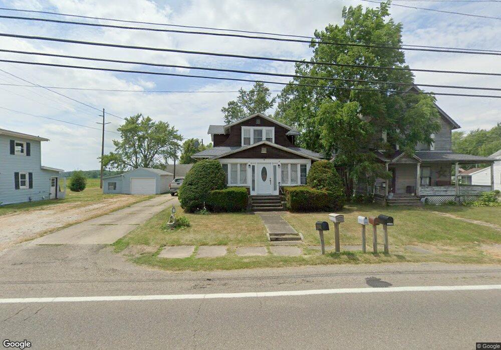
13816 S Main St Beloit, OH 44609
Estimated Value: $144,380 - $168,000
4
Beds
2
Baths
1,775
Sq Ft
$87/Sq Ft
Est. Value
About This Home
This home is located at 13816 S Main St, Beloit, OH 44609 and is currently estimated at $153,845, approximately $86 per square foot. 13816 S Main St is a home located in Mahoning County with nearby schools including West Branch Middle School, West Branch Early Learning Center, and West Branch High School.
Ownership History
Date
Name
Owned For
Owner Type
Purchase Details
Closed on
Jun 16, 2006
Sold by
Lister Raymond Douglas and Lister Georgia R
Bought by
Eberling Gary S and Eberling Christy Lynn
Current Estimated Value
Home Financials for this Owner
Home Financials are based on the most recent Mortgage that was taken out on this home.
Original Mortgage
$71,400
Outstanding Balance
$41,329
Interest Rate
6.68%
Mortgage Type
Purchase Money Mortgage
Estimated Equity
$112,516
Purchase Details
Closed on
Apr 14, 1993
Bought by
Lister Raymond D
Create a Home Valuation Report for This Property
The Home Valuation Report is an in-depth analysis detailing your home's value as well as a comparison with similar homes in the area
Purchase History
| Date | Buyer | Sale Price | Title Company |
|---|---|---|---|
| Eberling Gary S | $75,200 | Sebring Title Agency Inc | |
| Lister Raymond D | $47,500 | -- |
Source: Public Records
Mortgage History
| Date | Status | Borrower | Loan Amount |
|---|---|---|---|
| Open | Eberling Gary S | $71,400 |
Source: Public Records
Tax History
| Year | Tax Paid | Tax Assessment Tax Assessment Total Assessment is a certain percentage of the fair market value that is determined by local assessors to be the total taxable value of land and additions on the property. | Land | Improvement |
|---|---|---|---|---|
| 2025 | $1,578 | $39,250 | $2,530 | $36,720 |
| 2024 | $1,578 | $39,250 | $2,530 | $36,720 |
| 2023 | $1,551 | $39,250 | $2,530 | $36,720 |
| 2022 | $1,361 | $29,000 | $2,530 | $26,470 |
| 2021 | $1,488 | $29,000 | $2,530 | $26,470 |
| 2020 | $1,493 | $29,000 | $2,530 | $26,470 |
| 2019 | $1,310 | $23,210 | $2,530 | $20,680 |
| 2018 | $1,305 | $23,210 | $2,530 | $20,680 |
| 2017 | $1,374 | $23,210 | $2,530 | $20,680 |
| 2016 | $1,445 | $25,900 | $2,330 | $23,570 |
| 2015 | $1,413 | $25,900 | $2,330 | $23,570 |
| 2014 | $1,419 | $25,900 | $2,330 | $23,570 |
| 2013 | $1,402 | $25,900 | $2,330 | $23,570 |
Source: Public Records
Map
Nearby Homes
- 18061 Derr Ave
- 18280 5th St
- 57 Redwood St
- 18262 W Pine Lake Rd
- 345 E Indiana Ave
- 430 Hillsdale St
- 423 S 14th St
- 195 E Pennsylvania Ave
- 157 E Ohio Ave
- 324 S 15th St
- 208 S 15th St
- 945 N 12th St
- 104 W Carolina Ave
- 125 E Indiana Ave
- 166 E Michigan Ave
- 175 W Ohio Ave
- 1005 N 13th St
- 0 W Nevada Ave Unit 5181868
- 27292 Lake Front Dr
- 406 W Ohio Ave
- 13806 S Main St
- 13826 S Main St
- 18043 Derr Ave
- 13788 S Main St
- 18053 Derr Ave
- 13778 S Main St
- 13801 S Main St
- 18044 Derr Ave
- 13793 S Main St
- 13768 S Main St
- 18071 Derr Ave
- 13758 S Main St
- 13859 S Main St
- 18081 Derr Ave
- 13777 S Main St
- 18062 Derr Ave
- 13767 S Main St
- 17964 Fairview Ave
- 18091 Derr Ave
- 13875 S Main St
Your Personal Tour Guide
Ask me questions while you tour the home.