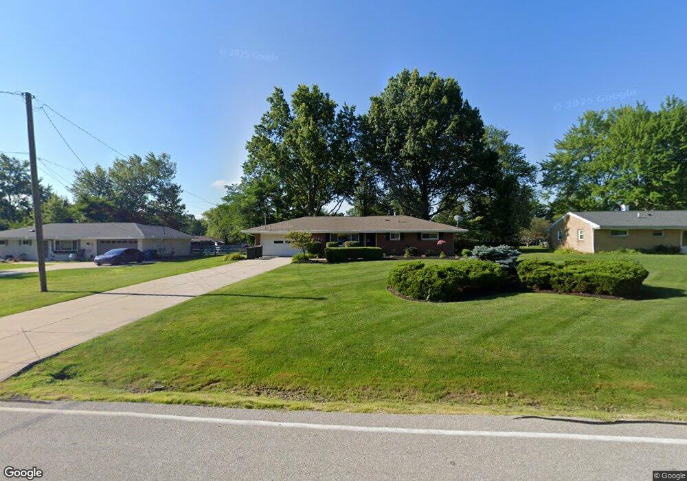
1382 Roseland Dr MacEdonia, OH 44056
Estimated Value: $216,000 - $248,000
3
Beds
2
Baths
1,247
Sq Ft
$183/Sq Ft
Est. Value
About This Home
This home is located at 1382 Roseland Dr, MacEdonia, OH 44056 and is currently estimated at $227,990, approximately $182 per square foot. 1382 Roseland Dr is a home located in Summit County with nearby schools including Lee Eaton Elementary School, Nordonia Middle School, and Nordonia High School.
Ownership History
Date
Name
Owned For
Owner Type
Purchase Details
Closed on
Jun 30, 2022
Sold by
Diersing Robert E and Diersing Dale C
Bought by
John D Brown Declaration Of Trust and Brown
Current Estimated Value
Purchase Details
Closed on
Nov 22, 2004
Sold by
Dennis James R and Diebold Laura Jean
Bought by
Diersing Robert E and Diersing Dale C
Home Financials for this Owner
Home Financials are based on the most recent Mortgage that was taken out on this home.
Original Mortgage
$133,650
Interest Rate
5.86%
Mortgage Type
Purchase Money Mortgage
Create a Home Valuation Report for This Property
The Home Valuation Report is an in-depth analysis detailing your home's value as well as a comparison with similar homes in the area
Home Values in the Area
Average Home Value in this Area
Purchase History
| Date | Buyer | Sale Price | Title Company |
|---|---|---|---|
| John D Brown Declaration Of Trust | $167,000 | Sabol Lisa A | |
| Diersing Robert E | $148,500 | Chicago Title Insurance Comp |
Source: Public Records
Mortgage History
| Date | Status | Borrower | Loan Amount |
|---|---|---|---|
| Previous Owner | Diersing Robert E | $133,650 |
Source: Public Records
Tax History Compared to Growth
Tax History
| Year | Tax Paid | Tax Assessment Tax Assessment Total Assessment is a certain percentage of the fair market value that is determined by local assessors to be the total taxable value of land and additions on the property. | Land | Improvement |
|---|---|---|---|---|
| 2025 | $3,058 | $62,532 | $13,815 | $48,717 |
| 2024 | $3,058 | $62,532 | $13,815 | $48,717 |
| 2023 | $3,058 | $62,532 | $13,815 | $48,717 |
| 2022 | $2,776 | $49,361 | $10,878 | $38,483 |
| 2021 | $2,921 | $49,361 | $10,878 | $38,483 |
| 2020 | $2,767 | $49,360 | $10,880 | $38,480 |
| 2019 | $2,892 | $47,170 | $10,330 | $36,840 |
| 2018 | $2,527 | $47,170 | $10,330 | $36,840 |
| 2017 | $2,590 | $47,170 | $10,330 | $36,840 |
| 2016 | $2,419 | $41,870 | $10,330 | $31,540 |
| 2015 | $2,590 | $41,870 | $10,330 | $31,540 |
| 2014 | $2,402 | $41,870 | $10,330 | $31,540 |
| 2013 | $2,355 | $41,970 | $10,330 | $31,640 |
Source: Public Records
Map
Nearby Homes
- 1533 Bradford Dr
- VL Shepard Rd
- SL 1 Chamberlin Rd
- 1632 Strauss Ln
- 9232 Chamberlin Rd
- SL 2 Chamberlin Rd
- 0 Chamberlin Rd Unit 5171385
- 9387 Hyde Park Dr
- 1780 Rolling Hills Dr Unit B
- 1035 Skyland Dr
- 1028 Sherwood Dr
- 9452 Fairfield Dr
- 9391 Monticello Dr
- 8607 Alexis Dr
- 34 E Aurora Rd
- 2092 Holmes Dr
- 1621 Ridgewood Ct
- 1816 Westwood Dr
- 9537 Ridge Ct Unit 7
- 615 Ledge Rd
- 1392 Roseland Dr
- 1372 Roseland Dr
- 1402 Roseland Dr
- 1431 Meadowlawn Dr
- 1362 Roseland Dr
- 1441 Meadowlawn Dr
- 1421 Meadowlawn Dr
- 1383 Roseland Dr
- 1393 Roseland Dr
- 1373 Roseland Dr
- 1451 Meadowlawn Dr
- 1411 Meadowlawn Dr
- 1412 Roseland Dr
- 1352 Roseland Dr
- 1363 Roseland Dr
- 1403 Roseland Dr
- 1461 Meadowlawn Dr
- 1401 Meadowlawn Dr
- 1353 Roseland Dr
- 1342 Roseland Dr