Estimated Value: $610,159 - $736,000
4
Beds
4
Baths
3,763
Sq Ft
$181/Sq Ft
Est. Value
About This Home
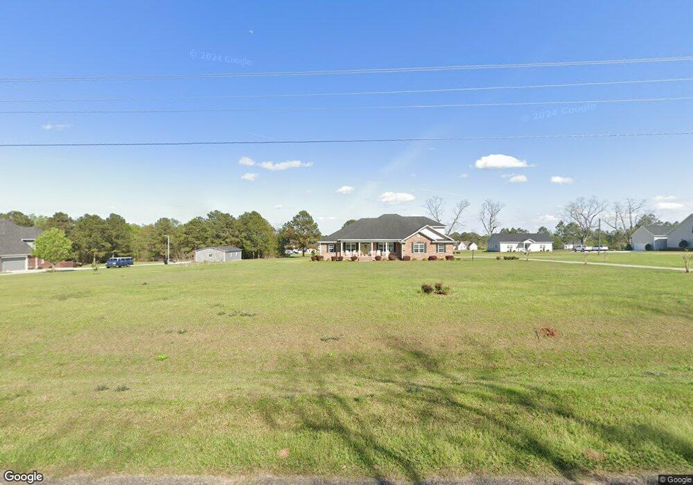
This home is located at 1382 Upper Hawthorne Trail, Cairo, GA 39828 and is currently estimated at $680,540, approximately $180 per square foot. 1382 Upper Hawthorne Trail is a home with nearby schools including Cairo High School.
Ownership History
Date
Name
Owned For
Owner Type
Purchase Details
Closed on
Oct 2, 2012
Sold by
The Main West Inc
Bought by
Gilbert Nitsa
Current Estimated Value
Purchase Details
Closed on
Jun 1, 2007
Sold by
Taylor Patrick Land Corp
Bought by
Valle Pines Land Corp
Purchase Details
Closed on
Nov 2, 1992
Bought by
Taylor Patrick Land Corp
Create a Home Valuation Report for This Property
The Home Valuation Report is an in-depth analysis detailing your home's value as well as a comparison with similar homes in the area
Home Values in the Area
Average Home Value in this Area
Purchase History
| Date | Buyer | Sale Price | Title Company |
|---|---|---|---|
| Gilbert Nitsa | $20,500 | -- | |
| Valle Pines Land Corp | $160,000 | -- | |
| Taylor Patrick Land Corp | -- | -- |
Source: Public Records
Tax History Compared to Growth
Tax History
| Year | Tax Paid | Tax Assessment Tax Assessment Total Assessment is a certain percentage of the fair market value that is determined by local assessors to be the total taxable value of land and additions on the property. | Land | Improvement |
|---|---|---|---|---|
| 2024 | $9,591 | $243,098 | $16,000 | $227,098 |
| 2023 | $7,293 | $197,034 | $8,200 | $188,834 |
| 2022 | $7,587 | $197,034 | $8,200 | $188,834 |
| 2021 | $7,606 | $197,034 | $8,200 | $188,834 |
| 2020 | $7,627 | $197,034 | $8,200 | $188,834 |
| 2019 | $7,625 | $197,034 | $8,200 | $188,834 |
| 2018 | $7,249 | $197,034 | $8,200 | $188,834 |
| 2017 | $6,971 | $197,034 | $8,200 | $188,834 |
| 2016 | $6,017 | $166,303 | $8,200 | $158,103 |
| 2015 | $5,957 | $166,303 | $8,200 | $158,103 |
| 2014 | $294 | $8,200 | $8,200 | $0 |
| 2013 | -- | $13,000 | $13,000 | $0 |
Source: Public Records
Map
Nearby Homes
- 1137 Summerfield
- 0 Upper Hawthorne Trail
- 1389 Lake Front Dr
- Lot 1 Crine Blvd
- 1500 15th Ave NW
- 1296 McQuaig St NW
- 1520 Upper Hawthorne Trail
- 1200 15th Ave NW
- 1006 Syrup Mill Creek
- 1002 Syrup Mill Creek
- 1006 Syrup Mill Creek Ln
- 1725 Tract 2 Hwy 84w
- 1725 Tract #1 Hwy 84w
- 1490 Magnolia Dr
- 698 12th Ave NW
- 000 1st Ave SW
- 1385 Martin Luther King Junior Ave
- 00 6th St NW
- 000 15th Ave Nw -- Tract 1
- 000 15th Ave Nw -- Tract 2
- 1398 Upper Hawthorne Trail
- 1368 Upper Hawthorne Trail
- 1422 Upper Hawthorne Trail
- 1133 Summerfield Dr
- 1129 Summerfield
- 1381 Upper Hawthorne Trail
- 1121 Summerfield
- Lot 11 Summerfield Dr Unit 11
- Lot 20 Summerfield Dr Unit 20
- 1117 Summerfield
- 1112 Summerfield
- 1124 Summerfield Dr
- 1304 Upper Hawthorne Trail
- 1108 Summerfield
- 1113 Summerfield
- 0000 Upper Hawthorne Trail
- 1113 W Lake Dr
- 1120 W Lake Dr
- 1116 W Lake Dr
- 1109 Summerfield