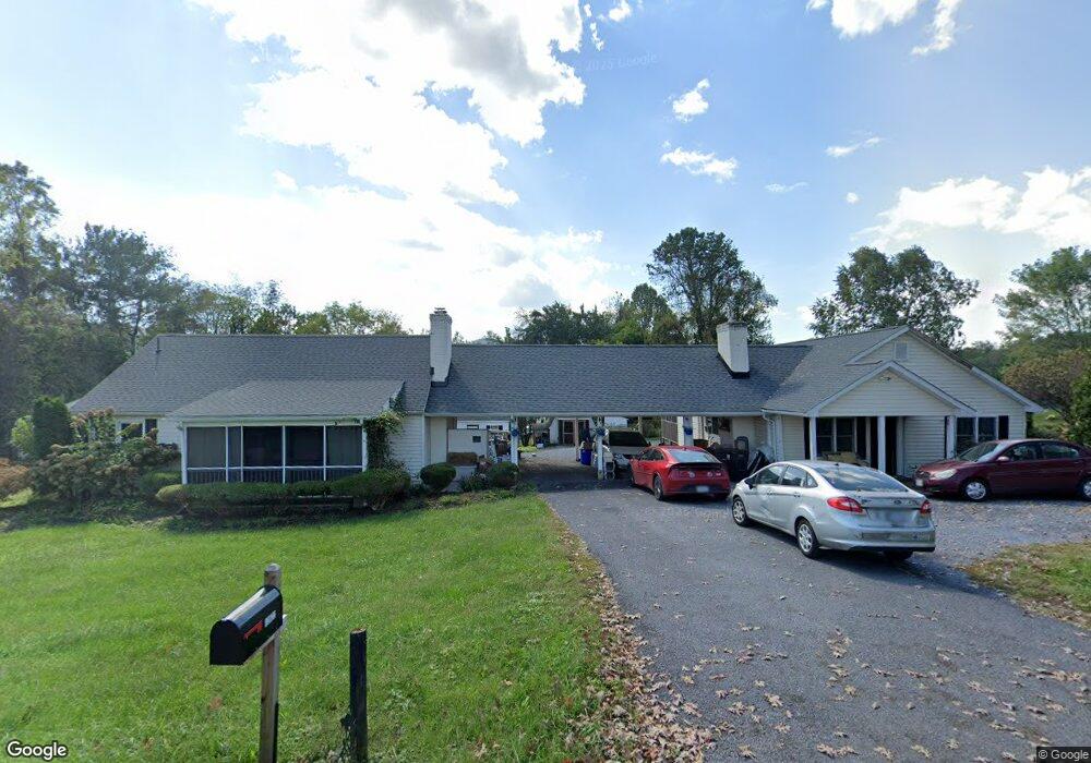
13822 Crest Hill Rd Flint Hill, VA 22627
Estimated Value: $592,000 - $709,000
3
Beds
4
Baths
2,298
Sq Ft
$276/Sq Ft
Est. Value
About This Home
This home is located at 13822 Crest Hill Rd, Flint Hill, VA 22627 and is currently estimated at $634,024, approximately $275 per square foot. 13822 Crest Hill Rd is a home located in Rappahannock County with nearby schools including Rappahannock County Elementary School, Rappahannock County High School, and Wakefield Country Day School.
Ownership History
Date
Name
Owned For
Owner Type
Purchase Details
Closed on
Dec 23, 2009
Sold by
Mccabe Mary A
Bought by
Ringland Timothy A and Sip Frances M
Current Estimated Value
Home Financials for this Owner
Home Financials are based on the most recent Mortgage that was taken out on this home.
Original Mortgage
$365,400
Outstanding Balance
$237,968
Interest Rate
4.87%
Mortgage Type
VA
Estimated Equity
$396,056
Purchase Details
Closed on
Mar 16, 2007
Sold by
Dattel Jerome M
Bought by
Mccabe Mary A and Mary A Mccabe Inter Vivos Trust
Home Financials for this Owner
Home Financials are based on the most recent Mortgage that was taken out on this home.
Original Mortgage
$280,000
Interest Rate
6.12%
Mortgage Type
New Conventional
Create a Home Valuation Report for This Property
The Home Valuation Report is an in-depth analysis detailing your home's value as well as a comparison with similar homes in the area
Home Values in the Area
Average Home Value in this Area
Purchase History
| Date | Buyer | Sale Price | Title Company |
|---|---|---|---|
| Ringland Timothy A | $380,000 | Hazelwood Title & Escrow | |
| Mccabe Mary A | $350,000 | None Available |
Source: Public Records
Mortgage History
| Date | Status | Borrower | Loan Amount |
|---|---|---|---|
| Open | Ringland Timothy A | $365,400 | |
| Previous Owner | Mccabe Mary A | $280,000 |
Source: Public Records
Tax History Compared to Growth
Tax History
| Year | Tax Paid | Tax Assessment Tax Assessment Total Assessment is a certain percentage of the fair market value that is determined by local assessors to be the total taxable value of land and additions on the property. | Land | Improvement |
|---|---|---|---|---|
| 2025 | $3,150 | $500,000 | $119,000 | $381,000 |
| 2024 | $3,050 | $500,000 | $119,000 | $381,000 |
| 2023 | $3,050 | $500,000 | $119,000 | $381,000 |
| 2022 | $3,000 | $500,000 | $119,000 | $381,000 |
| 2021 | $2,874 | $393,700 | $94,000 | $299,700 |
| 2020 | $2,874 | $393,700 | $94,000 | $299,700 |
| 2019 | $2,874 | $393,700 | $94,000 | $299,700 |
| 2018 | $2,874 | $393,700 | $94,000 | $299,700 |
| 2017 | $2,756 | $0 | $0 | $0 |
| 2016 | $2,756 | $393,700 | $0 | $0 |
| 2015 | -- | $379,200 | $105,400 | $273,800 |
| 2014 | -- | $379,200 | $105,400 | $273,800 |
Source: Public Records
Map
Nearby Homes
- 13886 Crest Hill Rd
- 675 Zachary Taylor Hwy
- 200 Fogg Mountain Ln
- 0 Aileen Rd
- 38 Bear Wallow Rd
- 521 Dearing Rd
- 63 Riley Hollow Rd
- 156 Bear Wallow Rd
- 18 Bolton Branch Ln
- 0 Woodlands Dr Unit VARP2001854
- 290 Riley Hollow Rd
- 0 Ben Venue Rd Unit VARP2002076
- 90 Liberty Springs Ln
- 0 Lee Hwy Unit VARP2002294
- 0 Lee Hwy Unit VACU2011884
- 821 Long Mountain Rd
- 18 Old Mill Rd
- 14105 Lee Hwy
- 609 Main St
- 7 Skyline Ln
- 13840 Crest Hill Rd
- 13843 Crest Hill Rd
- 13808 Crest Hill Rd
- 13862 Crest Hill Rd
- 13 Crest Hill Rd
- 13-140I Crest Hill Rd
- 13849 Crest Hill Rd
- 3 Rock Hill Ln
- 13782 Crest Hill Rd
- 23 Barneys View Ln
- 13863 Crest Hill Rd
- 14 Rock Hill Ln
- 14 Rock Hill Ln
- 14 Rock Hill Ln
- 38 Barneys View Ln
- 13772 Crest Hill Rd
- 0 Crest Hill Rd Unit RP10044342
- 13898 Crest Hill Rd
- 21 Post Office Ln
- 13767 Crest Hill Rd