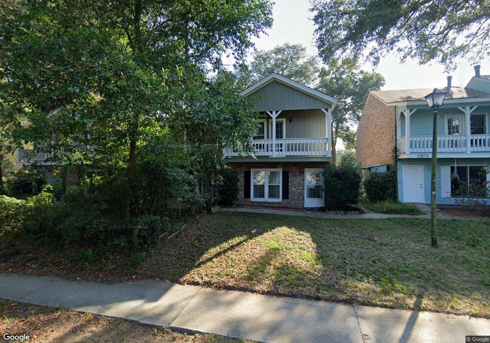
1383 Camp Rd Unit A Charleston, SC 29412
James Island NeighborhoodEstimated Value: $267,000 - $355,000
2
Beds
2
Baths
1,226
Sq Ft
$268/Sq Ft
Est. Value
About This Home
This home is located at 1383 Camp Rd Unit A, Charleston, SC 29412 and is currently estimated at $328,132, approximately $267 per square foot. 1383 Camp Rd Unit A is a home located in Charleston County with nearby schools including James Island Elementary School, Camp Road Middle, and James Island Charter High School.
Ownership History
Date
Name
Owned For
Owner Type
Purchase Details
Closed on
Mar 13, 2012
Sold by
Fannie Mae
Bought by
Oconnor Margaret
Current Estimated Value
Home Financials for this Owner
Home Financials are based on the most recent Mortgage that was taken out on this home.
Original Mortgage
$73,418
Outstanding Balance
$50,481
Interest Rate
3.89%
Mortgage Type
Construction
Estimated Equity
$277,651
Purchase Details
Closed on
Oct 18, 2011
Sold by
Hodges Scott Mcbride
Bought by
Federal National Mortgage Association
Purchase Details
Closed on
Mar 10, 2006
Sold by
Hodges Hugh O
Bought by
Hodges Scott Mcbride
Purchase Details
Closed on
Jul 13, 2001
Sold by
Carter And Sons Inc G S
Bought by
Hodges Hugh O
Create a Home Valuation Report for This Property
The Home Valuation Report is an in-depth analysis detailing your home's value as well as a comparison with similar homes in the area
Home Values in the Area
Average Home Value in this Area
Purchase History
| Date | Buyer | Sale Price | Title Company |
|---|---|---|---|
| Oconnor Margaret | $68,000 | -- | |
| Federal National Mortgage Association | -- | -- | |
| Hodges Scott Mcbride | -- | None Available | |
| Hodges Hugh O | $99,900 | -- |
Source: Public Records
Mortgage History
| Date | Status | Borrower | Loan Amount |
|---|---|---|---|
| Open | Oconnor Margaret | $73,418 |
Source: Public Records
Tax History Compared to Growth
Tax History
| Year | Tax Paid | Tax Assessment Tax Assessment Total Assessment is a certain percentage of the fair market value that is determined by local assessors to be the total taxable value of land and additions on the property. | Land | Improvement |
|---|---|---|---|---|
| 2024 | $1,837 | $5,950 | $0 | $0 |
| 2023 | $1,837 | $5,950 | $0 | $0 |
| 2022 | $1,670 | $5,950 | $0 | $0 |
| 2021 | $1,651 | $5,950 | $0 | $0 |
| 2020 | $1,639 | $5,950 | $0 | $0 |
| 2019 | $1,503 | $5,170 | $0 | $0 |
| 2017 | $1,439 | $5,170 | $0 | $0 |
| 2016 | $1,395 | $5,170 | $0 | $0 |
| 2015 | $1,335 | $5,170 | $0 | $0 |
| 2014 | $1,160 | $0 | $0 | $0 |
| 2011 | -- | $0 | $0 | $0 |
Source: Public Records
Map
Nearby Homes
- 1402 Camp Rd Unit 5E
- 1402 Camp Rd Unit 6E
- 1402 Camp Rd Unit 1H
- 1402 Camp Rd Unit 8B
- 1402 Camp Rd Unit 9C
- 1402 Camp Rd Unit 12F
- 1418 Kentwood Cir
- 1359 White House Blvd
- 1336 Briarfield Ave
- 1335 Camp Rd
- 1453 Camp Rd
- 1014 Arborwood Dr
- 1107 Secessionville Rd
- 27 Brockman Dr Unit 27B
- 27 Brockman Dr Unit 27C
- 1 S Anderson Ave
- 17 S Anderson Ave Unit A,B,C, D
- 1 Willingham Ct
- 1030 Pauline Ave
- 14 Maplecrest Dr
- 1383 Camp Rd
- 1383 Camp Rd
- 1383 Camp Rd
- 1383 Camp Rd Unit D
- 1383 Camp Rd Unit B
- 1387 Camp Rd
- 1387 Camp Rd
- 1387 Camp Rd
- 1387 Camp Rd
- 1387 Camp Rd Unit D
- 1387 Camp Rd Unit C
- 1387 Camp Rd Unit B
- 1035 Secessionville Rd
- 1394 Kentwood Cir
- 1034 Kentwood Cir
- 1391 Camp Rd
- 1391 Camp Rd
- 1391 Camp Rd Unit A
- 1391 Camp Rd
- 1391 Camp Rd Unit C