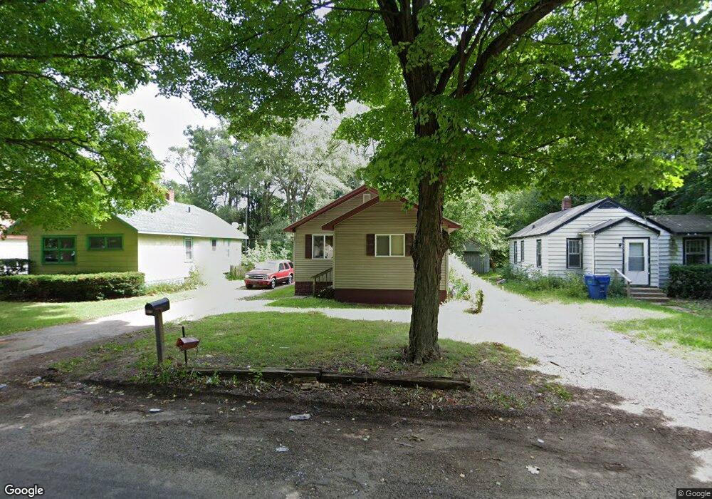
1383 Monroe St Benton Harbor, MI 49022
Fair Plain NeighborhoodEstimated Value: $105,000 - $133,000
2
Beds
1
Bath
984
Sq Ft
$121/Sq Ft
Est. Value
About This Home
This home is located at 1383 Monroe St, Benton Harbor, MI 49022 and is currently estimated at $118,875, approximately $120 per square foot. 1383 Monroe St is a home located in Berrien County with nearby schools including Fair Plain Middle School, Benton Harbor High School, and Benton Harbor Charter School Academy.
Ownership History
Date
Name
Owned For
Owner Type
Purchase Details
Closed on
Dec 23, 2011
Sold by
Bank Of America National Association
Bought by
Us Bank National Association
Current Estimated Value
Purchase Details
Closed on
Nov 21, 2011
Sold by
Us Bank National Association
Bought by
Dyman Vlad
Purchase Details
Closed on
Jun 17, 2010
Sold by
Spinks Madeline M
Bought by
Bank Of America National Association
Purchase Details
Closed on
Jul 12, 1993
Create a Home Valuation Report for This Property
The Home Valuation Report is an in-depth analysis detailing your home's value as well as a comparison with similar homes in the area
Home Values in the Area
Average Home Value in this Area
Purchase History
| Date | Buyer | Sale Price | Title Company |
|---|---|---|---|
| Us Bank National Association | -- | Fidelity National Title | |
| Dyman Vlad | $8,000 | Fidelity National Title | |
| Bank Of America National Association | $24,156 | None Available | |
| -- | $100 | -- |
Source: Public Records
Tax History
| Year | Tax Paid | Tax Assessment Tax Assessment Total Assessment is a certain percentage of the fair market value that is determined by local assessors to be the total taxable value of land and additions on the property. | Land | Improvement |
|---|---|---|---|---|
| 2025 | $851 | $50,200 | $0 | $0 |
| 2024 | $598 | $46,800 | $0 | $0 |
| 2023 | $569 | $45,500 | $0 | $0 |
| 2022 | $542 | $41,900 | $0 | $0 |
| 2021 | $741 | $38,900 | $1,000 | $37,900 |
| 2020 | $743 | $38,800 | $0 | $0 |
| 2019 | $721 | $30,600 | $700 | $29,900 |
| 2018 | $697 | $30,600 | $0 | $0 |
| 2017 | $687 | $30,100 | $0 | $0 |
| 2016 | $674 | $29,600 | $0 | $0 |
| 2015 | $672 | $30,300 | $0 | $0 |
| 2014 | $466 | $27,400 | $0 | $0 |
Source: Public Records
Map
Nearby Homes
- 1342 Monroe St
- 1250 Superior St
- 1190 Monroe St
- 1309 Agard Ave
- 1593 Columbus Ave
- 1238 Broadway
- 1216 Broadway
- 1064 Ogden Ave
- 1096 Pearl St
- 1132 Milton St
- V/L Mcalister
- 1712 W Ogden Cir
- 180 Emery Ave
- 1079 Hurd Ave
- 1504 Michigan 139
- 956 Union Ave
- 1298 Colfax Ave
- 854 Superior St
- 1613 Norton Ave
- 979 Lavette Ave
- 1391 Monroe St
- 1375 Monroe St
- 1399 Monroe St
- 1367 Monroe St
- 1382 Monroe St
- 1374 Monroe St
- 1398 Monroe St
- 1359 Monroe St
- 1366 Monroe St
- 1358 Monroe St
- 1351 Monroe St
- 1394 Jennings Ave
- 1350 Monroe St
- 1400 Monroe St
- 1405 Monroe St
- 1380 Jennings Ave
- 1388 Jennings Ave
- 1374 Jennings Ave
- 1366 Jennings Ave
- 1343 Monroe St
Your Personal Tour Guide
Ask me questions while you tour the home.