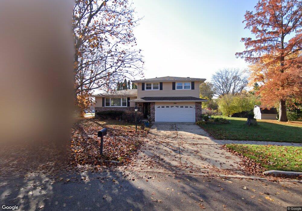
1385 Century Oaks Dr Elgin, IL 60123
Century Oaks NeighborhoodEstimated Value: $359,000 - $427,000
4
Beds
3
Baths
1,892
Sq Ft
$204/Sq Ft
Est. Value
About This Home
This home is located at 1385 Century Oaks Dr, Elgin, IL 60123 and is currently estimated at $385,125, approximately $203 per square foot. 1385 Century Oaks Dr is a home located in Kane County with nearby schools including Century Oaks Elementary School, Kimball Middle School, and Larkin High School.
Ownership History
Date
Name
Owned For
Owner Type
Purchase Details
Closed on
Jun 19, 2017
Sold by
Purncey Scott R and Purncey Carolyn
Bought by
Asefa Beneberu A and Wobeshet Zewdnesh
Current Estimated Value
Home Financials for this Owner
Home Financials are based on the most recent Mortgage that was taken out on this home.
Original Mortgage
$196,708
Outstanding Balance
$163,754
Interest Rate
4.05%
Mortgage Type
FHA
Estimated Equity
$221,371
Create a Home Valuation Report for This Property
The Home Valuation Report is an in-depth analysis detailing your home's value as well as a comparison with similar homes in the area
Home Values in the Area
Average Home Value in this Area
Purchase History
| Date | Buyer | Sale Price | Title Company |
|---|---|---|---|
| Asefa Beneberu A | $203,500 | Chicago Title Insurance Co |
Source: Public Records
Mortgage History
| Date | Status | Borrower | Loan Amount |
|---|---|---|---|
| Open | Asefa Beneberu A | $196,708 |
Source: Public Records
Tax History Compared to Growth
Tax History
| Year | Tax Paid | Tax Assessment Tax Assessment Total Assessment is a certain percentage of the fair market value that is determined by local assessors to be the total taxable value of land and additions on the property. | Land | Improvement |
|---|---|---|---|---|
| 2024 | $7,870 | $106,336 | $24,998 | $81,338 |
| 2023 | $7,507 | $96,067 | $22,584 | $73,483 |
| 2022 | $7,075 | $87,597 | $20,593 | $67,004 |
| 2021 | $6,771 | $81,897 | $19,253 | $62,644 |
| 2020 | $6,583 | $78,183 | $18,380 | $59,803 |
| 2019 | $6,395 | $74,474 | $17,508 | $56,966 |
| 2018 | $6,343 | $70,160 | $16,494 | $53,666 |
| 2017 | $6,205 | $66,327 | $15,593 | $50,734 |
| 2016 | $5,923 | $61,533 | $14,466 | $47,067 |
| 2015 | -- | $56,400 | $13,259 | $43,141 |
| 2014 | -- | $55,703 | $13,095 | $42,608 |
| 2013 | -- | $57,172 | $13,440 | $43,732 |
Source: Public Records
Map
Nearby Homes
- 1121 Forest Dr
- 1223 Ridgeway Dr
- 1235 Meadow Ln
- 89 Brookwood Ct
- 997 Meadow Ln
- 938 Hillcrest Rd
- 41 Lockman Cir Unit 5
- 5 Creekside Cir Unit B
- 1405 Creekside Ct Unit B
- 1142 Morningside Dr
- 801 N Mclean Blvd Unit 220
- 801 N Mclean Blvd Unit 226
- 801 N Mclean Blvd Unit 316
- 801 N Mclean Blvd Unit 362
- 1104 Florimond Dr
- 900 Ruth Dr
- 2032 Swan Ln
- 587 N Clifton Ave
- LOT 17 Teal Ave
- LOTS 14 & 15 Teal Ave
- 1270 Braeburn Dr
- 1409 Century Oaks Dr
- 1265 Lennoxshire Dr
- 1260 Braeburn Dr
- 1255 Lennoxshire Dr
- 1288 Braeburn Dr
- 1250 Braeburn Dr
- 1212 Century Oaks Dr
- 1245 Lennoxshire Dr
- 1277 Braeburn Dr
- 1240 Braeburn Dr
- 1427 Century Oaks Dr
- 1270 Lennoxshire Dr
- 1235 Lennoxshire Dr
- 1260 Lennoxshire Dr
- 1214 Century Oaks Dr
- 1134 Century Oaks Dr
- 1250 Lennoxshire Dr
- 1230 Braeburn Dr
- 1207 Forest Dr