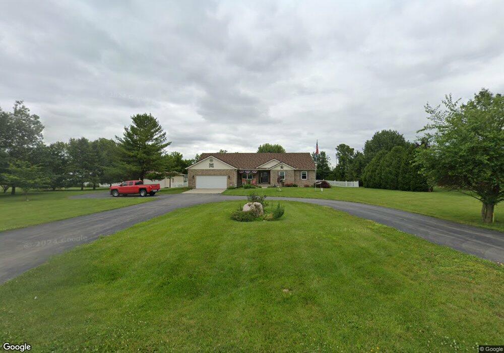
1385 Lightner Rd Tipp City, OH 45371
Estimated Value: $420,000 - $555,000
4
Beds
3
Baths
2,028
Sq Ft
$232/Sq Ft
Est. Value
About This Home
This home is located at 1385 Lightner Rd, Tipp City, OH 45371 and is currently estimated at $471,248, approximately $232 per square foot. 1385 Lightner Rd is a home located in Miami County with nearby schools including Broadway Elementary School, Nevin Coppock Elementary School, and L. T. Ball Intermediate School.
Ownership History
Date
Name
Owned For
Owner Type
Purchase Details
Closed on
Mar 6, 2019
Sold by
Dotson Ray and Dotson Carol D
Bought by
Meyer John R and Meyer Joan M B
Current Estimated Value
Home Financials for this Owner
Home Financials are based on the most recent Mortgage that was taken out on this home.
Original Mortgage
$336,992
Outstanding Balance
$292,633
Interest Rate
4.4%
Mortgage Type
VA
Estimated Equity
$178,615
Purchase Details
Closed on
Dec 10, 2007
Sold by
Hughes Randall W and Hughes Jeanne M
Bought by
Dotson Ray and Dotson Carol D
Home Financials for this Owner
Home Financials are based on the most recent Mortgage that was taken out on this home.
Original Mortgage
$164,000
Interest Rate
6.33%
Mortgage Type
New Conventional
Purchase Details
Closed on
Mar 7, 1994
Sold by
Hughes Jeanne M
Bought by
Kessler Charles T
Create a Home Valuation Report for This Property
The Home Valuation Report is an in-depth analysis detailing your home's value as well as a comparison with similar homes in the area
Home Values in the Area
Average Home Value in this Area
Purchase History
| Date | Buyer | Sale Price | Title Company |
|---|---|---|---|
| Meyer John R | $329,900 | None Available | |
| Dotson Ray | $205,000 | -- | |
| Kessler Charles T | $16,000 | -- |
Source: Public Records
Mortgage History
| Date | Status | Borrower | Loan Amount |
|---|---|---|---|
| Open | Meyer John R | $336,992 | |
| Previous Owner | Dotson Ray | $164,000 |
Source: Public Records
Tax History
| Year | Tax Paid | Tax Assessment Tax Assessment Total Assessment is a certain percentage of the fair market value that is determined by local assessors to be the total taxable value of land and additions on the property. | Land | Improvement |
|---|---|---|---|---|
| 2025 | $6,410 | $144,730 | $24,500 | $120,230 |
| 2024 | $6,410 | $123,140 | $23,630 | $99,510 |
| 2023 | $6,498 | $123,140 | $23,630 | $99,510 |
| 2022 | $5,957 | $123,140 | $23,630 | $99,510 |
| 2021 | $4,714 | $91,210 | $17,500 | $73,710 |
| 2020 | $4,771 | $91,210 | $17,500 | $73,710 |
| 2019 | $4,352 | $91,210 | $17,500 | $73,710 |
| 2018 | $3,805 | $75,920 | $12,290 | $63,630 |
| 2017 | $3,819 | $75,920 | $12,290 | $63,630 |
| 2016 | $3,663 | $75,920 | $12,290 | $63,630 |
| 2015 | $3,050 | $67,770 | $10,960 | $56,810 |
| 2014 | $3,050 | $67,770 | $10,960 | $56,810 |
| 2013 | $3,065 | $67,770 | $10,960 | $56,810 |
Source: Public Records
Map
Nearby Homes
- 290 Ginghamsburg Rd
- 802 Pebble Place
- 870 Michaels Rd
- S County Rd Unit 25A
- 36 Acres S County Rd Unit 25A
- 635 Kitrina Ave Unit B
- 445 Pilot Point Unit 1-203
- 435 Pilot Point Unit 1-303
- 425 Pilot Point Unit 1-305
- 405 Pilot Point Unit 1-204
- 455 Pilot Point Unit 1-202
- 415 Pilot Point Unit 1-304
- 5580 Peters Rd
- 0 Northwoods Blvd
- 626 W National Rd
- 475 Pilot Point Unit 1-300
- 465 Pilot Point Unit 1-302
- 270 Inverness Ave
- 4344 Wildflower Dr
- 3192 White Ash Dr
- 1375 Lightner Rd
- 7995 Peters Rd
- 11990 Peters Pike
- 1345 Lightner Rd
- 11990 Peters Pike
- 1325 Lightner Rd
- 1295 Lightner Rd
- 11970 Peters Pike
- 11970 Peters Pike
- 1275 Lightner Rd
- 1255 Lightner Rd
- 7890 Peters Rd
- 7855 Peters Rd
- 1225 Lightner Rd
- 1195 Lightner Rd
- 1177 Lightner Rd
- 7755 Peters Rd
- 7733 Peters Rd
- 7715 Peters Rd
- 0 Peters Pike Unit 756687
Your Personal Tour Guide
Ask me questions while you tour the home.