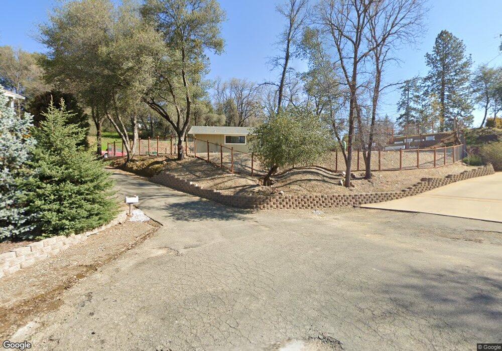
1386 Katie Ln Placerville, CA 95667
Estimated Value: $460,000 - $555,423
3
Beds
2
Baths
1,590
Sq Ft
$318/Sq Ft
Est. Value
About This Home
This home is located at 1386 Katie Ln, Placerville, CA 95667 and is currently estimated at $505,106, approximately $317 per square foot. 1386 Katie Ln is a home located in El Dorado County with nearby schools including El Dorado High School, Country Day Montessori, and El Dorado Adventist School.
Ownership History
Date
Name
Owned For
Owner Type
Purchase Details
Closed on
Mar 21, 2016
Sold by
Hawthorne Ben and Hawthorne Erin
Bought by
Hawthorne Benjamin G and Hawthorne Erin L
Current Estimated Value
Purchase Details
Closed on
Jul 2, 2007
Sold by
Evraiff David and Evraiff Gloria M
Bought by
Hawthorne Ben and Hawthorne Erin
Home Financials for this Owner
Home Financials are based on the most recent Mortgage that was taken out on this home.
Original Mortgage
$357,014
Outstanding Balance
$221,509
Interest Rate
6.36%
Mortgage Type
VA
Estimated Equity
$283,597
Purchase Details
Closed on
Dec 2, 2004
Sold by
Fernandes Dolores M
Bought by
Evraiff David and Evraiff Gloria M
Home Financials for this Owner
Home Financials are based on the most recent Mortgage that was taken out on this home.
Original Mortgage
$248,000
Interest Rate
5.75%
Mortgage Type
Purchase Money Mortgage
Create a Home Valuation Report for This Property
The Home Valuation Report is an in-depth analysis detailing your home's value as well as a comparison with similar homes in the area
Home Values in the Area
Average Home Value in this Area
Purchase History
| Date | Buyer | Sale Price | Title Company |
|---|---|---|---|
| Hawthorne Benjamin G | -- | None Available | |
| Hawthorne Ben | $349,500 | Fidelity Natl Title Co Of Ca | |
| Evraiff David | $310,000 | Inter County Title Co |
Source: Public Records
Mortgage History
| Date | Status | Borrower | Loan Amount |
|---|---|---|---|
| Open | Hawthorne Ben | $357,014 | |
| Previous Owner | Evraiff David | $248,000 |
Source: Public Records
Tax History Compared to Growth
Tax History
| Year | Tax Paid | Tax Assessment Tax Assessment Total Assessment is a certain percentage of the fair market value that is determined by local assessors to be the total taxable value of land and additions on the property. | Land | Improvement |
|---|---|---|---|---|
| 2025 | $5,284 | $518,209 | $170,749 | $347,460 |
| 2024 | $5,284 | $508,049 | $167,401 | $340,648 |
| 2023 | $5,221 | $498,088 | $164,119 | $333,969 |
| 2022 | $4,850 | $460,433 | $160,899 | $299,534 |
| 2021 | $4,794 | $451,406 | $157,745 | $293,661 |
| 2020 | $4,721 | $446,778 | $156,128 | $290,650 |
| 2019 | $3,377 | $318,000 | $118,500 | $199,500 |
| 2018 | $3,341 | $318,000 | $118,500 | $199,500 |
| 2017 | $3,356 | $318,000 | $118,500 | $199,500 |
| 2016 | $2,938 | $270,500 | $100,500 | $170,000 |
| 2015 | $2,892 | $270,000 | $100,500 | $169,500 |
| 2014 | $2,898 | $270,000 | $100,500 | $169,500 |
Source: Public Records
Map
Nearby Homes
- 2655 Mona Dr
- 2697 Morrene Dr
- 10 Mosquito Rd
- 2940 Anderson Way
- 1015 Utah Dr
- 1011 Utah Dr
- 2811 Pennsylvania Ct
- 2660 Clay St
- 1012 Utah Dr
- 1006 Utah Dr
- 1008 Utah Dr
- 2977 Mosquito Rd
- 2921 Miller Way
- 2350 Big Canyon Creek Rd
- 2399 Kingsgate Rd
- 1049 Kimi Way
- 1110 Madrone Ln
- 2532 Golden Eagle Dr
- 2896 Clay St
- 2624 Liberty Mine Ct
- 1385 Katie Ln
- 1380 Katie Ln
- 1123 Murray St
- 1379 Katie Ln
- 2663 Prescott Ave
- 1143 Murray St
- 2661 Mona Dr
- 1370 Katie Ln
- 1369 Katie Ln
- 2661 Mona Ave
- 1210 Sandra Cir
- 2660 Prescott Ave
- 2676 Prescott Ave
- 2647 Mona Dr
- 1360 Katie Ln
- 1281 Sandra Cir
- 2650 Prescott Ave
- 2808 Jaymar St
- 2808 Jaymar St
- 1275 Sandra Cir
