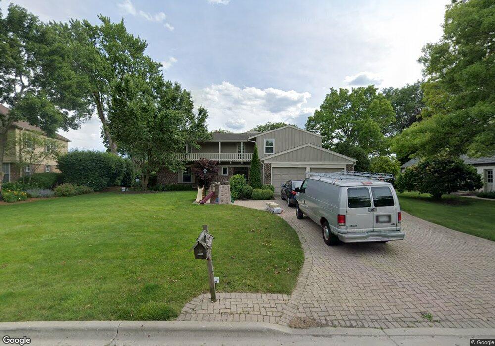
1387 The Point St Barrington, IL 60010
Estimated Value: $1,046,000 - $1,169,000
--
Bed
4
Baths
4,209
Sq Ft
$261/Sq Ft
Est. Value
About This Home
This home is located at 1387 The Point St, Barrington, IL 60010 and is currently estimated at $1,098,354, approximately $260 per square foot. 1387 The Point St is a home located in Lake County with nearby schools including Arnett C. Lines Elementary School, Barrington Middle School Station Campus, and Barrington High School.
Ownership History
Date
Name
Owned For
Owner Type
Purchase Details
Closed on
Feb 9, 2009
Sold by
Mccaulley Richard T
Bought by
Mccaulley Melissa M
Current Estimated Value
Purchase Details
Closed on
Aug 12, 2002
Sold by
Hyland T Peter and Hyland Joan C
Bought by
Mccaulley Richard T and Mccaulley Melissa M
Home Financials for this Owner
Home Financials are based on the most recent Mortgage that was taken out on this home.
Original Mortgage
$410,000
Interest Rate
6.41%
Create a Home Valuation Report for This Property
The Home Valuation Report is an in-depth analysis detailing your home's value as well as a comparison with similar homes in the area
Home Values in the Area
Average Home Value in this Area
Purchase History
| Date | Buyer | Sale Price | Title Company |
|---|---|---|---|
| Mccaulley Melissa M | -- | None Available | |
| Mccaulley Richard T | $662,000 | Ticor Title Insurance Co |
Source: Public Records
Mortgage History
| Date | Status | Borrower | Loan Amount |
|---|---|---|---|
| Previous Owner | Mccaulley Richard T | $410,000 | |
| Closed | Mccaulley Richard T | $119,000 |
Source: Public Records
Tax History Compared to Growth
Tax History
| Year | Tax Paid | Tax Assessment Tax Assessment Total Assessment is a certain percentage of the fair market value that is determined by local assessors to be the total taxable value of land and additions on the property. | Land | Improvement |
|---|---|---|---|---|
| 2024 | $21,072 | $314,814 | $70,427 | $244,387 |
| 2023 | $19,311 | $289,017 | $64,656 | $224,361 |
| 2022 | $19,311 | $263,467 | $63,405 | $200,062 |
| 2021 | $18,912 | $256,715 | $61,780 | $194,935 |
| 2020 | $18,496 | $256,715 | $61,780 | $194,935 |
| 2019 | $18,105 | $254,476 | $61,241 | $193,235 |
| 2018 | $18,752 | $273,407 | $65,880 | $207,527 |
| 2017 | $19,152 | $270,112 | $65,086 | $205,026 |
| 2016 | $19,012 | $261,559 | $63,025 | $198,534 |
| 2015 | $18,163 | $247,704 | $60,030 | $187,674 |
| 2014 | $17,417 | $229,730 | $55,121 | $174,609 |
| 2012 | $16,782 | $230,213 | $55,237 | $174,976 |
Source: Public Records
Map
Nearby Homes
- 1288 The Point St
- 1312 Lake Shore Dr N Unit 7
- 290 Cold Spring Rd
- 101 Surrey Ln
- 185 Cold Spring Rd
- 175 Hilltop Ave
- 104 Howe Terrace
- 523 N Ela Rd
- 248 Beverly Rd
- 216 Beverly Rd
- 117 Beverly Rd
- 432 Whitney Dr
- 110 Tudor Dr
- 104 Lois Ln
- 534 E Main St
- 336 Eastern Ave Unit C4
- 145 Walton St
- 319 S Glendale Ave Unit 204
- 1010 Oakland Dr
- 44 Oak Ridge Ln
- 1389 The Point St
- 1291 The Point St
- 1391 The Point St
- 1289 The Point St
- 1386 The Point St
- 1388 The Point St
- 1393 The Point St Unit 7
- 1290 The Point St Unit 7
- 1390 The Point St
- 1313 Lake Shore Dr N
- 1311 Lake Shore Dr N
- 1315 Lake Shore Dr N
- 26047 Lake Shore Dr N
- 1309 Lake Shore Dr N Unit 7
- 1317 Lake Shore Dr N
- 1314 Lake Shore Dr N
- 1307 Lake Shore Dr N
- 1203 Lake Shore Dr N
- 1205 Lake Shore Dr N
- 1316 Lake Shore Dr N Unit 7