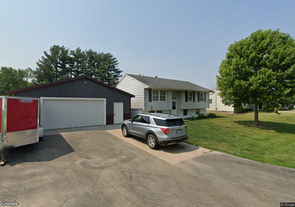
13887 Janson Rd Morrison, IL 61270
Estimated Value: $119,000 - $220,000
3
Beds
1
Bath
1,080
Sq Ft
$145/Sq Ft
Est. Value
About This Home
This home is located at 13887 Janson Rd, Morrison, IL 61270 and is currently estimated at $156,727, approximately $145 per square foot. 13887 Janson Rd is a home located in Whiteside County with nearby schools including Northside School, Southside School, and Morrison Junior High School.
Ownership History
Date
Name
Owned For
Owner Type
Purchase Details
Closed on
Sep 17, 2021
Sold by
Belt Brandon L
Bought by
Lyerla Zachary W
Current Estimated Value
Home Financials for this Owner
Home Financials are based on the most recent Mortgage that was taken out on this home.
Original Mortgage
$173,910
Outstanding Balance
$158,009
Interest Rate
2.7%
Mortgage Type
Purchase Money Mortgage
Estimated Equity
-$1,282
Purchase Details
Closed on
Aug 3, 2018
Sold by
Belt Dale L
Bought by
Belt Brandon L
Home Financials for this Owner
Home Financials are based on the most recent Mortgage that was taken out on this home.
Original Mortgage
$112,929
Interest Rate
4.5%
Mortgage Type
Purchase Money Mortgage
Purchase Details
Closed on
Aug 14, 2009
Sold by
Illinois Housing Development Authority
Bought by
Belt Dale L
Purchase Details
Closed on
Jun 4, 2009
Sold by
Crossman Jan and Crossman Jan Marie
Bought by
Illinois Housing Development Aughority
Create a Home Valuation Report for This Property
The Home Valuation Report is an in-depth analysis detailing your home's value as well as a comparison with similar homes in the area
Home Values in the Area
Average Home Value in this Area
Purchase History
| Date | Buyer | Sale Price | Title Company |
|---|---|---|---|
| Lyerla Zachary W | $170,000 | None Available | |
| Belt Brandon L | -- | -- | |
| Belt Dale L | -- | None Available | |
| Illinois Housing Development Aughority | -- | None Available |
Source: Public Records
Mortgage History
| Date | Status | Borrower | Loan Amount |
|---|---|---|---|
| Open | Lyerla Zachary W | $173,910 | |
| Previous Owner | Belt Brandon L | $112,929 |
Source: Public Records
Tax History
| Year | Tax Paid | Tax Assessment Tax Assessment Total Assessment is a certain percentage of the fair market value that is determined by local assessors to be the total taxable value of land and additions on the property. | Land | Improvement |
|---|---|---|---|---|
| 2024 | $2,781 | $44,241 | $3,721 | $40,520 |
| 2023 | $2,078 | $40,278 | $3,388 | $36,890 |
| 2022 | $1,927 | $37,405 | $3,146 | $34,259 |
| 2021 | $1,878 | $36,629 | $3,081 | $33,548 |
| 2020 | $1,944 | $37,323 | $3,139 | $34,184 |
| 2019 | $2,402 | $36,987 | $4,133 | $32,854 |
| 2018 | $1,483 | $33,235 | $4,114 | $29,121 |
| 2017 | $1,382 | $23,432 | $3,952 | $19,480 |
| 2016 | $1,313 | $22,601 | $3,812 | $18,789 |
| 2015 | $1,397 | $23,153 | $3,905 | $19,248 |
| 2014 | $1,376 | $22,891 | $3,861 | $19,030 |
| 2013 | $1,397 | $23,153 | $3,905 | $19,248 |
Source: Public Records
Map
Nearby Homes
- 13629 Garden Plain Rd
- 604 Hillandale Ct
- 620 Hillandale Dr
- 624 W Lincolnway
- 617 W Lincolnway
- 701 W Wall St
- 814 W Park St
- 402 W Lincolnway
- 306 S Heaton St
- 0 Garden Plain Rd Unit NOC6335284
- 411 W Park St
- 105 E Knox St
- 208 Johnson St
- Lot 17 Masters Dr
- Lot 19 Masters Dr
- Lot 18 Masters Dr
- Lot 20 Masters Dr
- Lot 21 Masters Dr
- 12719 Garden Plain Rd
- 805 Keith Dr
- 13871 Janson Rd
- 13849 Janson Rd
- 16440 Norton Rd
- 13880 Janson Rd
- 16392 Norton Rd
- 16380 Norton Rd
- 16462 Norton Rd
- 0 Norton Rd
- 16352 Norton Rd
- 16425 Norton Rd
- 16330 Union St
- 16330 Union St
- 16490 Norton Rd
- 13824 Harmony St
- 16310 Union St
- 16353 Norton Rd
- 16311 Norton Rd
- 16290 Union St
- 13770 Lincoln Rd
- 13740 Lincoln Rd
Your Personal Tour Guide
Ask me questions while you tour the home.