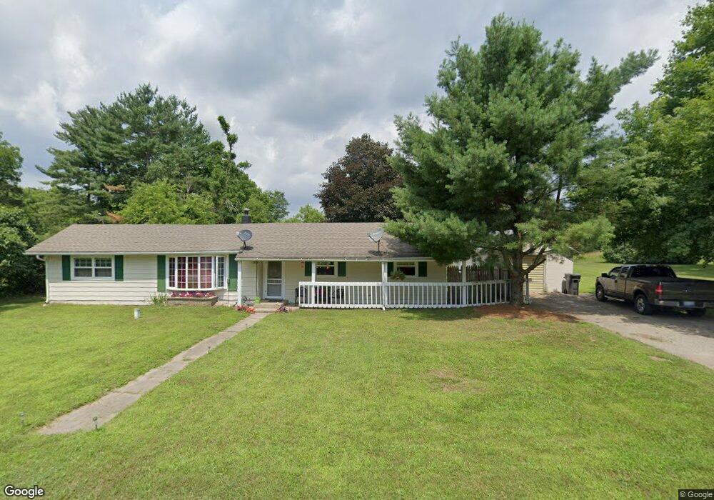
13889 Covered Bridge Rd Lowell, MI 49331
Estimated Value: $276,828 - $393,000
3
Beds
1
Bath
1
Sq Ft
$316,707/Sq Ft
Est. Value
About This Home
This home is located at 13889 Covered Bridge Rd, Lowell, MI 49331 and is currently estimated at $316,707, approximately $316,707 per square foot. 13889 Covered Bridge Rd is a home located in Kent County with nearby schools including Murray Lake Elementary School, Lowell Middle School, and Lowell Senior High School.
Ownership History
Date
Name
Owned For
Owner Type
Purchase Details
Closed on
Dec 1, 2014
Sold by
Rumbaugh Earl Alan
Bought by
Rumbaugh E Alan
Current Estimated Value
Purchase Details
Closed on
Oct 13, 2009
Sold by
Fallasburg Historical Society
Bought by
Rumbaugh E Alan
Purchase Details
Closed on
Mar 26, 1997
Sold by
Fallasburg Historical S
Bought by
Rumbaugh E Alan
Purchase Details
Closed on
Mar 17, 1997
Bought by
Fallsburg Historical and Alan Rumbaugh E
Purchase Details
Closed on
Sep 4, 1996
Bought by
Fallsburg Historical and Alan Rumbaugh E
Purchase Details
Closed on
Jan 21, 1993
Create a Home Valuation Report for This Property
The Home Valuation Report is an in-depth analysis detailing your home's value as well as a comparison with similar homes in the area
Home Values in the Area
Average Home Value in this Area
Purchase History
| Date | Buyer | Sale Price | Title Company |
|---|---|---|---|
| Rumbaugh E Alan | -- | None Available | |
| Rumbaugh E Alan | $29,300 | Dba Group Title Agency Svcs | |
| Rumbaugh E Alan | $1,000 | -- | |
| Fallsburg Historical | $1,000 | -- | |
| Fallsburg Historical | -- | -- | |
| -- | $59,000 | -- |
Source: Public Records
Tax History
| Year | Tax Paid | Tax Assessment Tax Assessment Total Assessment is a certain percentage of the fair market value that is determined by local assessors to be the total taxable value of land and additions on the property. | Land | Improvement |
|---|---|---|---|---|
| 2025 | $1,785 | $119,400 | $0 | $0 |
| 2024 | $18 | $108,500 | $0 | $0 |
| 2023 | $1,708 | $93,600 | $0 | $0 |
| 2022 | $2,524 | $81,900 | $0 | $0 |
| 2021 | $2,470 | $75,200 | $0 | $0 |
| 2020 | $1,554 | $71,700 | $0 | $0 |
| 2019 | $2,395 | $69,800 | $0 | $0 |
| 2018 | $2,345 | $60,000 | $0 | $0 |
| 2017 | $2,290 | $63,200 | $0 | $0 |
| 2016 | $2,232 | $58,300 | $0 | $0 |
| 2015 | -- | $58,300 | $0 | $0 |
| 2013 | -- | $53,300 | $0 | $0 |
Source: Public Records
Map
Nearby Homes
- 14111 Thompson Dr NE
- 13164 Beckwith Dr NE
- 13461 Burroughs St NE
- 2020 Fallasburg Park Dr NE Unit 1
- 1954 Fallasburg Park Dr NE Unit 4
- VL Burroughs St NE
- 12740 Triple Oak Dr NE
- 13875 Rolling Creek Dr
- 13940 Rolling Creek Dr
- 1040 N Washington Rd
- 1040 N Washington St
- 12036 Alden Ct NE
- 12020 Alden Ct NE
- 1080 N Washington St SE
- 913 N Monroe St
- 723 N Washington St
- 3101 Lincoln Lake Ave NE
- 12033 Harvest Acre Dr
- 12068 Harvest Acre Dr SE
- 220 King St Unit 10
- 13879 Covered Bridge Rd
- 13837 Covered Bridge Rd
- 13894 Covered Bridge Rd
- 13894 Covered Bridge Rd
- 13850 Covered Bridge Rd
- 13850 Covered Bridge Rd
- 13885 Covered Bridge Rd
- 13885 Covered Bridge Rd
- 13835 Covered Bridge Rd
- 13907 Covered Bridge Rd
- 13925 Bieri Rd
- 13959 Covered Bridge Rd
- 13959 Covered Bridge Rd NE
- 13810 Covered Bridge Rd
- 13970 Covered Bridge Rd NE
- 13900 Bieri Rd
- 853 Montcalm Ave NE
- 13788 Beckwith Dr NE
- 13836 Covered Bridge Rd
- 13989 Covered Bridge Rd
Your Personal Tour Guide
Ask me questions while you tour the home.