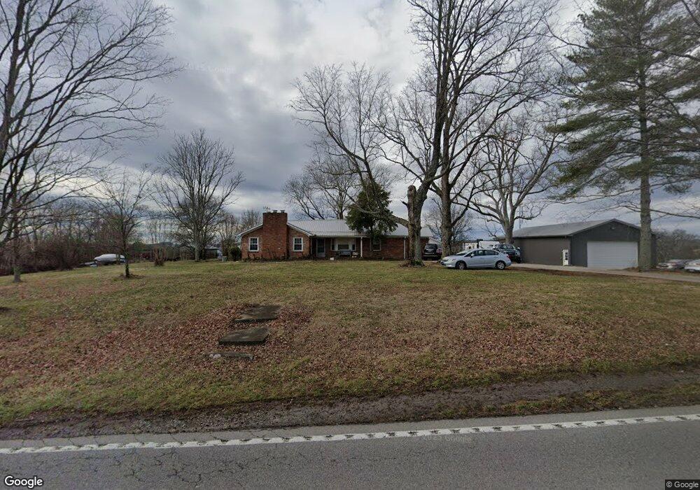
1389 Highway 25 Gallatin, TN 37066
Estimated Value: $472,000 - $777,000
3
Beds
3
Baths
2,285
Sq Ft
$266/Sq Ft
Est. Value
About This Home
This home is located at 1389 Highway 25, Gallatin, TN 37066 and is currently estimated at $607,490, approximately $265 per square foot. 1389 Highway 25 is a home located in Sumner County with nearby schools including Station Camp High School and St. John Vianney Catholic School.
Ownership History
Date
Name
Owned For
Owner Type
Purchase Details
Closed on
Jun 17, 2022
Sold by
Clayton Properties Group Inc
Bought by
Vilar Aderito and Vilar Rebecca
Current Estimated Value
Home Financials for this Owner
Home Financials are based on the most recent Mortgage that was taken out on this home.
Original Mortgage
$443,802
Outstanding Balance
$422,206
Interest Rate
5.25%
Mortgage Type
FHA
Estimated Equity
$185,284
Purchase Details
Closed on
May 1, 2015
Sold by
Welty Sandr5a W and Mecorkle Layna W
Bought by
Anderson Stephen and Anderson Jennifer
Home Financials for this Owner
Home Financials are based on the most recent Mortgage that was taken out on this home.
Original Mortgage
$178,415
Interest Rate
3.8%
Mortgage Type
Purchase Money Mortgage
Create a Home Valuation Report for This Property
The Home Valuation Report is an in-depth analysis detailing your home's value as well as a comparison with similar homes in the area
Home Values in the Area
Average Home Value in this Area
Purchase History
| Date | Buyer | Sale Price | Title Company |
|---|---|---|---|
| Vilar Aderito | -- | None Listed On Document | |
| Anderson Stephen | $209,900 | Tennessee Title Services Llc |
Source: Public Records
Mortgage History
| Date | Status | Borrower | Loan Amount |
|---|---|---|---|
| Open | Vilar Aderito | $443,802 | |
| Previous Owner | Anderson Stephen | $178,415 |
Source: Public Records
Tax History Compared to Growth
Tax History
| Year | Tax Paid | Tax Assessment Tax Assessment Total Assessment is a certain percentage of the fair market value that is determined by local assessors to be the total taxable value of land and additions on the property. | Land | Improvement |
|---|---|---|---|---|
| 2024 | $2,081 | $146,425 | $70,225 | $76,200 |
| 2023 | $2,029 | $90,100 | $45,525 | $44,575 |
| 2022 | $2,038 | $90,100 | $45,525 | $44,575 |
| 2021 | $2,038 | $90,100 | $45,525 | $44,575 |
| 2020 | $2,038 | $90,100 | $45,525 | $44,575 |
| 2019 | $2,038 | $0 | $0 | $0 |
| 2018 | $1,593 | $0 | $0 | $0 |
| 2017 | $1,593 | $0 | $0 | $0 |
| 2016 | $1,593 | $0 | $0 | $0 |
| 2015 | -- | $0 | $0 | $0 |
| 2014 | -- | $0 | $0 | $0 |
Source: Public Records
Map
Nearby Homes
- 1036 Middleton Ln
- 1017 Wickshire Dr
- 608 Bradford Dr
- 540 Bradford Dr
- 1176 Liberty Ln
- 1328 Wentworth Dr
- 420 Dorchester Place
- 1273 Wentworth Dr
- 415 Buckingham Blvd
- 688 Douglas Ln
- 650 Neals Ln
- 1239 Wentworth Dr
- 376 Huntington Dr
- 300 Remington Ave
- 305 Remington Ave
- 1245 Amherst Ct
- 294 Buckingham Blvd
- 662 Neals Ln
- 156 Hackney Ln
- 548 Dottie Dr
- 1388 Highway 25
- 1392 Highway 25
- 1392 Highway 25
- 25 Highway
- 1379 Highway 25
- 1384 Highway 25
- 1007 Liberty Ln
- 25W Highway Hwy
- 121 Lawrencetown Rd
- 100 Village Green Rd
- 1025 Liberty Ln
- 1393 Highway 25
- 120 Lawrencetown Rd
- 0 Liberty Ln Unit 1945847
- 0 Liberty Ln Unit 1904394
- 0 Liberty Ln Unit 1904391
- 0 Liberty Ln Unit 1886938
- 0 Liberty Ln Unit RTC1331254
- 0 Liberty Ln Unit RTC2497767
- 0 Liberty Ln Unit 2159642