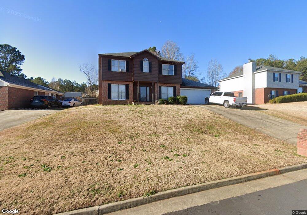
1389 Kings Mountain Rd Columbus, GA 31907
Eastern Columbus NeighborhoodEstimated Value: $218,000 - $229,000
4
Beds
3
Baths
2,013
Sq Ft
$111/Sq Ft
Est. Value
About This Home
This home is located at 1389 Kings Mountain Rd, Columbus, GA 31907 and is currently estimated at $222,964, approximately $110 per square foot. 1389 Kings Mountain Rd is a home located in Muscogee County with nearby schools including Dawson Elementary School, East Columbus Magnet Academy, and Spencer High School.
Ownership History
Date
Name
Owned For
Owner Type
Purchase Details
Closed on
Jul 22, 2010
Sold by
Secretary Of Veterans Affairs
Bought by
Poindexter Mary
Current Estimated Value
Purchase Details
Closed on
Feb 2, 2010
Sold by
Wells Fargo Bank Na
Bought by
Secretary Of Veterans Affairs
Create a Home Valuation Report for This Property
The Home Valuation Report is an in-depth analysis detailing your home's value as well as a comparison with similar homes in the area
Home Values in the Area
Average Home Value in this Area
Purchase History
| Date | Buyer | Sale Price | Title Company |
|---|---|---|---|
| Poindexter Mary | -- | None Available | |
| Secretary Of Veterans Affairs | -- | None Available | |
| Wells Fargo Bank Na | $105,756 | None Available |
Source: Public Records
Tax History Compared to Growth
Tax History
| Year | Tax Paid | Tax Assessment Tax Assessment Total Assessment is a certain percentage of the fair market value that is determined by local assessors to be the total taxable value of land and additions on the property. | Land | Improvement |
|---|---|---|---|---|
| 2025 | $2,936 | $74,996 | $12,660 | $62,336 |
| 2024 | $2,936 | $74,996 | $12,660 | $62,336 |
| 2023 | $2,954 | $74,996 | $12,660 | $62,336 |
| 2022 | $2,361 | $57,828 | $12,660 | $45,168 |
| 2021 | $2,106 | $51,584 | $12,660 | $38,924 |
| 2020 | $2,107 | $51,584 | $12,660 | $38,924 |
| 2019 | $2,113 | $51,584 | $12,660 | $38,924 |
| 2018 | $2,113 | $51,584 | $12,660 | $38,924 |
| 2017 | $2,120 | $51,584 | $12,660 | $38,924 |
| 2016 | $2,486 | $60,268 | $7,200 | $53,068 |
| 2015 | $2,489 | $60,268 | $7,200 | $53,068 |
| 2014 | $1,495 | $60,268 | $7,200 | $53,068 |
| 2013 | -- | $60,268 | $7,200 | $53,068 |
Source: Public Records
Map
Nearby Homes
- 1340 Bunker Ridge Ln
- 5613 Quebec Dr
- 5310 Stoney Point Rd
- 5644 Quebec Dr
- 1238 Brandywine Dr
- 5728 Lexington Dr
- 5664 St Marys Rd
- 1210 Bunker Hill Rd
- 5090 Lexington Ln
- 5109 Lexington Ln
- 1513 Alamo Dr
- 5336 Gettysburg Way
- 5219 Argonne Dr
- 4462 Walking Stick Way
- 4408 Walking Stick Way
- 849 Bunker Hill Rd
- 4939 Aaron Dr
- 780 Honey Do Ct
- 1225 Rowell St
- 1025 Belmar St
- 1393 Kings Mountain Rd
- 1385 Kings Mountain Rd
- 1658 Bunker Hill Rd
- 1650 Bunker Hill Rd
- 1381 Kings Mountain Rd
- 1384 Kings Mountain Rd
- 1644 Bunker Hill Rd
- 1388 Kings Mountain Rd
- 1380 Kings Mountain Rd
- 1377 Kings Mountain Rd
- 1392 Kings Mountain Rd
- 1376 Kings Mountain Rd
- 1638 Bunker Hill Rd
- 1396 Kings Mountain Rd
- 1403 Kings Mountain Rd
- 1661 Bunker Hill Rd
- 1655 Bunker Hill Rd
- 1373 Kings Mountain Rd
- 1372 Kings Mountain Rd
- 1649 Bunker Hill Rd