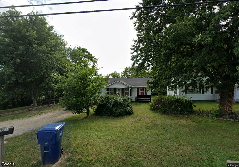
1389 Springfield Rd Lebanon, MO 65536
Estimated Value: $110,000 - $147,000
2
Beds
--
Bath
934
Sq Ft
$131/Sq Ft
Est. Value
About This Home
This home is located at 1389 Springfield Rd, Lebanon, MO 65536 and is currently estimated at $122,423, approximately $131 per square foot. 1389 Springfield Rd is a home located in Laclede County with nearby schools including Joe D. Esther Elementary School, Maplecrest Elementary School, and Boswell Elementary School.
Ownership History
Date
Name
Owned For
Owner Type
Purchase Details
Closed on
Dec 3, 2024
Sold by
Weaver Crystal
Bought by
Weaver Bobby
Current Estimated Value
Purchase Details
Closed on
Nov 2, 2007
Sold by
Starnes Michael D
Bought by
Weaver Bobby and Weaver Crystal
Home Financials for this Owner
Home Financials are based on the most recent Mortgage that was taken out on this home.
Original Mortgage
$62,000
Interest Rate
6.37%
Mortgage Type
New Conventional
Purchase Details
Closed on
Jul 3, 2006
Sold by
Bartholomew Joe K
Bought by
Starnes Michael D and Starnes Sallie
Home Financials for this Owner
Home Financials are based on the most recent Mortgage that was taken out on this home.
Original Mortgage
$45,500
Interest Rate
6.63%
Mortgage Type
Future Advance Clause Open End Mortgage
Create a Home Valuation Report for This Property
The Home Valuation Report is an in-depth analysis detailing your home's value as well as a comparison with similar homes in the area
Home Values in the Area
Average Home Value in this Area
Purchase History
| Date | Buyer | Sale Price | Title Company |
|---|---|---|---|
| Weaver Bobby | -- | None Listed On Document | |
| Weaver Bobby | -- | None Available | |
| Starnes Michael D | -- | Jeffries Abstract & Title In |
Source: Public Records
Mortgage History
| Date | Status | Borrower | Loan Amount |
|---|---|---|---|
| Previous Owner | Weaver Bobby | $62,000 | |
| Previous Owner | Starnes Michael D | $45,500 |
Source: Public Records
Tax History Compared to Growth
Tax History
| Year | Tax Paid | Tax Assessment Tax Assessment Total Assessment is a certain percentage of the fair market value that is determined by local assessors to be the total taxable value of land and additions on the property. | Land | Improvement |
|---|---|---|---|---|
| 2025 | $351 | $6,950 | $0 | $0 |
| 2024 | $351 | $6,160 | $0 | $0 |
| 2023 | $362 | $6,160 | $0 | $0 |
| 2022 | $334 | $6,100 | $0 | $0 |
| 2021 | $368 | $6,099 | $1,387 | $4,712 |
| 2020 | $370 | $6,099 | $1,387 | $4,712 |
| 2019 | $354 | $6,100 | $1,390 | $4,710 |
| 2018 | $333 | $6,120 | $1,390 | $4,730 |
| 2017 | $316 | $6,120 | $0 | $0 |
| 2016 | $316 | $6,120 | $0 | $0 |
| 2015 | $316 | $6,120 | $0 | $0 |
| 2014 | $316 | $6,120 | $0 | $0 |
| 2013 | -- | $6,120 | $0 | $0 |
Source: Public Records
Map
Nearby Homes
- 11 Sunrise Dr
- 1171 W Elm St
- 1 Ice Cream Way
- 3 Ice Cream Way
- 4 Ice Cream Way
- 545 W Pierce St
- 406 Perry St
- 31 Greenwood Dr
- 100 State Highway 32
- 14300 State Highway 32
- 22 Stanwood Dr
- 517 Holly St
- 22781 U S Route 66
- 000 #25 U S Route 66
- 000-#72 U S Route 66
- 000#72 U S Route 66
- 000#25 U S Route 66
- 704 W 2nd St
- 1211 W Elm St
- 286 Polk Ave
- 1 Sunrise Dr
- 1388 Springfield Rd
- 1387 Springfield Rd
- 1355 Springfield Rd
- 914 Bethel Rd
- 3 Sunrise Dr
- 4 Sunrise Dr
- 691 W Elm St
- 5 Sunrise Dr
- 1110 Springfield Rd
- 6 Sunrise Dr
- 7 Sunrise Dr
- 8 Sunrise Dr
- 9 Sunrise Dr
- 2 Sunrise Dr
- 10 Sunrise Dr
- 12 Sunrise Dr
- 13 Sunrise Dr
- 0 Kansas Unit 18051207
- 0 Kansas Unit 16074350