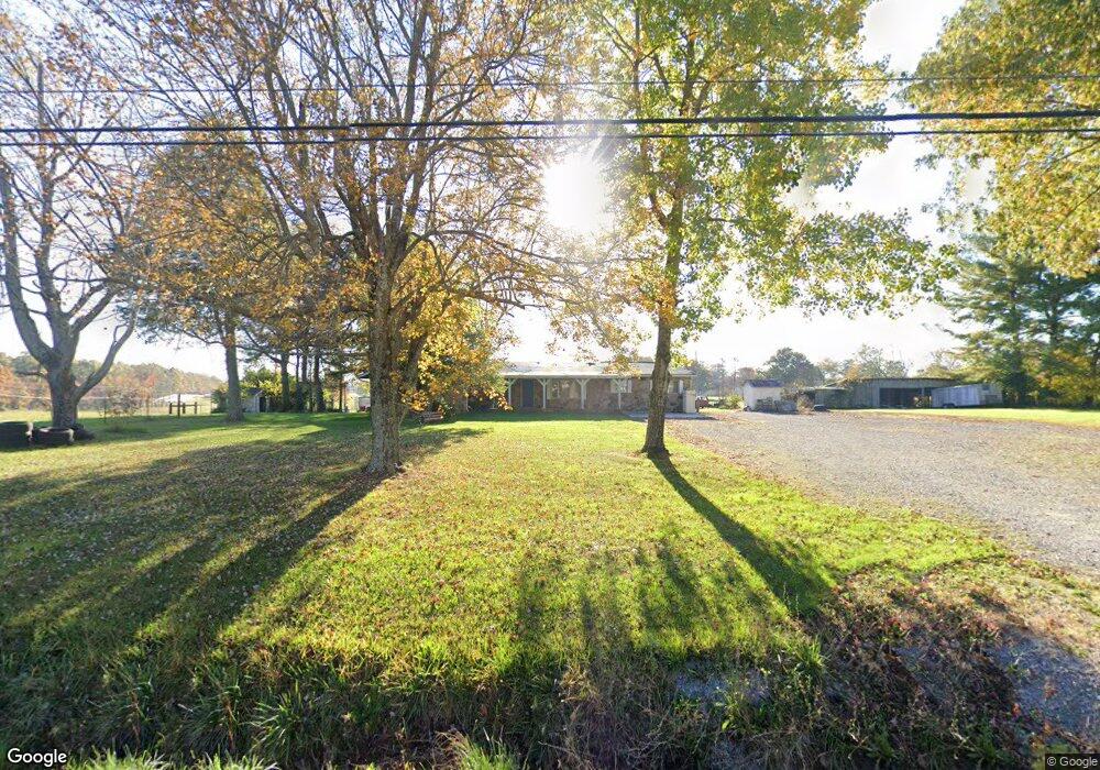
13896 Highway 127 N Crossville, TN 38571
Estimated Value: $205,000 - $343,000
3
Beds
2
Baths
1,911
Sq Ft
$151/Sq Ft
Est. Value
About This Home
This home is located at 13896 Highway 127 N, Crossville, TN 38571 and is currently estimated at $288,445, approximately $150 per square foot. 13896 Highway 127 N is a home located in Cumberland County with nearby schools including North Cumberland Elementary School and Stone Memorial High School.
Ownership History
Date
Name
Owned For
Owner Type
Purchase Details
Closed on
Jul 21, 2023
Sold by
Moore Ronald L and Moore April J
Bought by
State Of Tennessee
Current Estimated Value
Purchase Details
Closed on
May 10, 2011
Sold by
Federal Home Loan Mortgage Corporation
Bought by
Moore Ronald L and Moore April J
Home Financials for this Owner
Home Financials are based on the most recent Mortgage that was taken out on this home.
Original Mortgage
$40,303
Interest Rate
4.79%
Mortgage Type
Commercial
Purchase Details
Closed on
Mar 1, 2011
Sold by
Jones Billy Dale
Bought by
Federal Home Loan Mortgage Corporation
Purchase Details
Closed on
May 1, 2002
Sold by
Jones Billy Dale
Bought by
Jones Billy Dale
Purchase Details
Closed on
Jun 23, 2000
Sold by
Jones Billy D
Bought by
Jones David
Create a Home Valuation Report for This Property
The Home Valuation Report is an in-depth analysis detailing your home's value as well as a comparison with similar homes in the area
Home Values in the Area
Average Home Value in this Area
Purchase History
| Date | Buyer | Sale Price | Title Company |
|---|---|---|---|
| State Of Tennessee | $274,445 | None Listed On Document | |
| Moore Ronald L | $50,403 | -- | |
| Federal Home Loan Mortgage Corporation | -- | -- | |
| Jones Billy Dale | -- | -- | |
| Jones David | $2,900 | -- |
Source: Public Records
Mortgage History
| Date | Status | Borrower | Loan Amount |
|---|---|---|---|
| Previous Owner | Moore Ronald L | $40,303 |
Source: Public Records
Tax History Compared to Growth
Tax History
| Year | Tax Paid | Tax Assessment Tax Assessment Total Assessment is a certain percentage of the fair market value that is determined by local assessors to be the total taxable value of land and additions on the property. | Land | Improvement |
|---|---|---|---|---|
| 2024 | $537 | $47,350 | $7,525 | $39,825 |
| 2023 | $287 | $47,350 | $0 | $0 |
| 2022 | $547 | $48,150 | $8,325 | $39,825 |
| 2021 | $448 | $28,625 | $7,100 | $21,525 |
| 2020 | $448 | $28,625 | $7,100 | $21,525 |
| 2019 | $448 | $28,625 | $7,100 | $21,525 |
| 2018 | $448 | $28,625 | $7,100 | $21,525 |
| 2017 | $425 | $28,625 | $7,100 | $21,525 |
| 2016 | $402 | $26,325 | $7,100 | $19,225 |
| 2015 | $394 | $26,325 | $7,100 | $19,225 |
| 2014 | $394 | $26,323 | $0 | $0 |
Source: Public Records
Map
Nearby Homes
- 257 Colby Cir
- 738 Colby Cir
- 307 Colby Cir
- 145 Windswept Dr
- 0 Hwy 127 N Unit RTC2636228
- 405 Smith Rd
- 549 Smith Rd
- 401 Smith Rd
- 555 Smith Rd
- 4 Smith Rd
- 3 Smith Rd
- 1 Smith Rd
- 2 Smith Rd
- 60 Greenview Ln
- 0 Bluff View Cir
- 0 0 Mountain Laurel Tr
- 21 Bluff View Loop
- 127 Bluff View Loop
- 0 Hollow Lane - 35 Acres
- 13895 Highway 127 N
- 13945 Highway 127 N
- 1006 Colby Cir
- 1026 Colby Cir
- 980 Colby Cir
- 1118 Colby Cir
- 987 Colby Cir
- 1043 Colby Cir
- 14041 Highway 127 N
- 920 Colby Cir
- 0 Colby Cir Unit 595883
- 0 Colby Cir Unit 595881
- 0 Colby Cir Unit 595880
- 0 Colby Cir Unit 595878
- 0 Colby Cir Unit 595877
- 0 Colby Cir Unit 595876
- 0 Colby Cir Unit 595875
- 0 Colby Cir Unit 595874
- 0 Colby Cir Unit 595873
- 0 Colby Cir Unit 595871