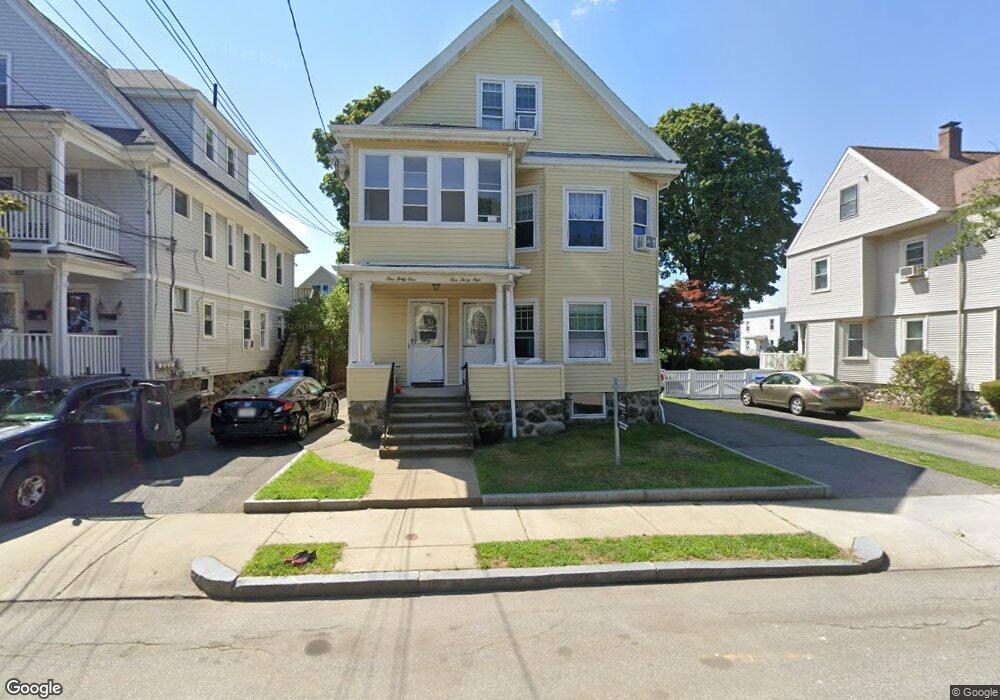
139 Alder St Unit 141 Waltham, MA 02453
South Side NeighborhoodEstimated Value: $1,091,000 - $1,201,000
4
Beds
3
Baths
2,750
Sq Ft
$416/Sq Ft
Est. Value
About This Home
This home is located at 139 Alder St Unit 141, Waltham, MA 02453 and is currently estimated at $1,144,597, approximately $416 per square foot. 139 Alder St Unit 141 is a home located in Middlesex County with nearby schools including Henry Whittemore Elementary School, John W. Mcdevitt Middle School, and Waltham Sr High School.
Ownership History
Date
Name
Owned For
Owner Type
Purchase Details
Closed on
Dec 21, 2022
Sold by
Millian Edward M and Millian Joan M
Bought by
Lin Ruiting and Gao Nan
Current Estimated Value
Home Financials for this Owner
Home Financials are based on the most recent Mortgage that was taken out on this home.
Original Mortgage
$721,875
Outstanding Balance
$699,306
Interest Rate
7.08%
Mortgage Type
Purchase Money Mortgage
Estimated Equity
$445,291
Purchase Details
Closed on
Mar 23, 1978
Bought by
Millian Edward M and Millian Joan M
Create a Home Valuation Report for This Property
The Home Valuation Report is an in-depth analysis detailing your home's value as well as a comparison with similar homes in the area
Home Values in the Area
Average Home Value in this Area
Purchase History
| Date | Buyer | Sale Price | Title Company |
|---|---|---|---|
| Lin Ruiting | $962,500 | None Available | |
| Millian Edward M | $40,000 | -- |
Source: Public Records
Mortgage History
| Date | Status | Borrower | Loan Amount |
|---|---|---|---|
| Open | Lin Ruiting | $721,875 |
Source: Public Records
Tax History Compared to Growth
Tax History
| Year | Tax Paid | Tax Assessment Tax Assessment Total Assessment is a certain percentage of the fair market value that is determined by local assessors to be the total taxable value of land and additions on the property. | Land | Improvement |
|---|---|---|---|---|
| 2025 | $9,018 | $918,300 | $357,100 | $561,200 |
| 2024 | $8,510 | $882,800 | $357,100 | $525,700 |
| 2023 | $7,985 | $773,700 | $325,300 | $448,400 |
| 2022 | $8,094 | $726,600 | $297,000 | $429,600 |
| 2021 | $7,623 | $673,400 | $268,700 | $404,700 |
| 2020 | $7,543 | $631,200 | $254,600 | $376,600 |
| 2019 | $7,078 | $559,100 | $252,000 | $307,100 |
| 2018 | $6,389 | $506,700 | $233,400 | $273,300 |
| 2017 | $6,097 | $485,400 | $212,100 | $273,300 |
| 2016 | $5,639 | $460,700 | $187,400 | $273,300 |
| 2015 | $5,386 | $410,200 | $183,900 | $226,300 |
Source: Public Records
Map
Nearby Homes
- 308 Newton St Unit 1
- 312 Newton St Unit 1A
- 138 Myrtle St Unit 2
- 162 Myrtle St Unit 1
- 39 Clinton St Unit 2
- 39 Clinton St Unit 1
- 81 Alder St
- 9 John St
- 42 Alder St
- 47 Alder St Unit 6
- 40 Myrtle St Unit 9
- 25 Tolman St Unit 2
- 61 Hall St Unit 9
- 61 Hall St Unit 7
- 24 Tolman St Unit A
- 15 Alder St Unit 1
- 28-32 Calvary St
- 75 Cherry St
- 76 Taft Ave Unit 1
- 76 Taft Ave
- 139-141 Alder St Unit 2
- 139-141 Alder St Unit 3
- 139-141 Alder St Unit 1
- 139-141 Alder St
- 145 Alder St Unit 147
- 137 Alder St
- 151 Alder St
- 133 Alder St Unit 135
- 146 Myrtle St
- 142 Myrtle St Unit 2
- 142 Myrtle St Unit 1
- 150 Myrtle St Unit 152
- 155 Alder St Unit 155
- 144 Alder St
- 153 Alder St Unit 155
- 146 Alder St
- 154 Myrtle St Unit 156
- 153-155 Alder St Unit 2
- 153-155 Alder St Unit 3
- 153-155 Alder St