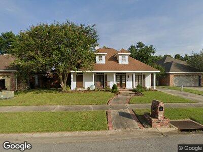
139 Ashland Ct Lafayette, LA 70508
Pilette NeighborhoodEstimated Value: $287,000 - $355,000
--
Bed
--
Bath
2,331
Sq Ft
$139/Sq Ft
Est. Value
About This Home
This home is located at 139 Ashland Ct, Lafayette, LA 70508 and is currently estimated at $325,127, approximately $139 per square foot. 139 Ashland Ct is a home located in Lafayette Parish with nearby schools including Katharine Drexel Elementary School, Broussard Middle School, and O. Comeaux High School.
Ownership History
Date
Name
Owned For
Owner Type
Purchase Details
Closed on
Nov 29, 2021
Sold by
Hines Richard Arvie and Hines Andrea Linam
Bought by
Conston Kendrick and Conston Maple
Current Estimated Value
Home Financials for this Owner
Home Financials are based on the most recent Mortgage that was taken out on this home.
Original Mortgage
$327,458
Outstanding Balance
$304,789
Interest Rate
3.09%
Mortgage Type
FHA
Estimated Equity
$11,574
Create a Home Valuation Report for This Property
The Home Valuation Report is an in-depth analysis detailing your home's value as well as a comparison with similar homes in the area
Home Values in the Area
Average Home Value in this Area
Purchase History
| Date | Buyer | Sale Price | Title Company |
|---|---|---|---|
| Conston Kendrick | $333,500 | Sure Title | |
| Conston Kendrick | $333,500 | None Listed On Document |
Source: Public Records
Mortgage History
| Date | Status | Borrower | Loan Amount |
|---|---|---|---|
| Open | Maple Conston | $16,294 | |
| Open | Conston Kendrick | $327,458 | |
| Closed | Conston Kendrick | $327,458 | |
| Previous Owner | Hines Richard Arvie | $93,359 |
Source: Public Records
Tax History Compared to Growth
Tax History
| Year | Tax Paid | Tax Assessment Tax Assessment Total Assessment is a certain percentage of the fair market value that is determined by local assessors to be the total taxable value of land and additions on the property. | Land | Improvement |
|---|---|---|---|---|
| 2024 | $2,630 | $31,175 | $4,357 | $26,818 |
| 2023 | $2,630 | $21,839 | $4,357 | $17,482 |
| 2022 | $2,285 | $21,839 | $4,357 | $17,482 |
| 2021 | $2,293 | $21,839 | $4,357 | $17,482 |
| 2020 | $2,285 | $21,839 | $4,357 | $17,482 |
| 2019 | $1,182 | $21,839 | $4,357 | $17,482 |
| 2018 | $1,597 | $21,839 | $4,357 | $17,482 |
| 2017 | $1,595 | $21,840 | $2,990 | $18,850 |
| 2015 | $1,594 | $21,840 | $2,990 | $18,850 |
| 2013 | -- | $21,840 | $2,990 | $18,850 |
Source: Public Records
Map
Nearby Homes
- 204 Eva Dr
- 104 Queen of Peace Dr
- 610 Pillette Rd Unit 194
- 103 Cindy Dr
- 116 Isaiah Dr
- 200 Vieux Orleans Cir
- 101 Vieux Orleans Cir
- 108 Lafittes Landing Pass
- 136 Edie Ann Dr
- 127 Treasure Cove
- 117 Treasure Cove
- 113 Treasure Cove
- 100 Blk Tarpon St
- 109 Barataria Bay Point
- 303 Cougar Ridge
- 102 Sunstone Ave
- 100 Darbonne Rd
- 305 Woodbridge Dr
- 108 Avalon St
- 108 Lorna St
- 139 Ashland Ct
- 143 Ashland Ct
- 135 Ashland Ct
- 131 Ashland Ct
- 147 Ashland Ct
- 134 Ashland Ct
- 138 Ashland Ct
- 130 Ashland Ct
- 151 Ashland Ct
- 127 Ashland Ct
- 142 Ashland Ct
- 146 Ashland Ct
- 126 Ashland Ct
- 410 Planters Row
- 418 Planters Row
- 415 Harvest Dr
- 411 Harvest Dr
- 419 Harvest Dr
- 407 Harvest Dr
- 119 Ashland Ct