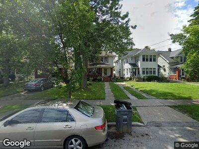
139 Dartmouth Dr Toledo, OH 43614
Beverly NeighborhoodEstimated Value: $133,787 - $159,000
3
Beds
1
Bath
1,364
Sq Ft
$105/Sq Ft
Est. Value
About This Home
This home is located at 139 Dartmouth Dr, Toledo, OH 43614 and is currently estimated at $142,947, approximately $104 per square foot. 139 Dartmouth Dr is a home located in Lucas County with nearby schools including Harvard Elementary School, Bowsher High School, and Our Lady of Perpetual Help School.
Ownership History
Date
Name
Owned For
Owner Type
Purchase Details
Closed on
Sep 26, 2007
Sold by
Kremnetz Anthony L
Bought by
Laporte Michel A
Current Estimated Value
Home Financials for this Owner
Home Financials are based on the most recent Mortgage that was taken out on this home.
Original Mortgage
$95,000
Interest Rate
6.49%
Mortgage Type
Purchase Money Mortgage
Purchase Details
Closed on
Jul 14, 1997
Sold by
Kremnetz Anthony
Bought by
Kremnetz Anthony L
Home Financials for this Owner
Home Financials are based on the most recent Mortgage that was taken out on this home.
Original Mortgage
$69,939
Interest Rate
8%
Mortgage Type
FHA
Create a Home Valuation Report for This Property
The Home Valuation Report is an in-depth analysis detailing your home's value as well as a comparison with similar homes in the area
Home Values in the Area
Average Home Value in this Area
Purchase History
| Date | Buyer | Sale Price | Title Company |
|---|---|---|---|
| Laporte Michel A | $95,000 | Chicago Title Insurance Co | |
| Kremnetz Anthony L | $70,330 | -- |
Source: Public Records
Mortgage History
| Date | Status | Borrower | Loan Amount |
|---|---|---|---|
| Open | Goins Michel A | $94,415 | |
| Closed | Laporte Michel A | $95,000 | |
| Previous Owner | Kremnetz Anthony | $88,000 | |
| Previous Owner | Kremnetz Anthony L | $22,000 | |
| Previous Owner | Kremnetz Anthony L | $26,500 | |
| Previous Owner | Kremnetz Anthony L | $69,939 |
Source: Public Records
Tax History Compared to Growth
Tax History
| Year | Tax Paid | Tax Assessment Tax Assessment Total Assessment is a certain percentage of the fair market value that is determined by local assessors to be the total taxable value of land and additions on the property. | Land | Improvement |
|---|---|---|---|---|
| 2024 | $1,001 | $32,900 | $6,195 | $26,705 |
| 2023 | $1,921 | $30,310 | $5,705 | $24,605 |
| 2022 | $1,923 | $30,310 | $5,705 | $24,605 |
| 2021 | $1,971 | $30,310 | $5,705 | $24,605 |
| 2020 | $1,866 | $25,305 | $4,830 | $20,475 |
| 2019 | $1,816 | $25,305 | $4,830 | $20,475 |
| 2018 | $1,782 | $25,305 | $4,830 | $20,475 |
| 2017 | $1,763 | $23,205 | $5,110 | $18,095 |
| 2016 | $1,758 | $66,300 | $14,600 | $51,700 |
| 2015 | $1,742 | $66,300 | $14,600 | $51,700 |
| 2014 | $1,460 | $23,210 | $5,110 | $18,100 |
| 2013 | $1,460 | $23,210 | $5,110 | $18,100 |
Source: Public Records
Map
Nearby Homes
- 153 University Blvd
- 1309 Harvard Blvd
- 1020 Woodsdale Ave
- 1407 Kenyon Dr
- 858 Ogden Ave
- 837 Woodsdale Ave
- 818 Geneva Ave
- 1012 Alden Ct
- 1010 Alden Ct
- 835 Atlantic Ave
- 822 Wright Ave
- 766 Spencer St
- 701 Brighton Ave
- 372 Riverside Dr
- 634 Woodsdale Ave
- 624 Nicholas St
- 1409 Wildwood Rd
- 547 Lodge Ave
- 551 Woodsdale Ave
- 1453 Prouty Ave
- 139 Dartmouth Dr
- 135 Dartmouth Dr
- 141 Dartmouth Dr
- 131 Dartmouth Dr
- 145 Dartmouth Dr
- 149 Dartmouth Dr
- 127 Dartmouth Dr
- 221 Amherst Dr
- 227 Amherst Dr
- 155 Dartmouth Dr
- 217 Amherst Dr
- 231 Amherst Dr
- 235 Amherst Dr
- 157 Dartmouth Dr
- 211 Amherst Dr
- 239 Amherst Dr
- 124 Cornell Dr
- 161 Dartmouth Dr
- 207 Amherst Dr
- 126 Cornell Dr
