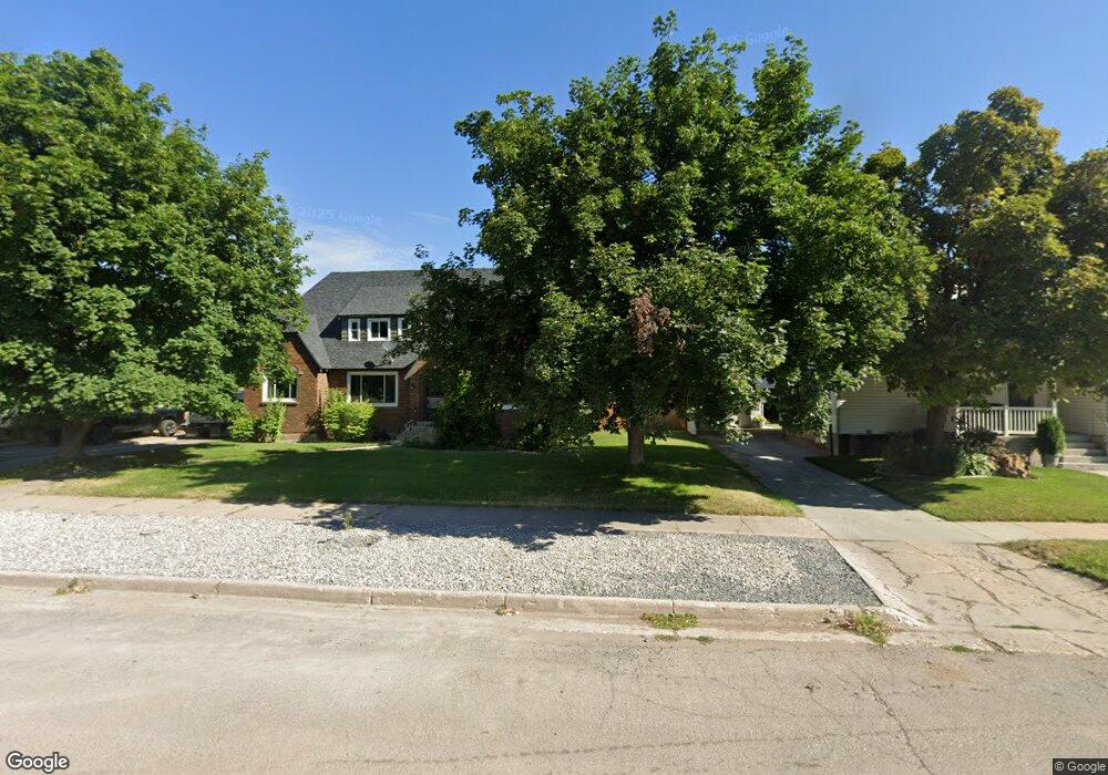
139 E 1st N Franklin, ID 83237
Estimated Value: $289,000 - $325,000
3
Beds
1
Bath
1,070
Sq Ft
$288/Sq Ft
Est. Value
About This Home
This home is located at 139 E 1st N, Franklin, ID 83237 and is currently estimated at $308,144, approximately $287 per square foot. 139 E 1st N is a home located in Franklin County with nearby schools including Oakwood Elementary School, Pioneer Elementary School, and Preston Junior High School.
Ownership History
Date
Name
Owned For
Owner Type
Purchase Details
Closed on
Jul 24, 2025
Sold by
Loveday Paul Jeremiah and Loveday Nacona Carmen
Bought by
Scott Alysha and Scott Corey
Current Estimated Value
Home Financials for this Owner
Home Financials are based on the most recent Mortgage that was taken out on this home.
Original Mortgage
$10,500
Outstanding Balance
$6,407
Interest Rate
6.84%
Mortgage Type
FHA
Estimated Equity
$301,737
Purchase Details
Closed on
Oct 19, 2020
Sold by
Loveday Paul J and Loveday Nacona C
Bought by
Loveday Paul Jeramiah and Loveday Nacona Carmen
Home Financials for this Owner
Home Financials are based on the most recent Mortgage that was taken out on this home.
Original Mortgage
$114,000
Interest Rate
2.8%
Mortgage Type
New Conventional
Purchase Details
Closed on
Feb 23, 2009
Sold by
Loveday Nacona C and Loveday Paul J
Bought by
Loveday Paul J and Loveday Nocona C
Create a Home Valuation Report for This Property
The Home Valuation Report is an in-depth analysis detailing your home's value as well as a comparison with similar homes in the area
Purchase History
| Date | Buyer | Sale Price | Title Company |
|---|---|---|---|
| Scott Alysha | -- | Northern Title Company | |
| Loveday Paul Jeramiah | -- | Northern Title | |
| Loveday Paul J | -- | -- |
Source: Public Records
Mortgage History
| Date | Status | Borrower | Loan Amount |
|---|---|---|---|
| Open | Scott Alysha | $10,500 | |
| Open | Scott Alysha | $294,566 | |
| Previous Owner | Loveday Paul Jeramiah | $114,000 |
Source: Public Records
Tax History
| Year | Tax Paid | Tax Assessment Tax Assessment Total Assessment is a certain percentage of the fair market value that is determined by local assessors to be the total taxable value of land and additions on the property. | Land | Improvement |
|---|---|---|---|---|
| 2025 | $890 | $205,459 | $60,000 | $145,459 |
| 2024 | $921 | $207,082 | $60,000 | $147,082 |
| 2023 | $862 | $207,082 | $60,000 | $147,082 |
| 2022 | $1,060 | $186,335 | $37,618 | $148,717 |
| 2021 | $1,022 | $170,699 | $37,618 | $133,081 |
| 2020 | $817 | $114,979 | $37,618 | $77,361 |
| 2019 | $792 | $97,135 | $37,618 | $59,517 |
| 2018 | $774 | $88,951 | $28,482 | $60,469 |
| 2017 | $790 | $88,951 | $28,482 | $60,469 |
| 2016 | $406 | $75,682 | $28,482 | $47,200 |
| 2015 | $639 | $62,542 | $28,482 | $34,060 |
| 2014 | $11,066 | $62,542 | $28,482 | $34,060 |
| 2013 | $9,812 | $62,540 | $28,480 | $34,060 |
Source: Public Records
Map
Nearby Homes
- 35 N 2nd E
- 209 E Main St
- 227 E Main St
- 150 N 300 E
- 4008 Little Mountain Cir
- 3647 E Maple Creek Rd
- 483 S 30 E
- 36 W Legacy Dr
- 690 E 4800 S Unit 1
- 690 E 4800 S Unit 2
- 5337 E Maple Creek Rd Unit 1
- 2214 S 1600 E
- 2214 S 1600 E
- 3201 Cherryville Ln Unit 3
- 3597 S Mountain Meadows Dr Unit 15
- 3436 Cub River Rd
- TBD S 1600 E
- 1345 Sugar Factory Rd Unit 4
- 50 W 300 S
- 310 S Main St
Your Personal Tour Guide
Ask me questions while you tour the home.